

On the trail of the Incas
Another year and another photo trip to South America. This time to Peru where I spent a summer with family visiting my dad while he was on a short contract setting up a copper slurry distribution port. One of the highlights of the trip was visiting Cusco, the Scared Valley (Urubamba) and Machu Picchu. It has been on mind ever since. Standing immersed in this engineering wonder you can only marvel at what the Incas achieved in such a short period of time (1438-1533/1572) without the use of the wheel, draft animals and iron/steel.
The Inca Empire, officially known as the Realm of the Four Parts, was the largest empire in pre-Columbian America. The administrative, political, and military center of the empire was in the city of Cusco. The Inca civilization rose from the Peruvian highlands sometime in the early 13th century. The Portuguese explorer Aleixo Garcia was the first European to reach the Inca Empire in 1524. Later, in 1532, the Spanish began the conquest of the Inca Empire, and by 1572 the last Inca state was fully conquered.
https://en.wikipedia.org/wiki/Inca_Empire
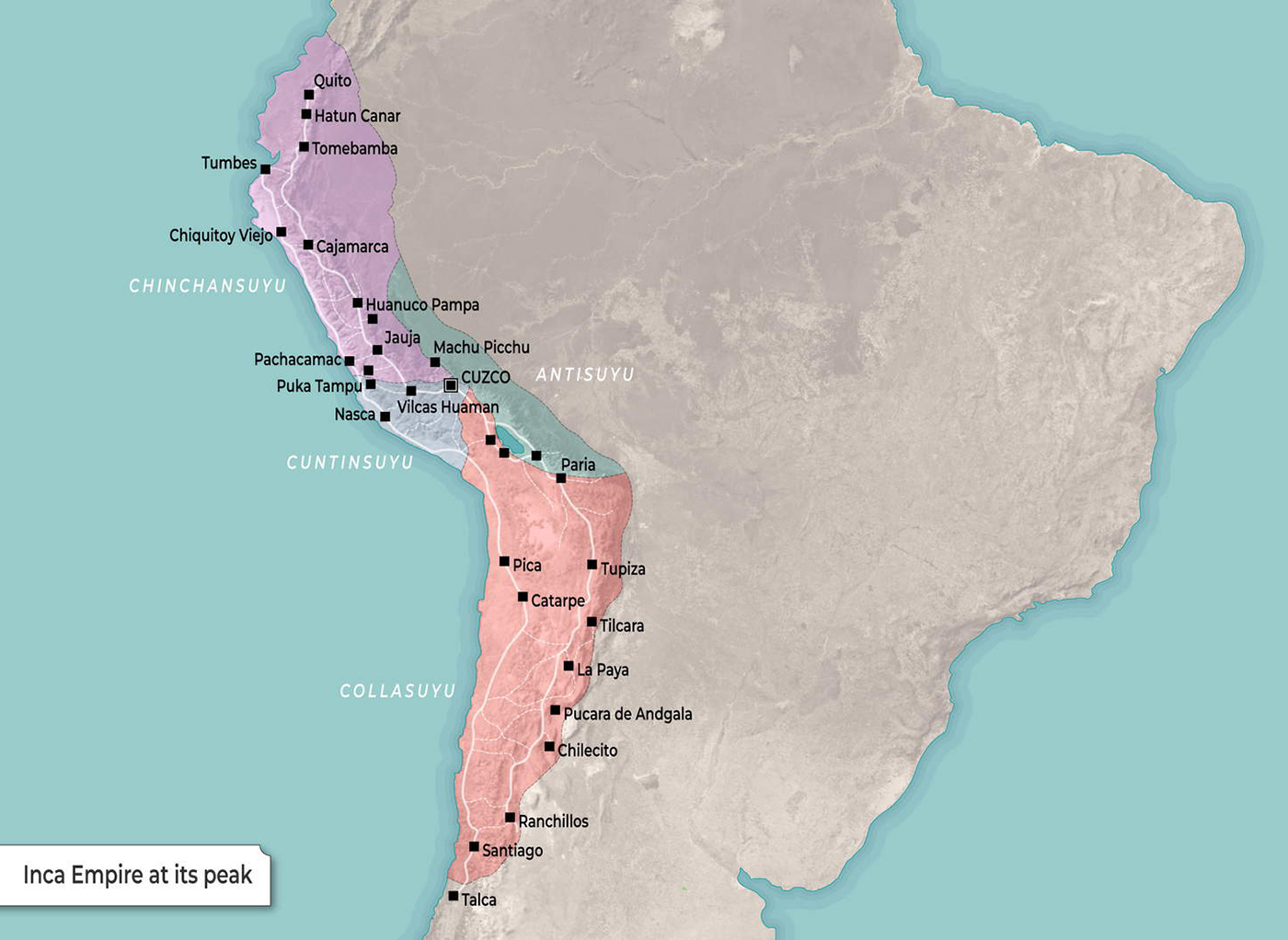
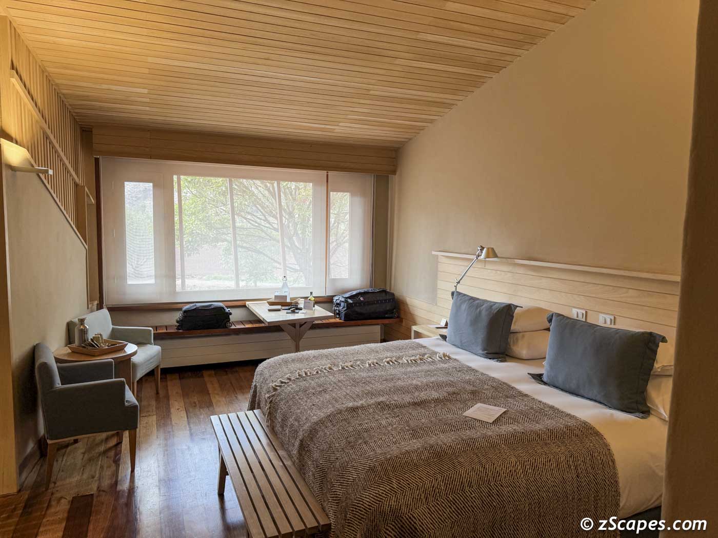
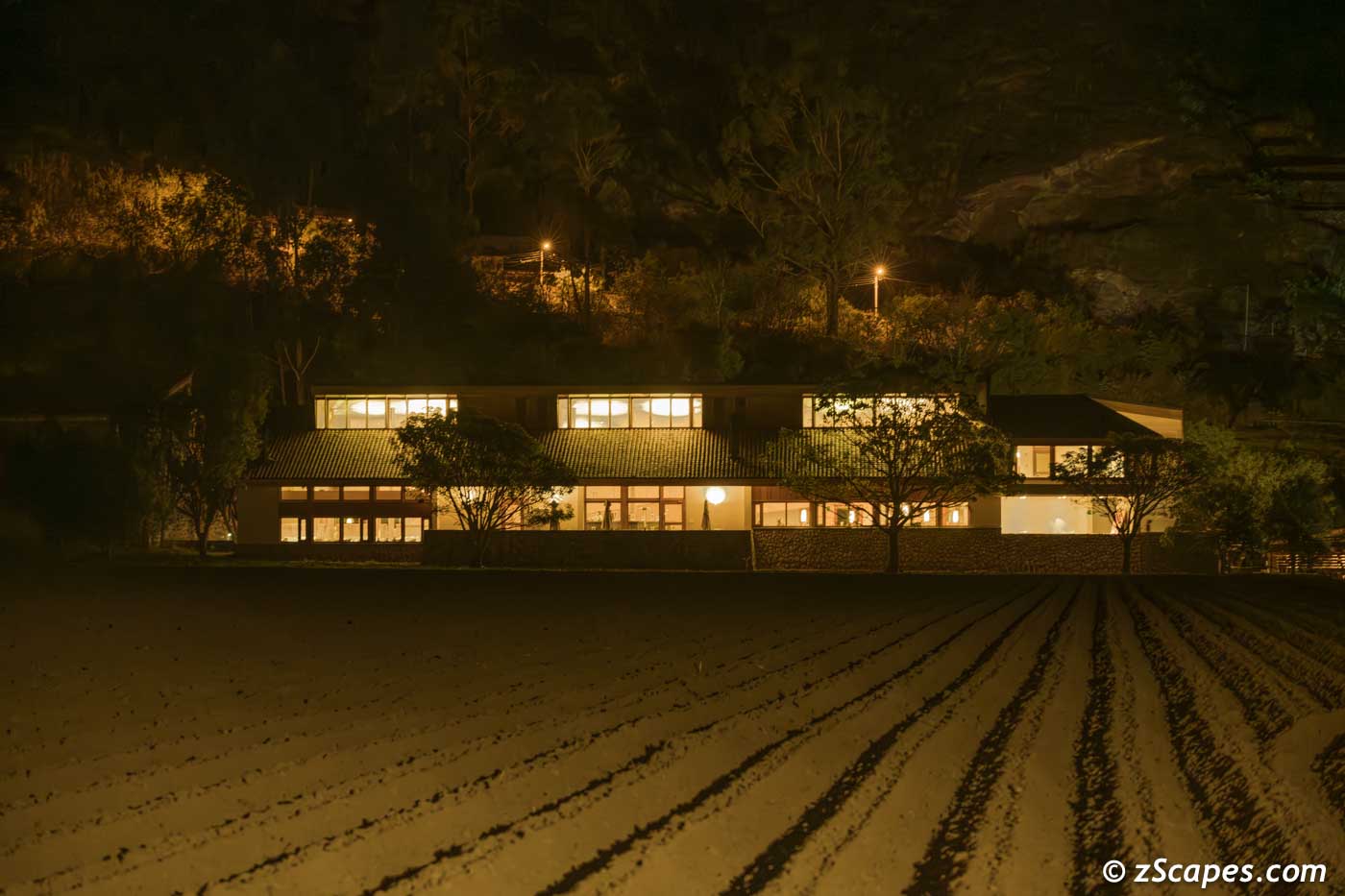
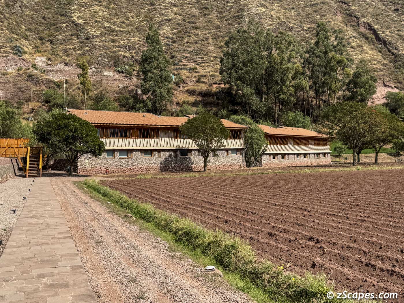
Long Trek to the Explora Hotel
Getting there was a challenge given flight schedules and multiple transit points. SFO to ATL and overnight. ATL to LIM and overnight. Lima to Cusco and overnight. And finally, Cusco to the Sacred Valley. Three days to get here, well worth it in my humble opinion.
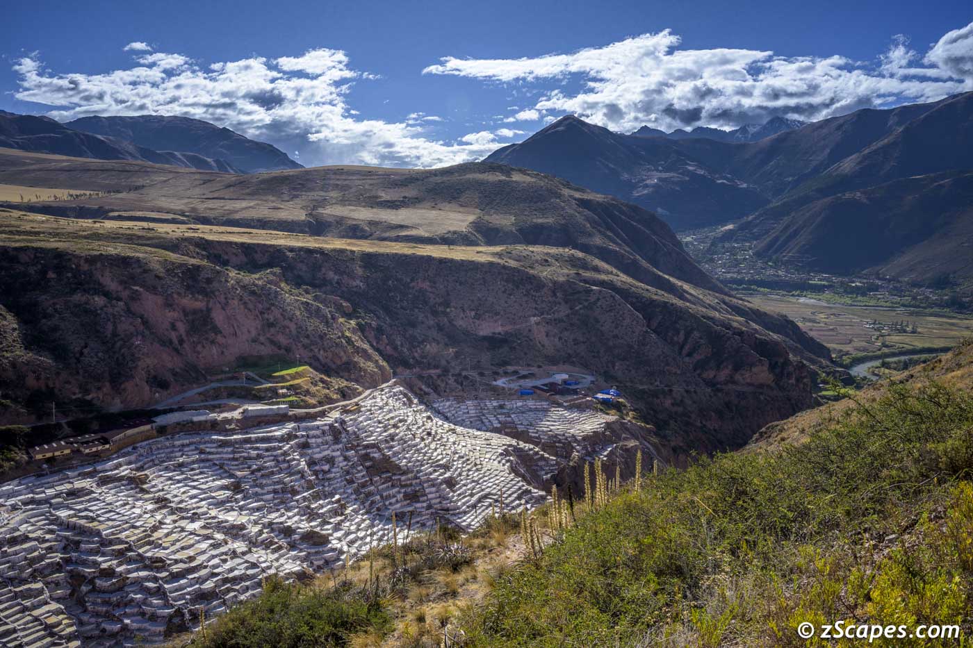
Maras Salt Ponds & Pampas
Maras is a town in the Sacred Valley of the Incas, 40 kilometers north of Cusco, in the Cusco Region of Peru. The town is well known for its salt evaporation ponds that are of prehistoric origin (900BC). Salt has been obtained in Maras by evaporating salty water from a local subterranean stream. The highly salty water emerges at a spring, a natural outlet of the underground stream. The flow is directed into an intricate system of tiny channels constructed so that the water runs gradually down onto the several hundred ancient terraced pond. Access to the salt ponds is managed by the local informal cooperative for 400 families of the local community.
We returned the following morning to capture the sunrise on the Maras Pampas with fabulous views of the highlands and Urubamba Valley. Was worth getting up at 6am!
We returned the following morning to capture the sunrise on the Maras Pampas with fabulous views of the highlands and Urubamba Valley. Was worth getting up at 6am!
Maras mountain & Urubamba valley view
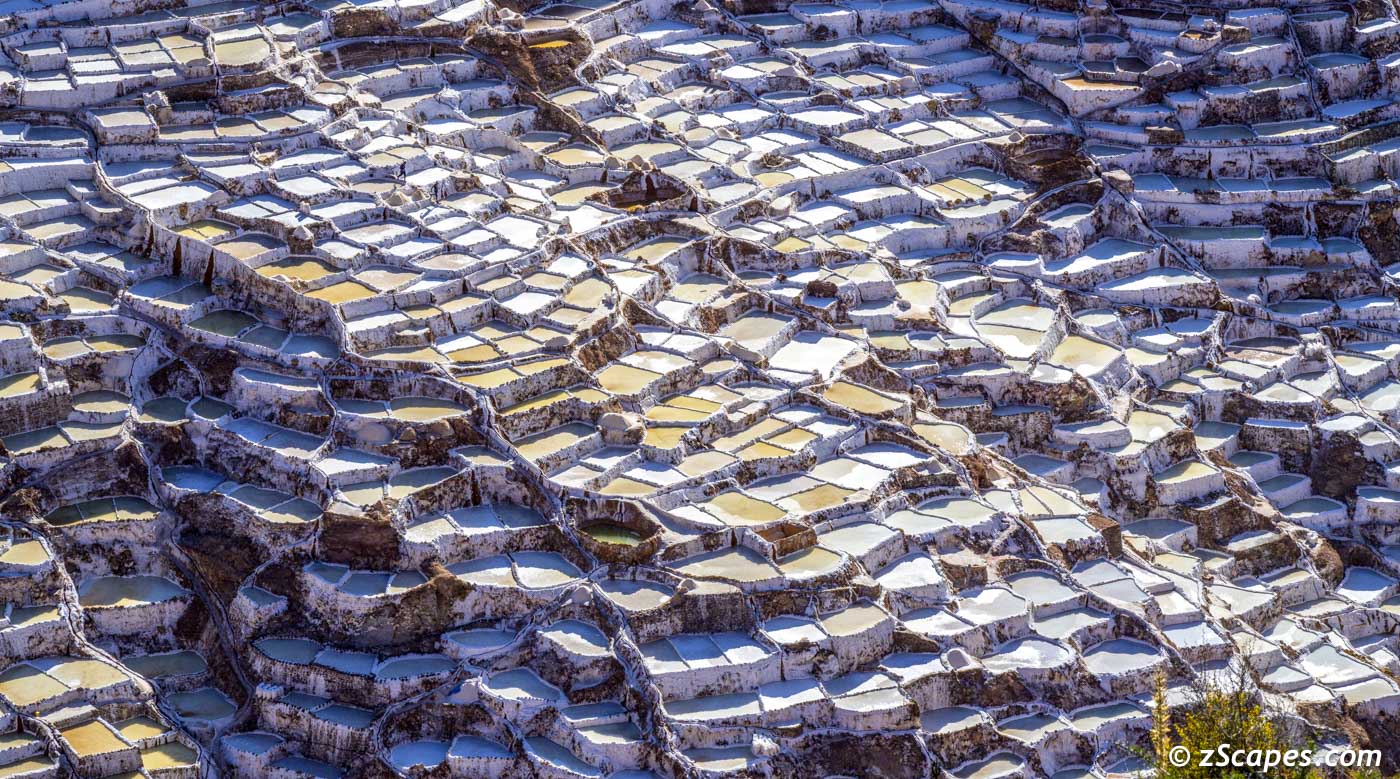
Maras pond stacking
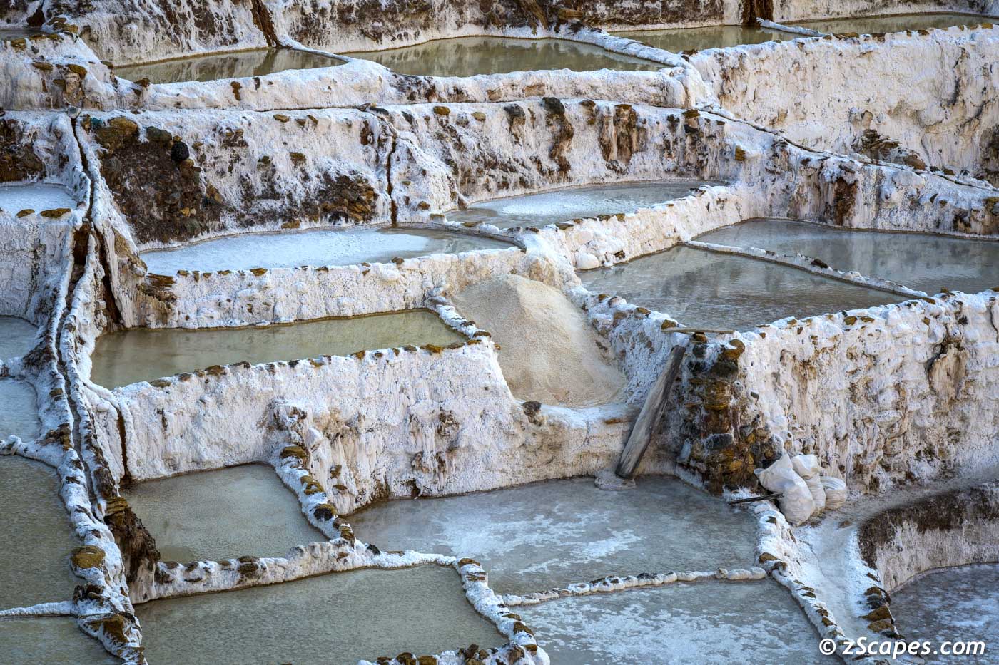
Maras salt flat parcels all less than 4 square meters and maximum of 30cm deep
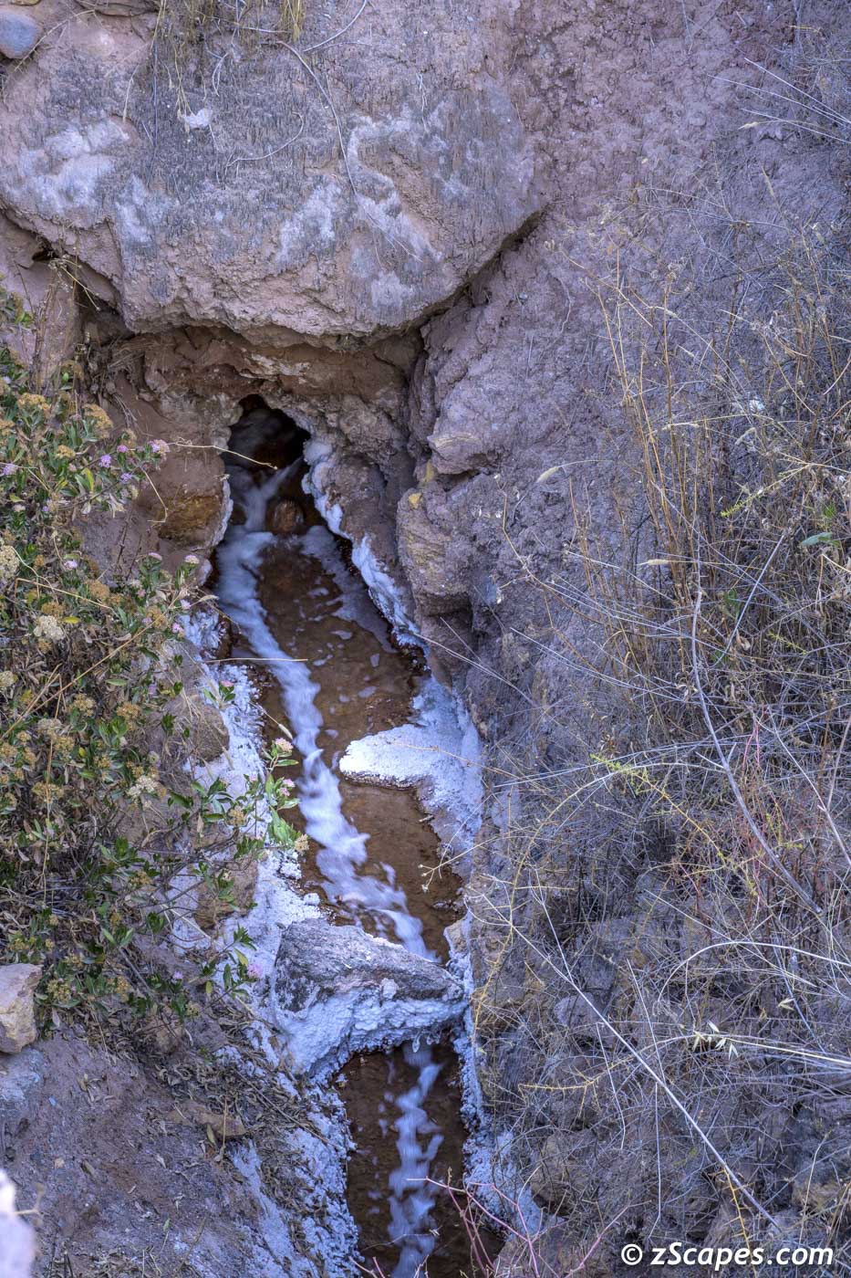
Maras salt pond source emerging from the bedrock
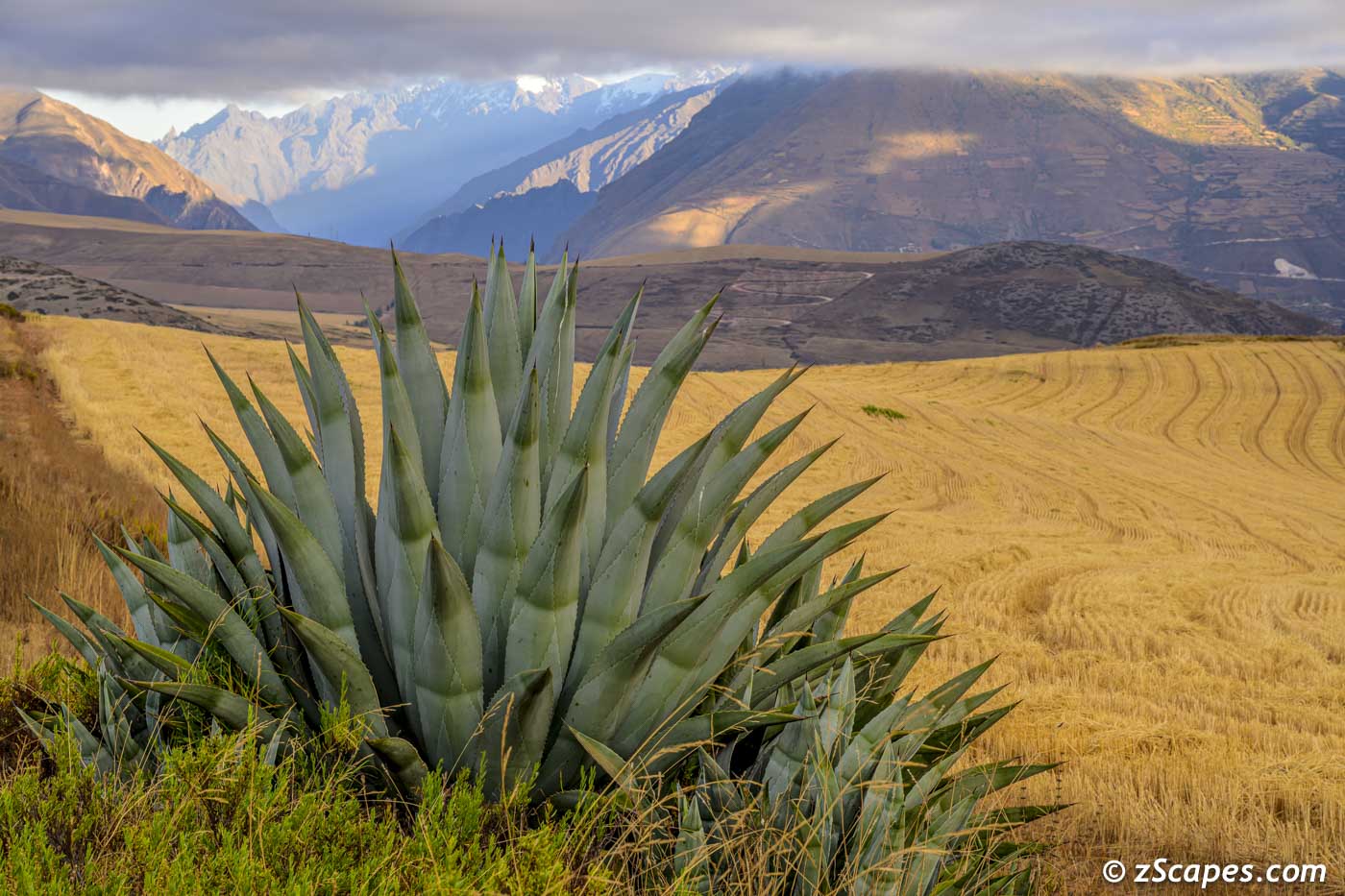
Maras Pampa catcus & wheatfield
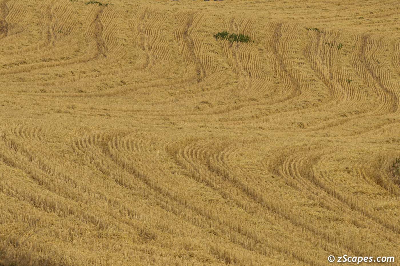
Maras pampa wheat waves
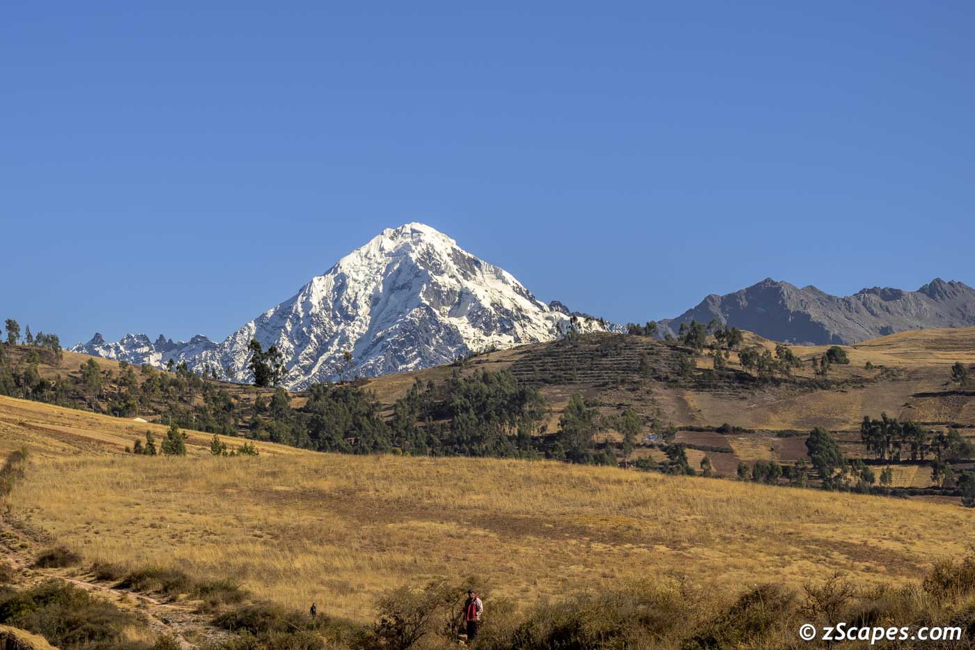
Mt Veronica @ 19,334 ft ~ Highest peak in the Urubamba range
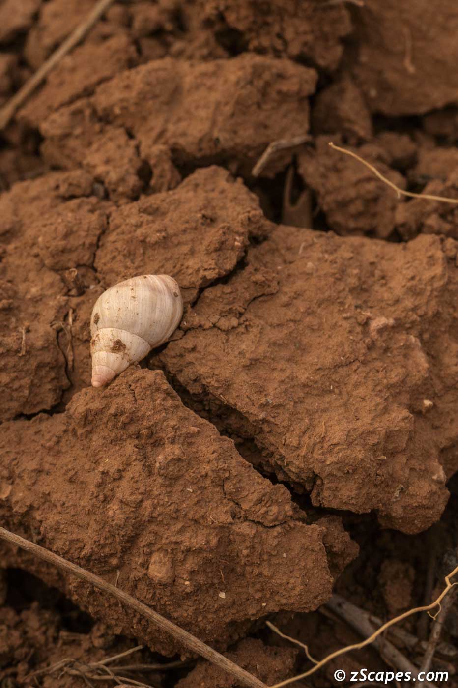
Seashell from tetonic uplift on the Maras Pampa
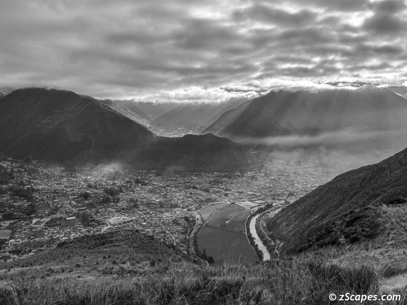
Urubamba Valley from Maras Pampa
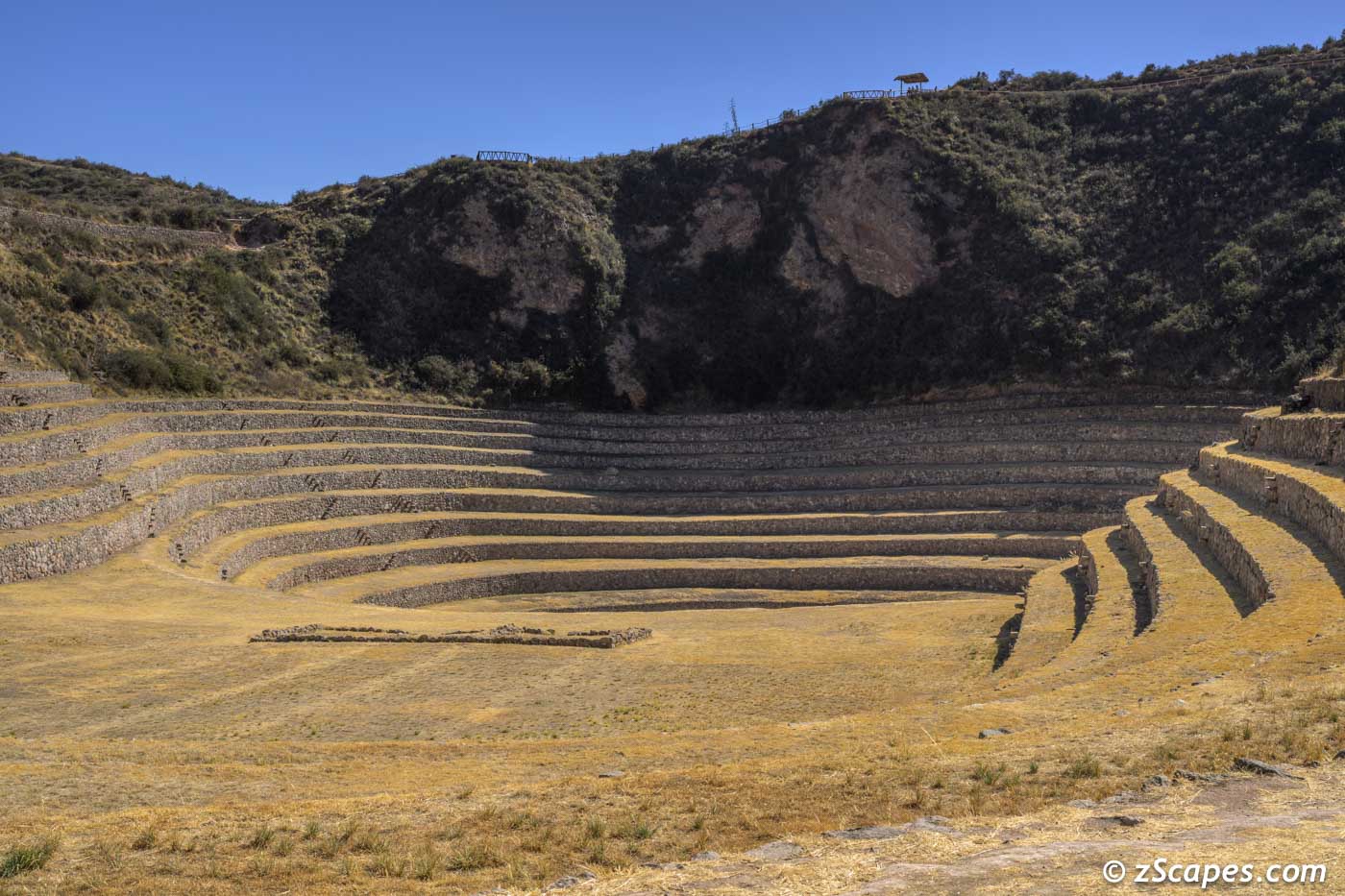
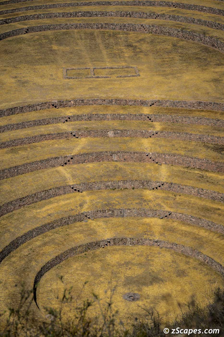
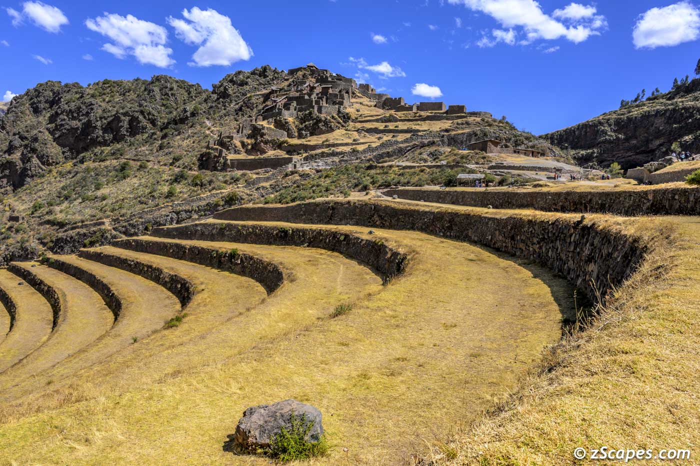
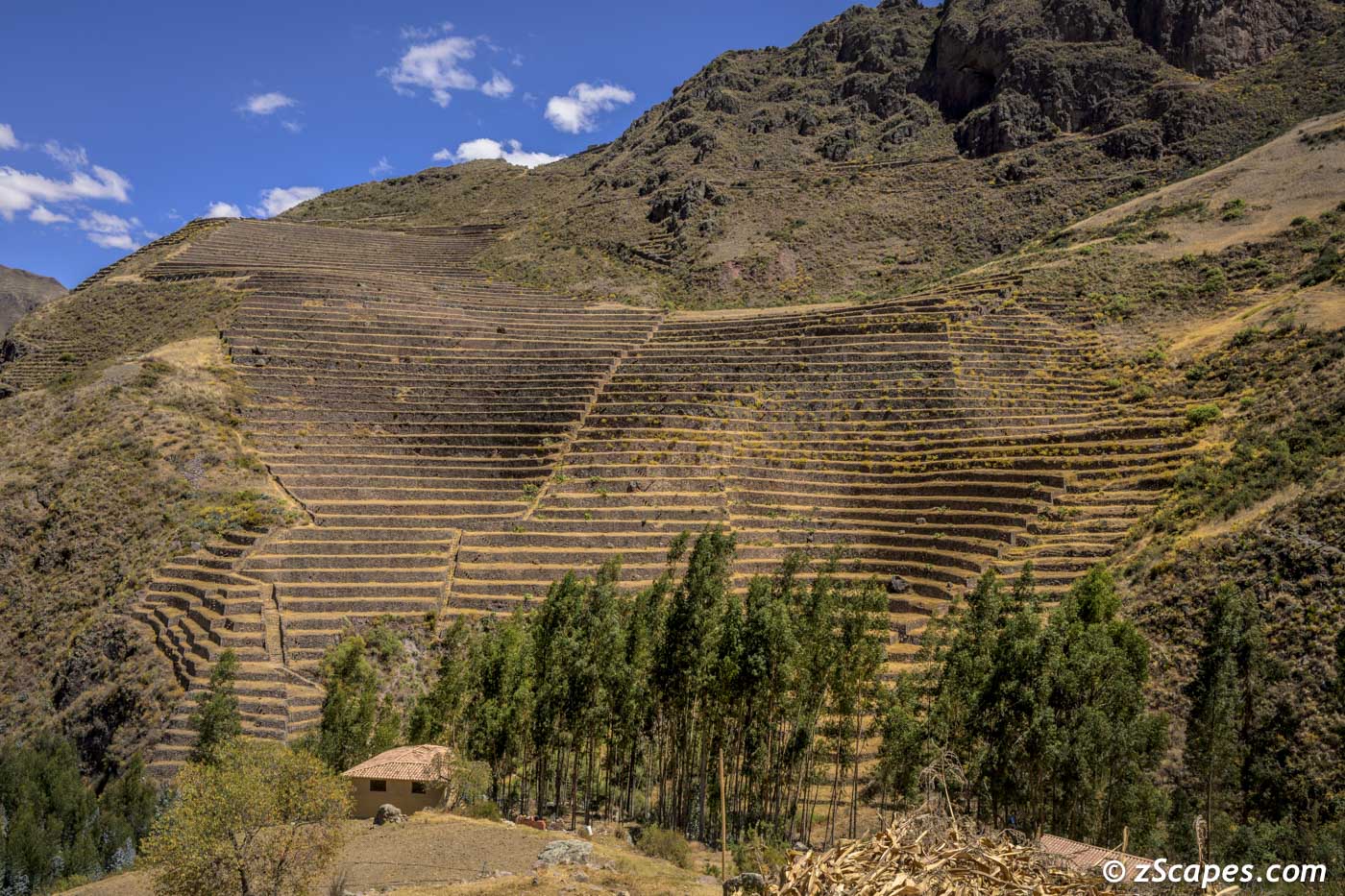
Moray & Pisaq Archeological Sites
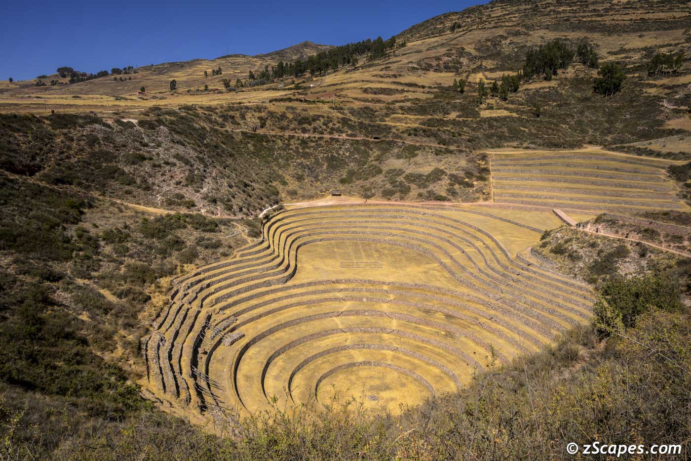
Moray is an archaeological site in Peru approximately 50 kilometres northwest of Cuzco on a high plateau at about 3,500 metres and just west of the village of Maras. The site contains Inca ruins, mostly consisting of several terraced circular depressions, the largest of which is approximately 30 m deep. As with many other Inca sites, it also has an irrigation system. The purpose of these depressions is uncertain, but their depth, design, and orientation with respect to wind and sun creates a temperature difference of as much as 15 °C between the top and the bottom. The latest research is leaning towards an outdoor greenhouse.
The Inca complex at Pisac is a large Incan complex of agricultural terraces, residences, guard posts, watchtowers and a ceremonial/religious centre located along a mountain ridge above the modern town of Pisac in the Sacred Valley of Peru. In 1983 the Pisac National Archeological Park was established to recognize the importance of and to protect the remains of the complex.
The Inca complex at Pisac is a large Incan complex of agricultural terraces, residences, guard posts, watchtowers and a ceremonial/religious centre located along a mountain ridge above the modern town of Pisac in the Sacred Valley of Peru. In 1983 the Pisac National Archeological Park was established to recognize the importance of and to protect the remains of the complex.
Moray Inca site terraces
Moray levels containing soils from different regions
Moray terrace water channels
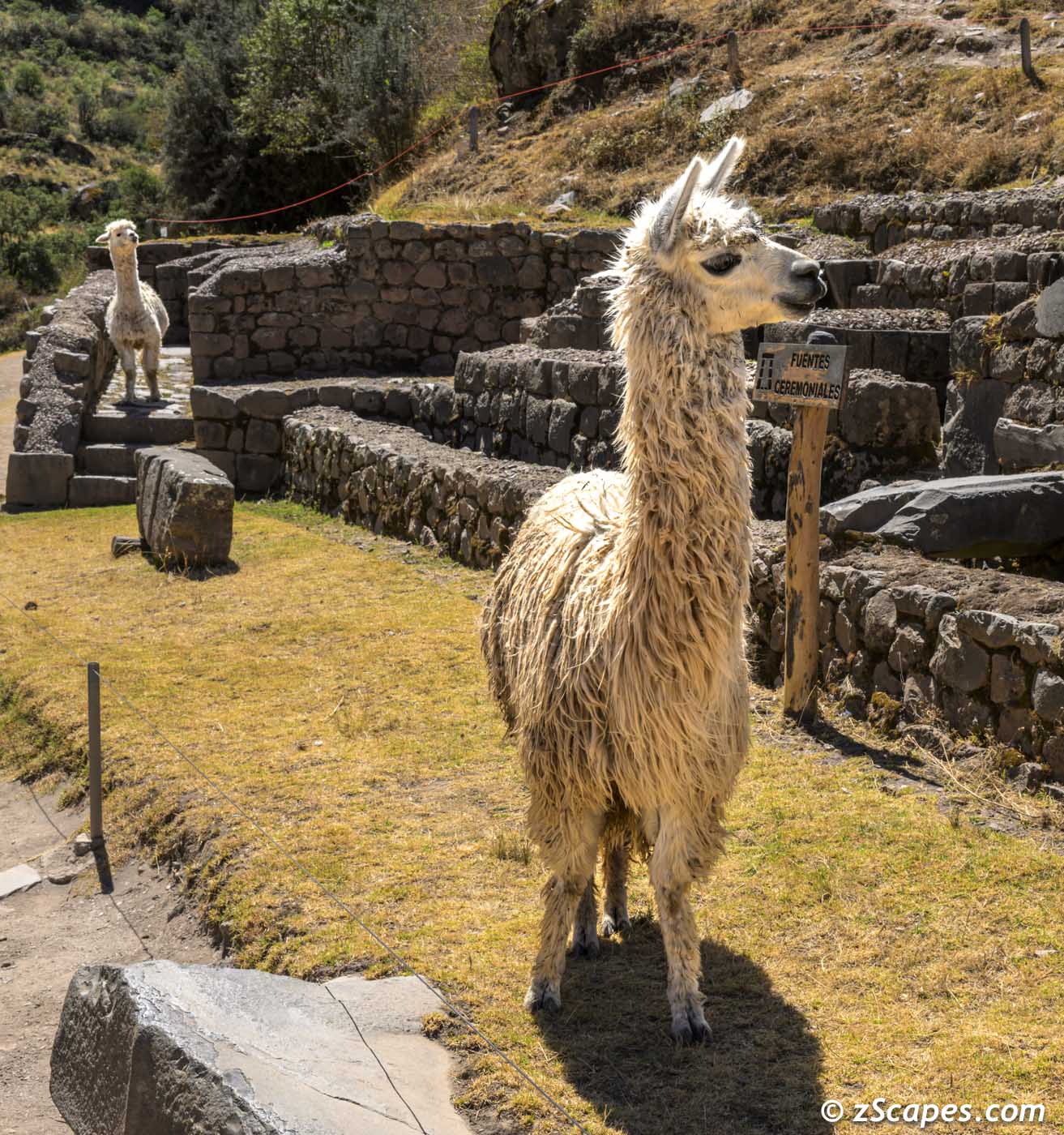
Pisaq multi-purpose residence, citadel, observatory and religious site
Terraces @ Pisaq
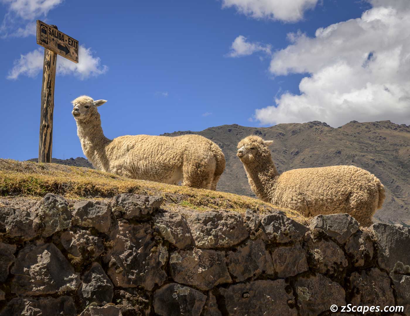
Llamas @ Pisaq
Pisaq Llama mother & juvenile
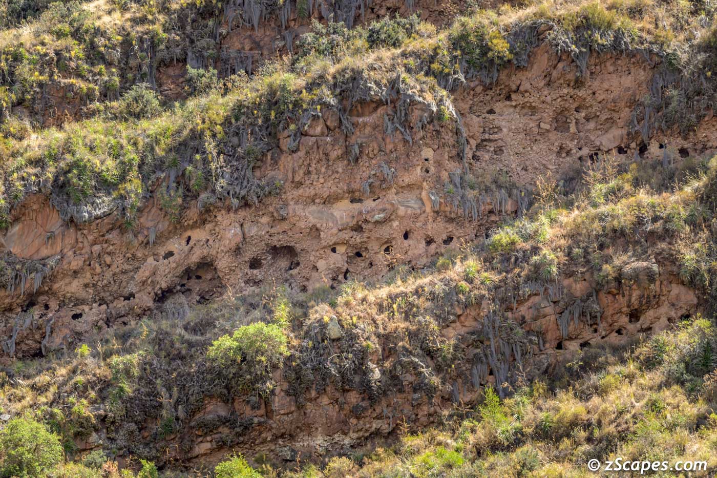
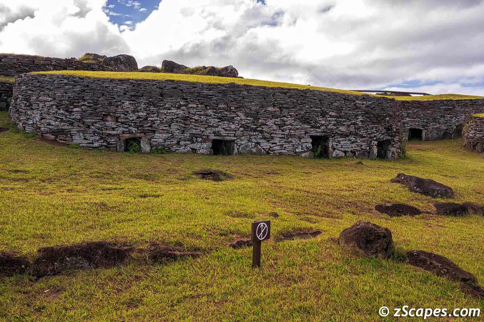
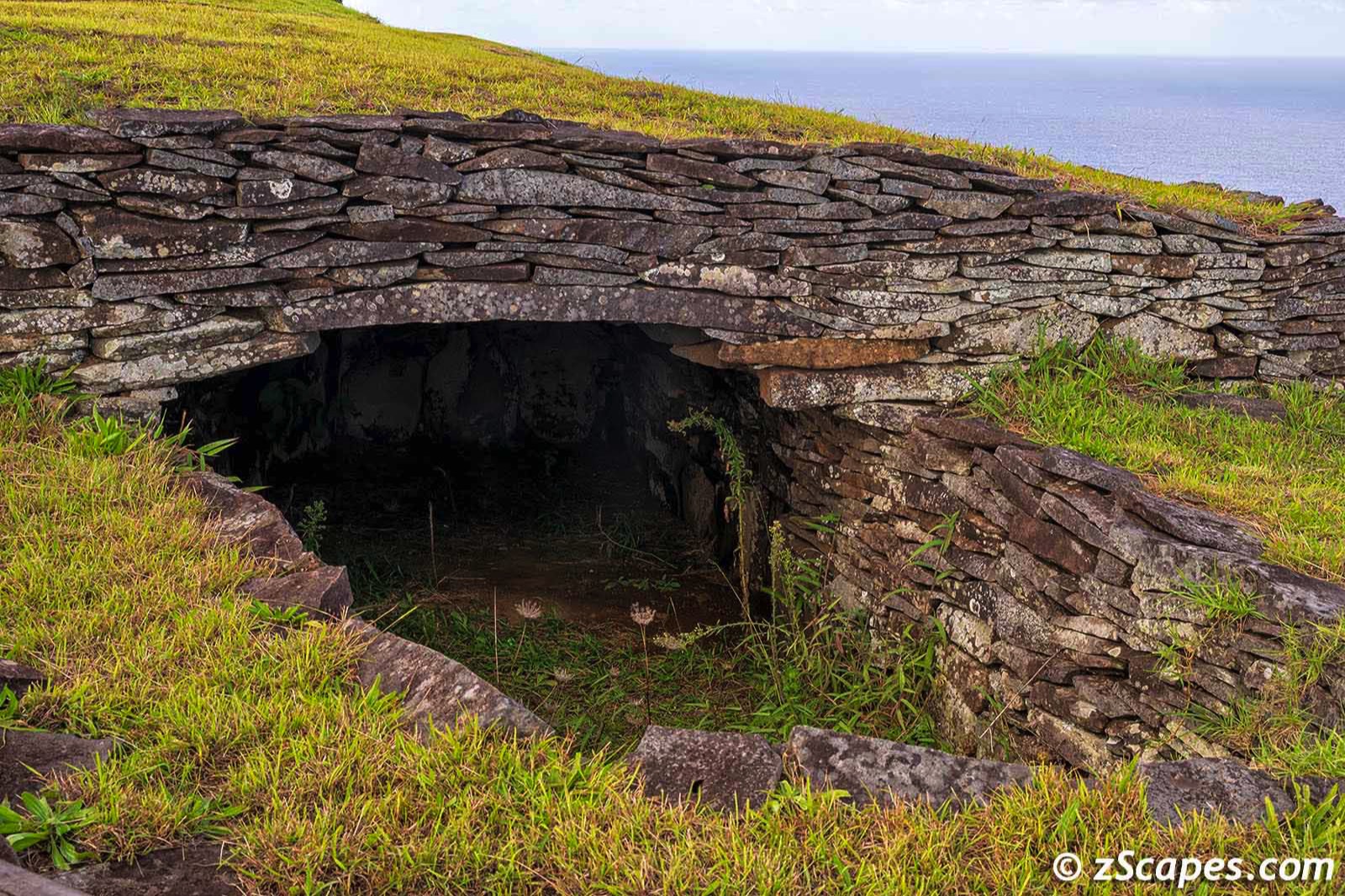
T'antana Marka burial caves @ Pisaq numbering over 3500
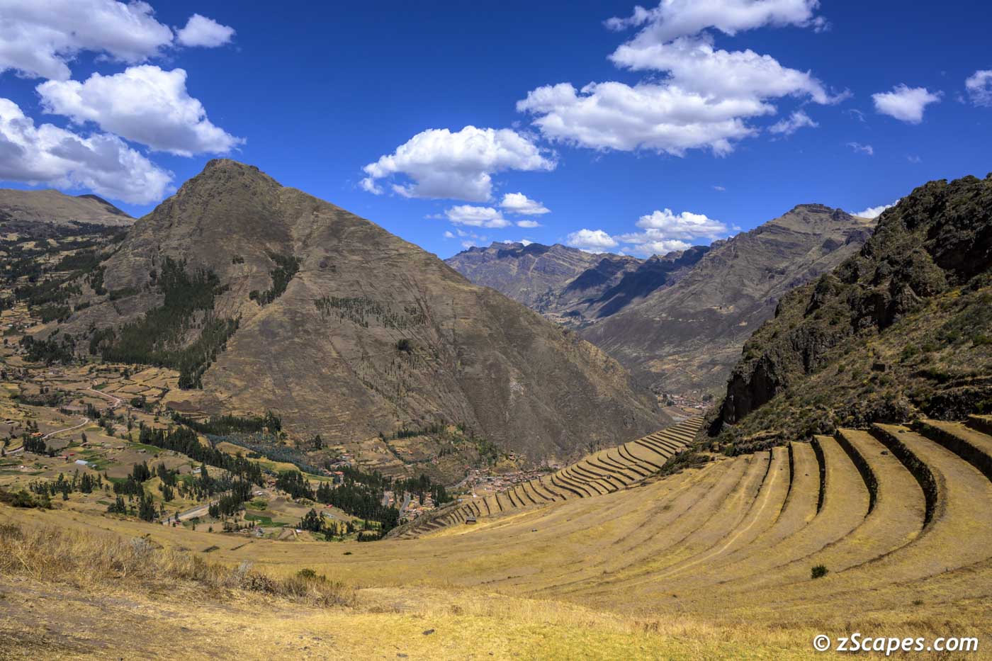
Pisaq Urubamba Valley view
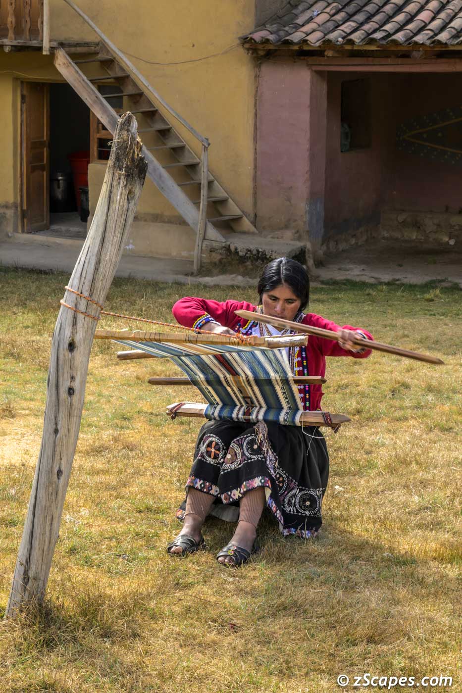
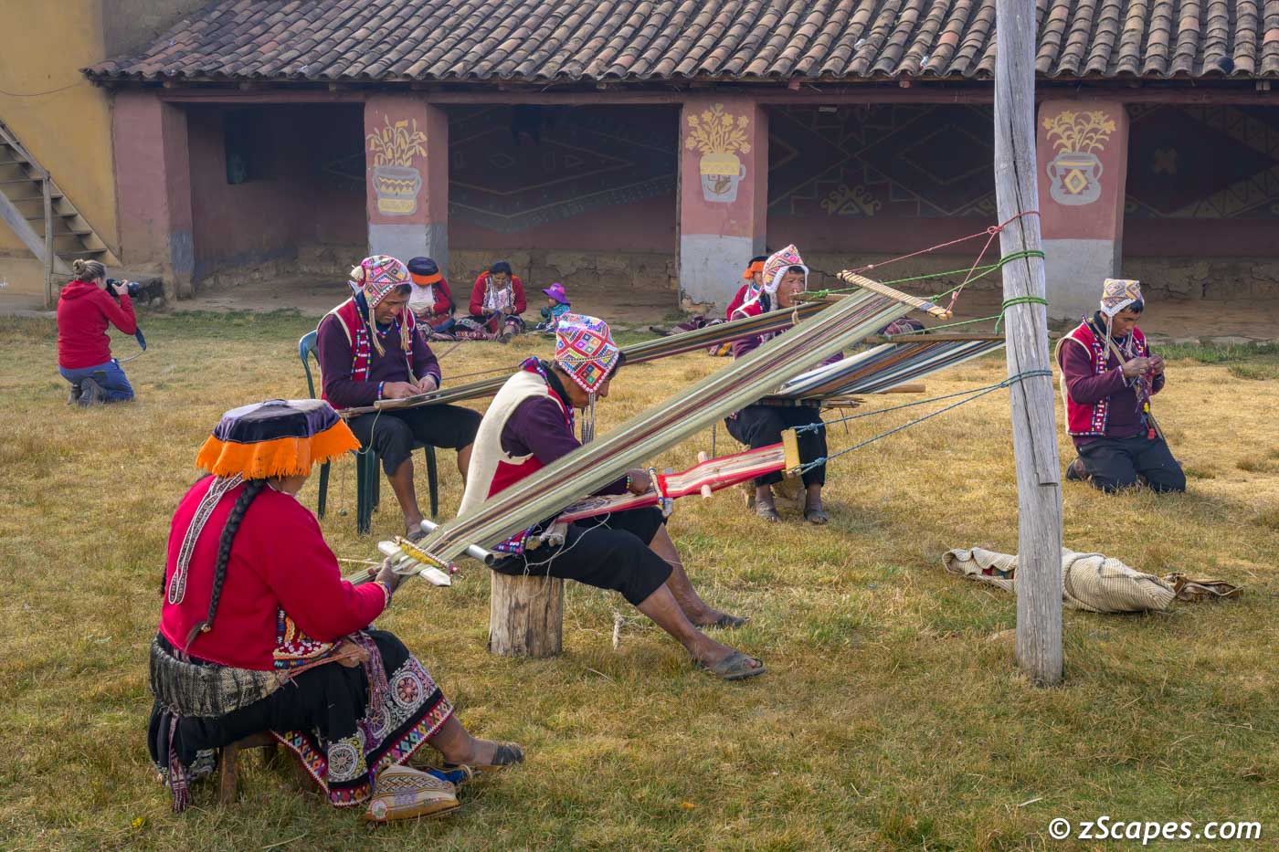
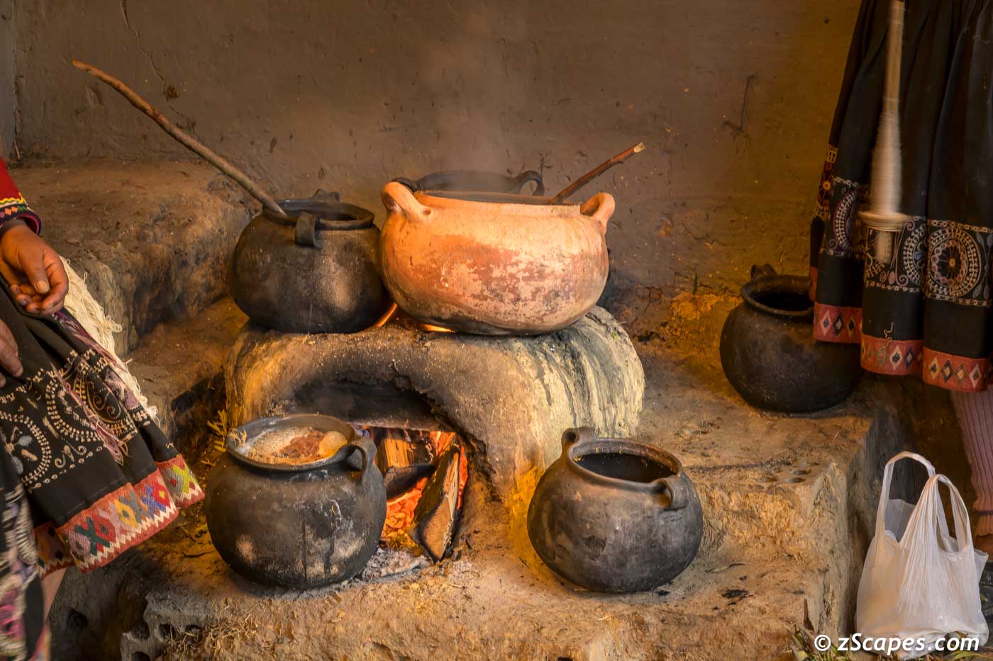
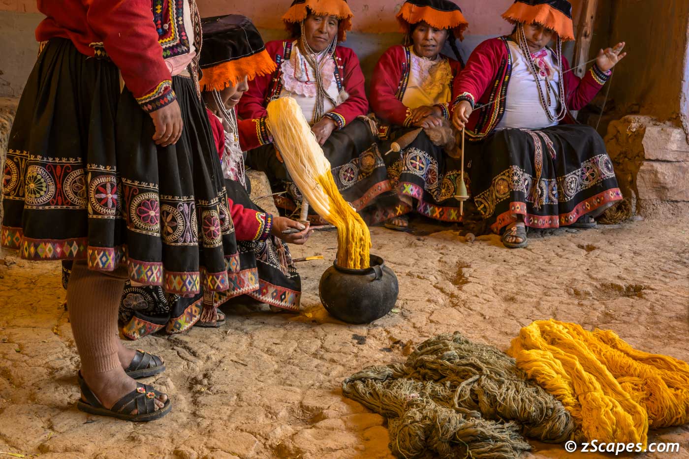
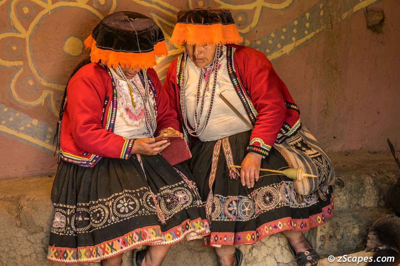
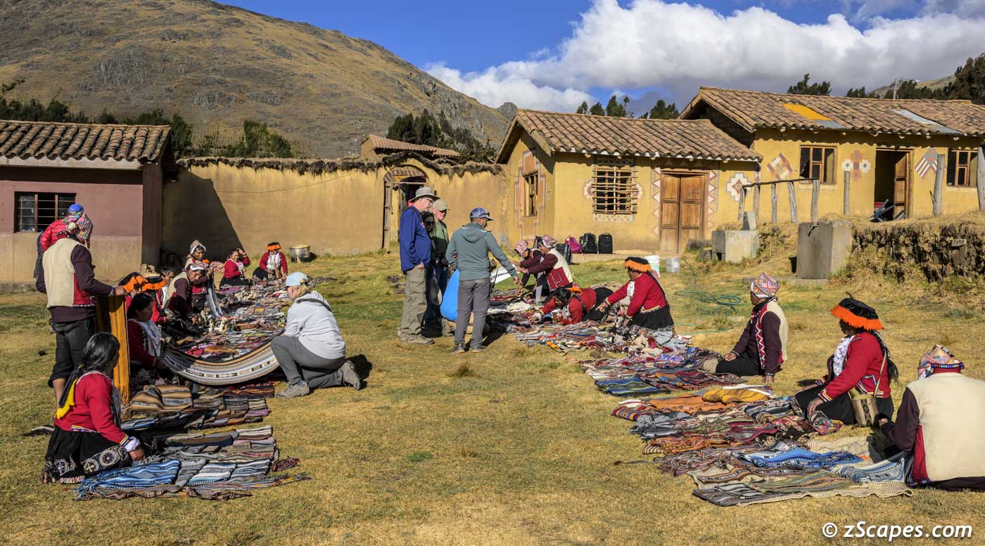
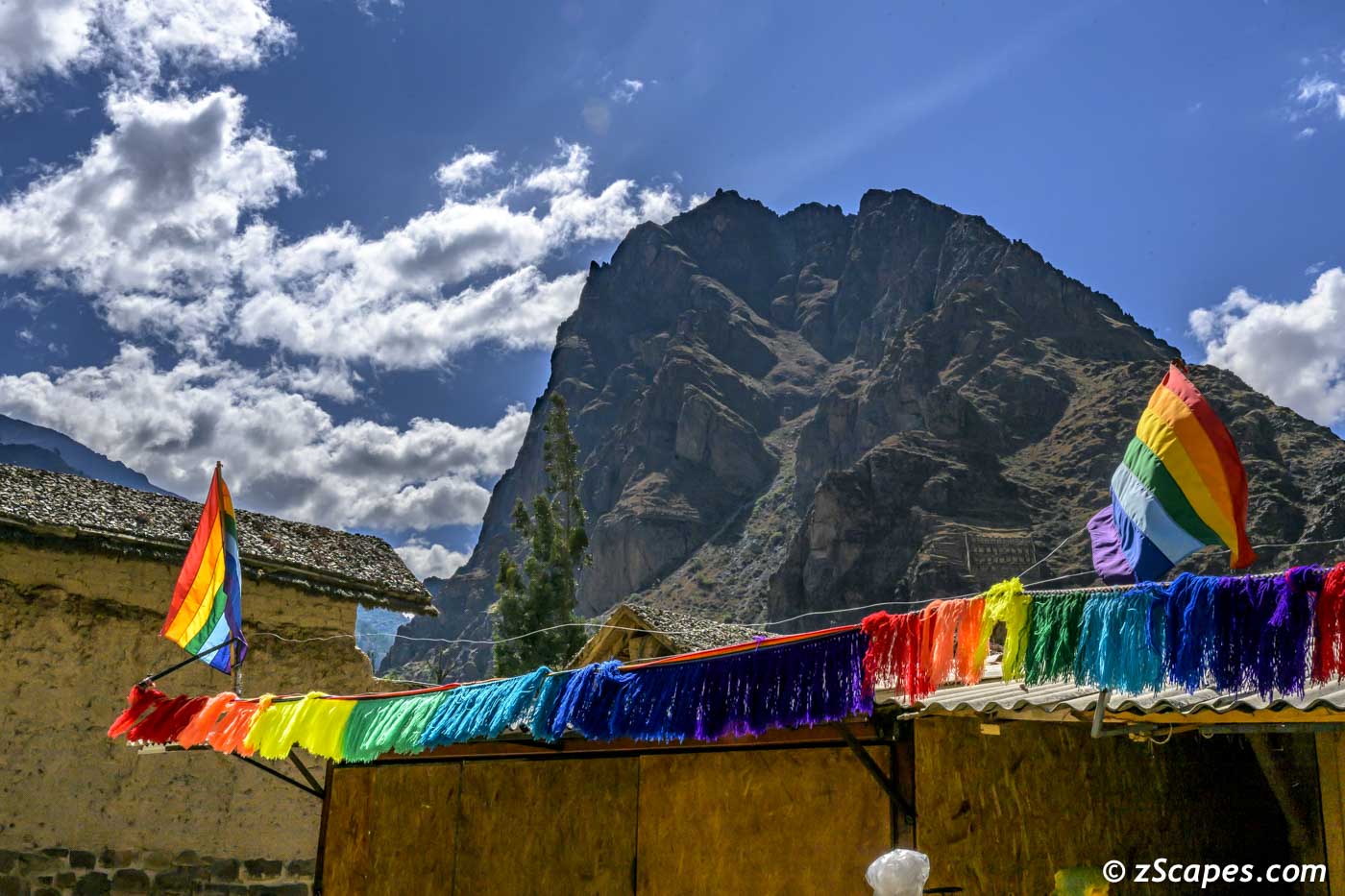
Weaving Community of Chahwuaytire
After taking in Mara & Moray sites, we had a long drive to the village of Chahwuaytire climbing up from the Scared Valley city of Pisaq to 12,631 ft (3,850 meters). Here nestled in spires of the Urubmaba range, is a small tight knit community of textile weavers who practice traditional methods and gather/farm all the materials to make natural dyes. We were allowed to photo them as they created their magic on a variety of looms and were treated to a demonstration of weaving styles and the dying process. And finished with an opportunity to buy these exquisite creations from the artists themselves. Of interest as this is a cooperative, any sale of merchandise was evenly distributed among the community with proceeds allowing them to send their children to school. You can learn more at the Centro de Textiles Tradicionales del Cusco.
Weaving on a backstrap loom
Weaving on a four-stake loom
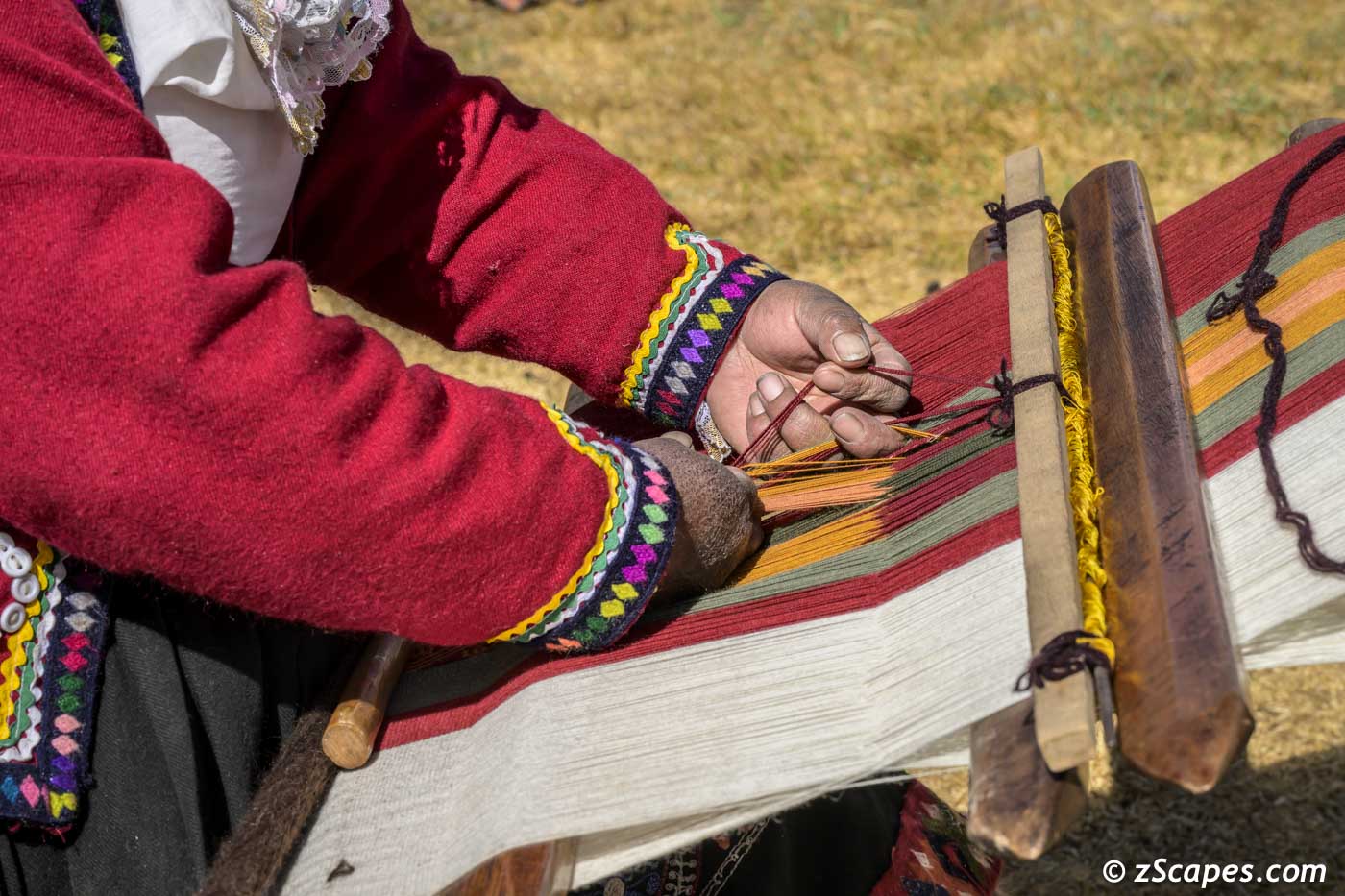
Close in of the intricate manipulation of the wools to create elborate patterns
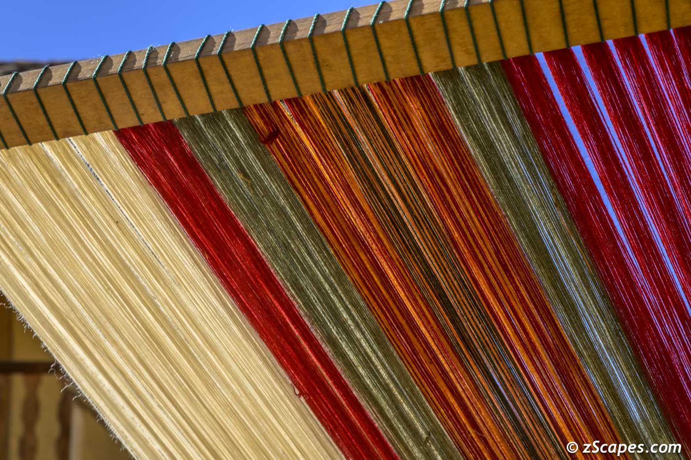
Vibrant colors all around
A perfect dye starts with a perfect oven
Orange dye creation as the artist look on and keep spinning

Rainbow of dyed wool and natural color sources
At 12k feet LTE with 3 bars!
Our chance to payback and support the community
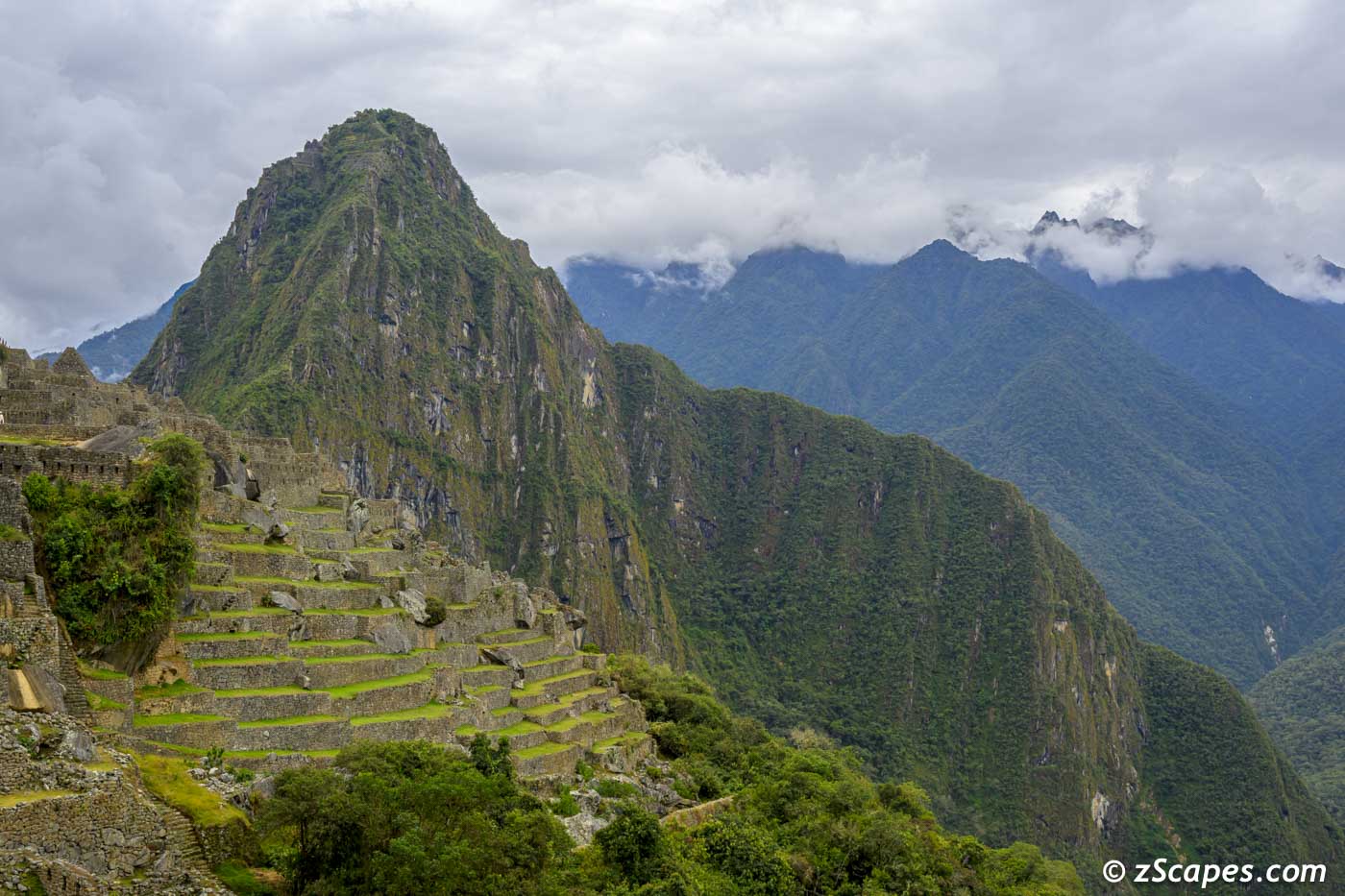
Machu Picchu Citadel of Pachacuti Inca
Today we embarked on the crown jewel of our adventure, Machu Picchu. Having been here 52 years ago, I was wondering how much change has occurred. When I went, we caught the train in Ollantaytambo, rumbled along the Urubamba river, passed Agua Calientes, stopped dead in the tracks (no station), stepped down with the aide of a wooden box, boarded a minivan (VW), proceeded up the switchbacks to the entrance and marveled at the low slung hotel/restaurant with a Coca-Cola sign! On this trip, boarded in Ollantaytambo, rumbled along the river, stopped in Agua Calientes station, walked to the the bus staging area, boarded a 40 passenger air-conditioned bus, proceeded up the switchbacks (much improved) to an intensely crowded entrance and a 5 star hotel. The entrance was swarming with people snaking along one of two routes (reservations needed) and finally walking into the city. Fifty two years ago, about 200 people in and around and access to the entire complex. Fast forward to 2025, the daily quota is 6k via two routes and being pushed to 7k per day along 3 routes. Still the magical place I remember, hoping it can be preserved for the wonder it is. My last thought, you have to go and be there to absorb the power of this place.
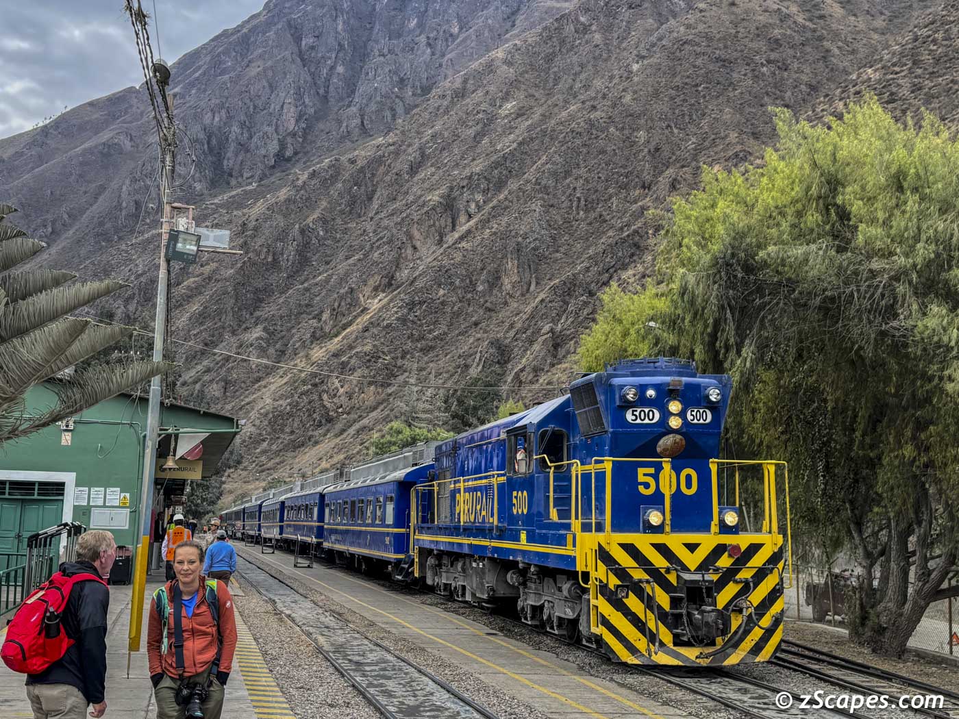
Ollantaytambo departure station via PeruRail
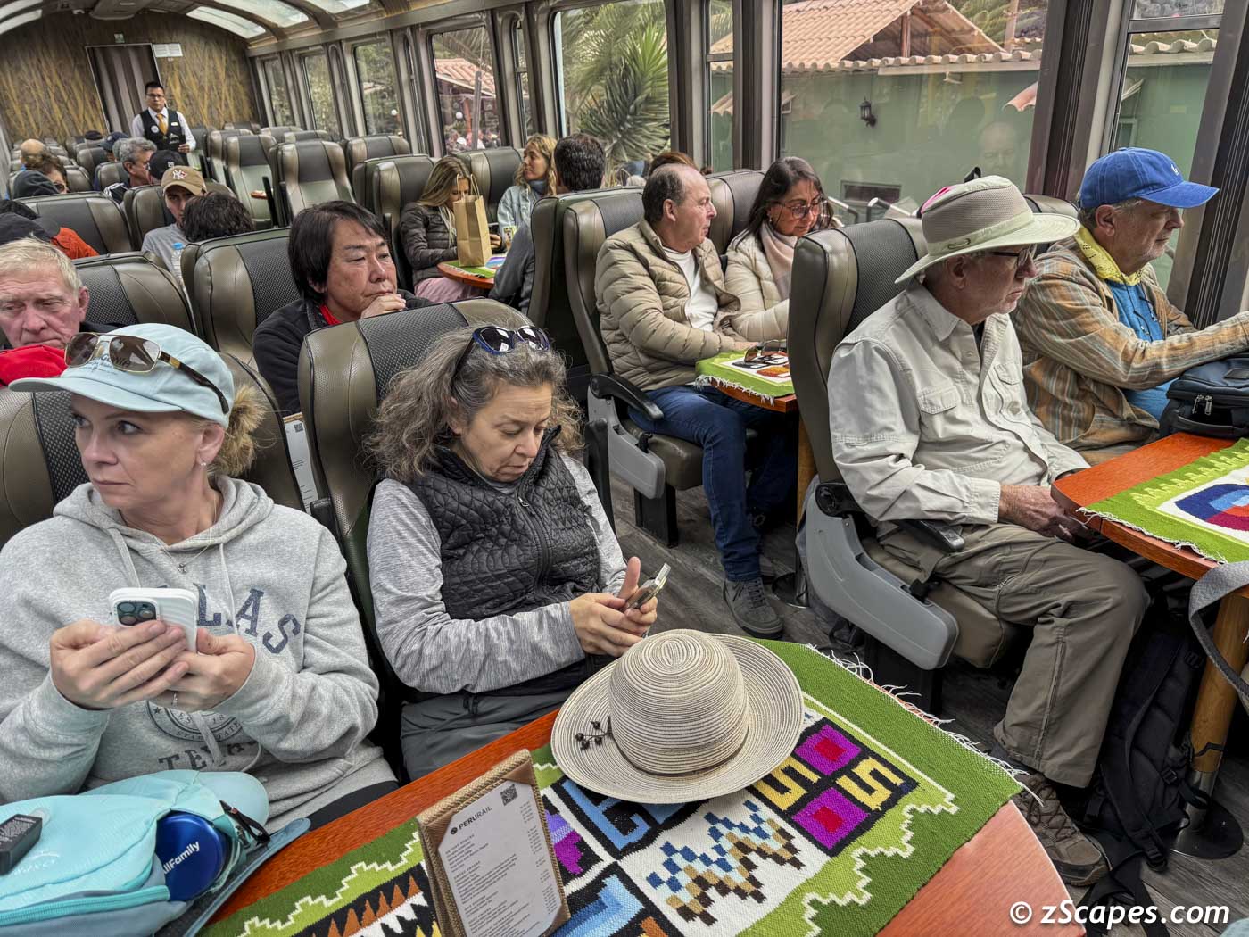
On our way to Machu Picchu

Henry our five star guide to our journey
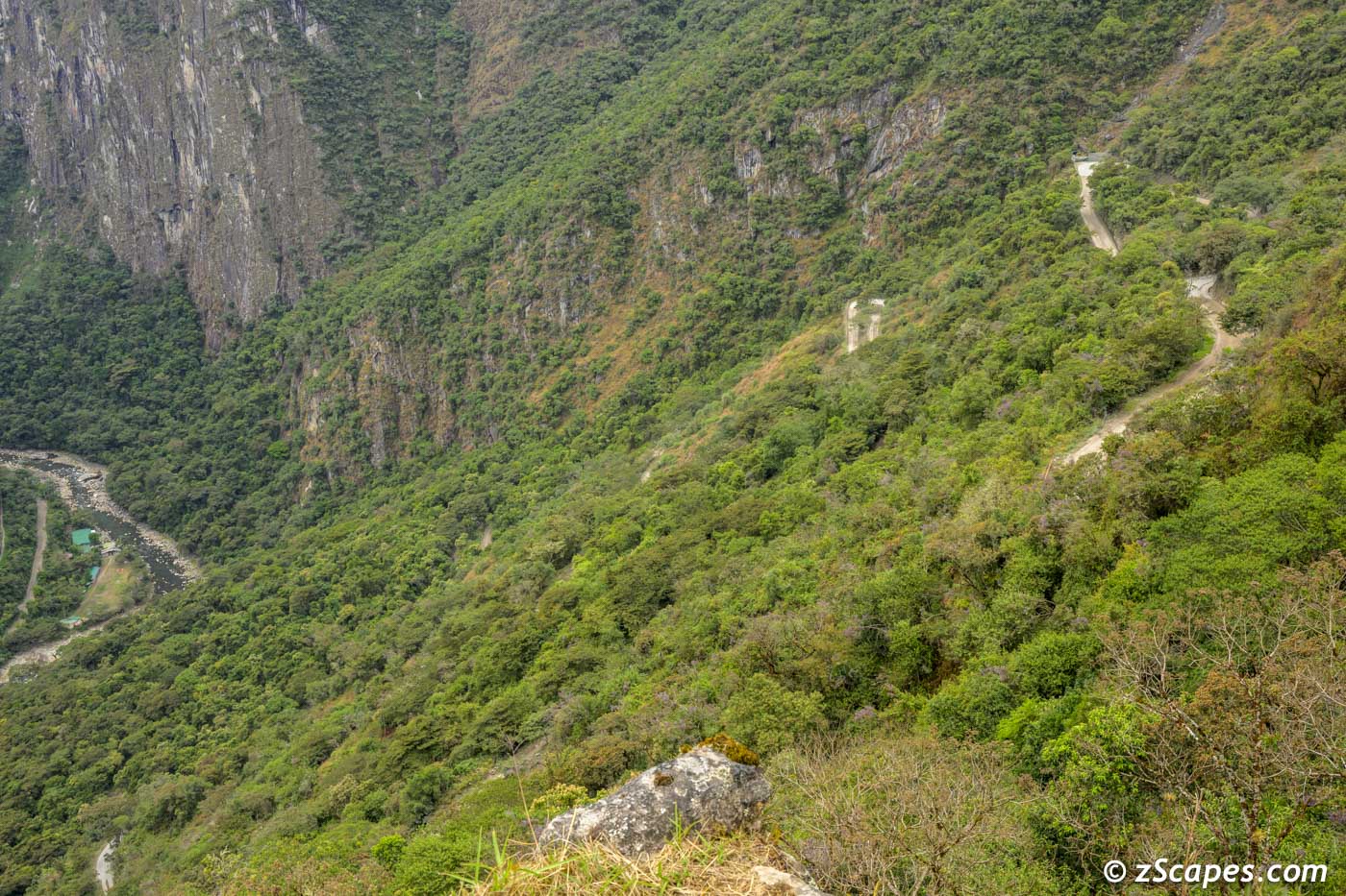
The zig zag to Inca heaven
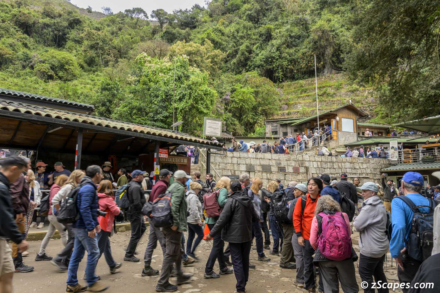
Winding queues at the entrance
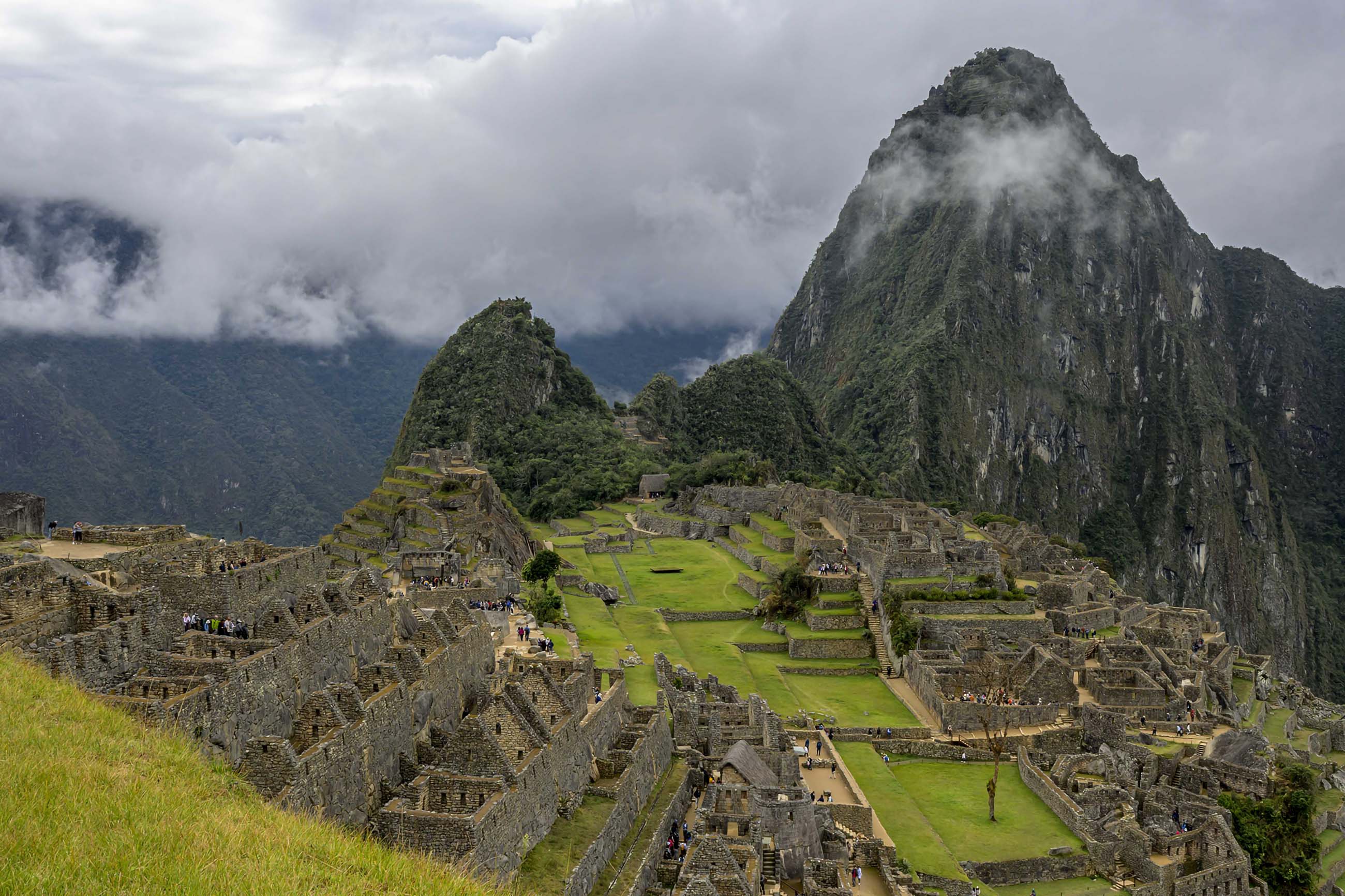
Classic view
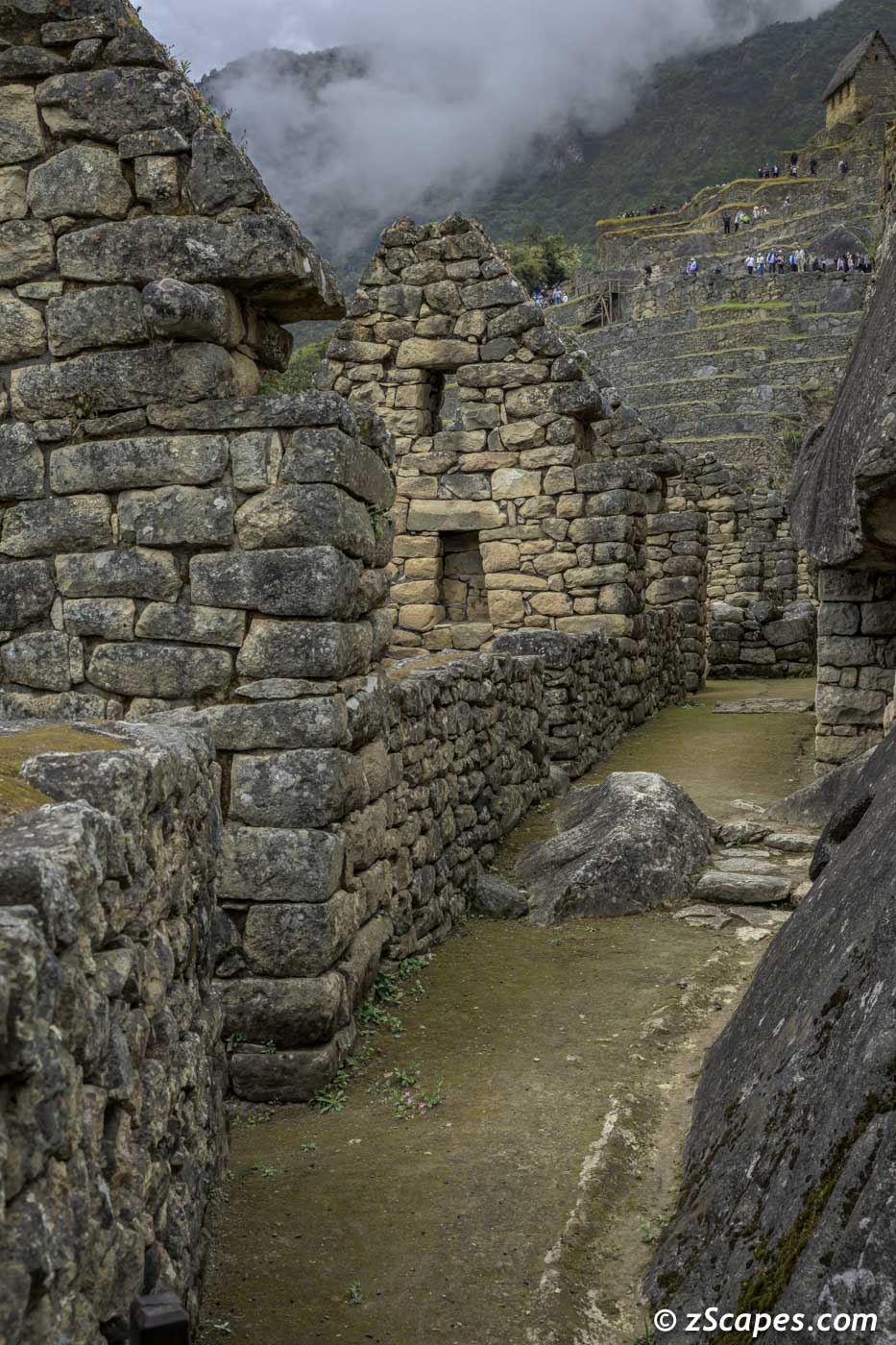
Example of the tight stonework and structures
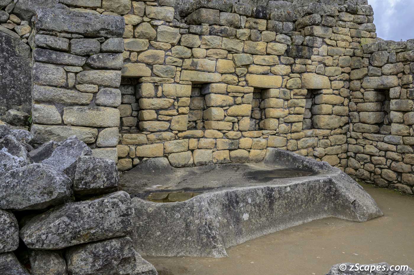
Possibly one of the many altars in the complex
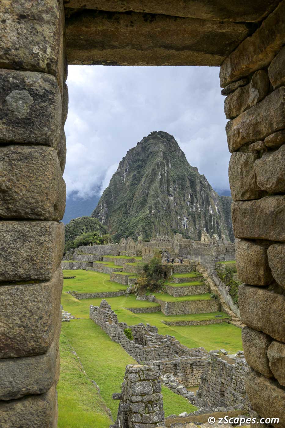
Huaynapicchu picture window
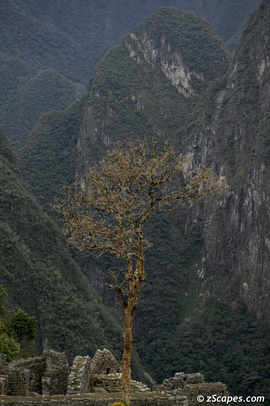
Lonely tree
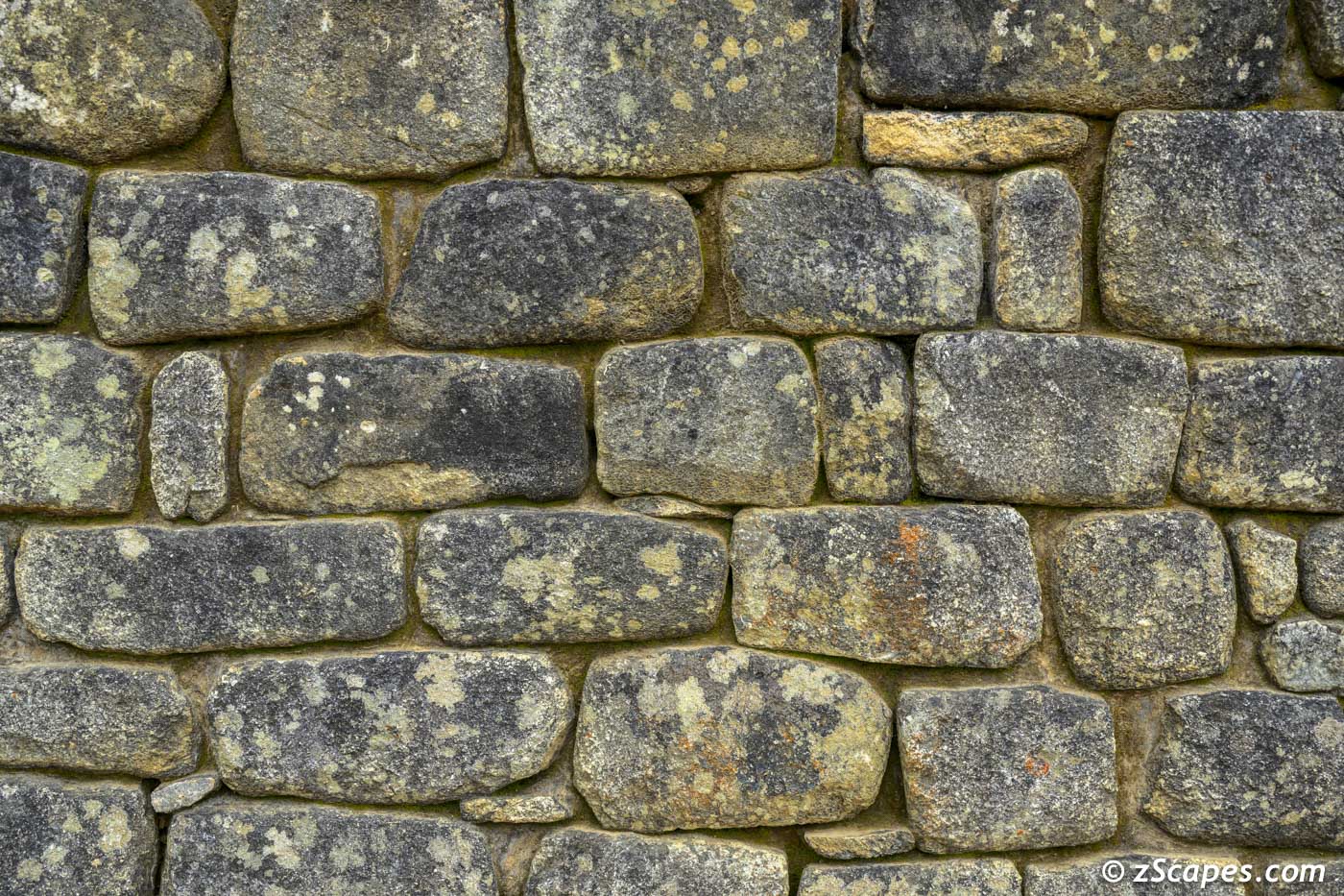
Stonecraft of the Incas
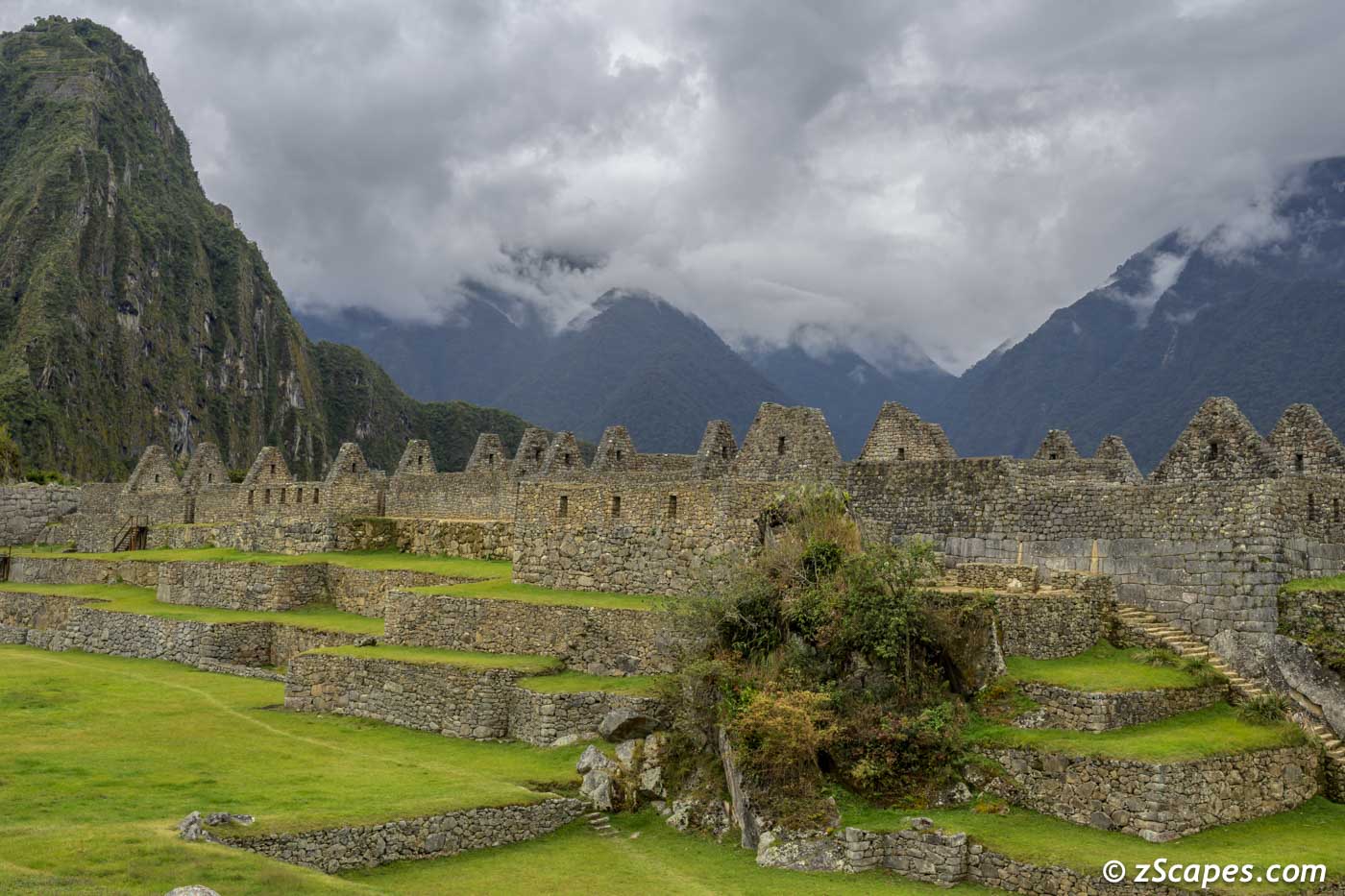
Roofs & peaks of Machi Picchu
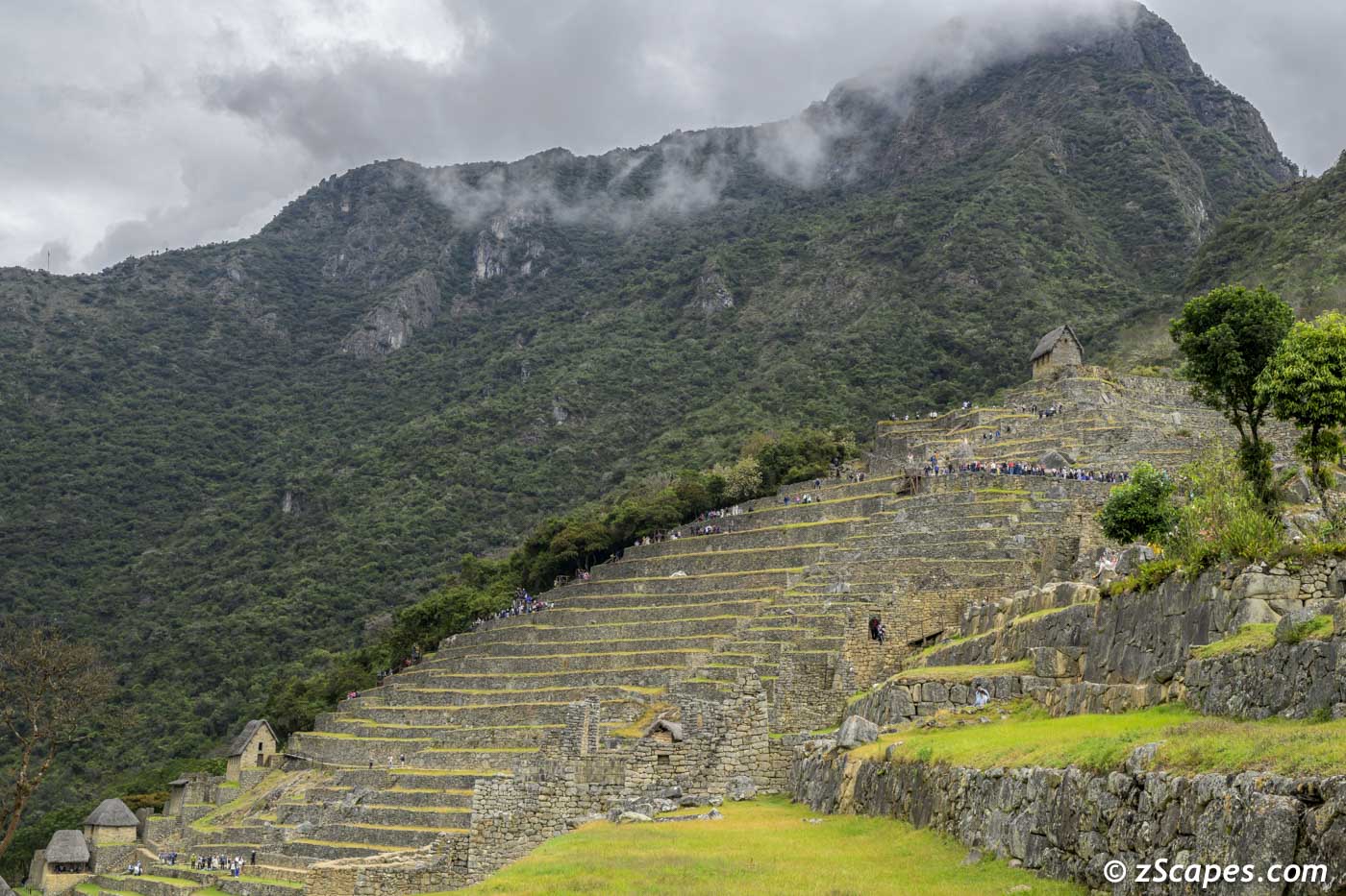
Cultivation terraces
Huayna Ridge (requires reservation to climb)
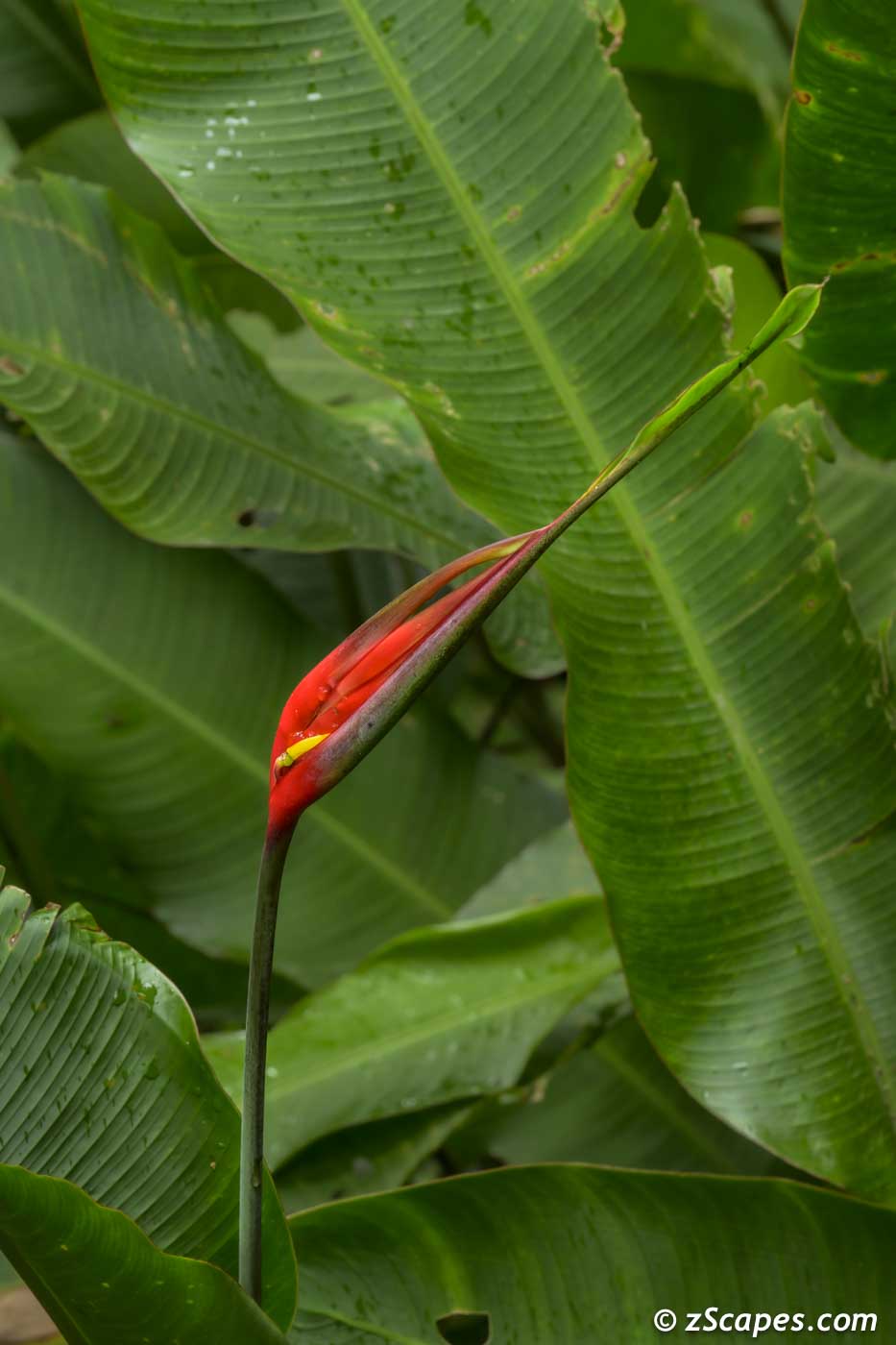
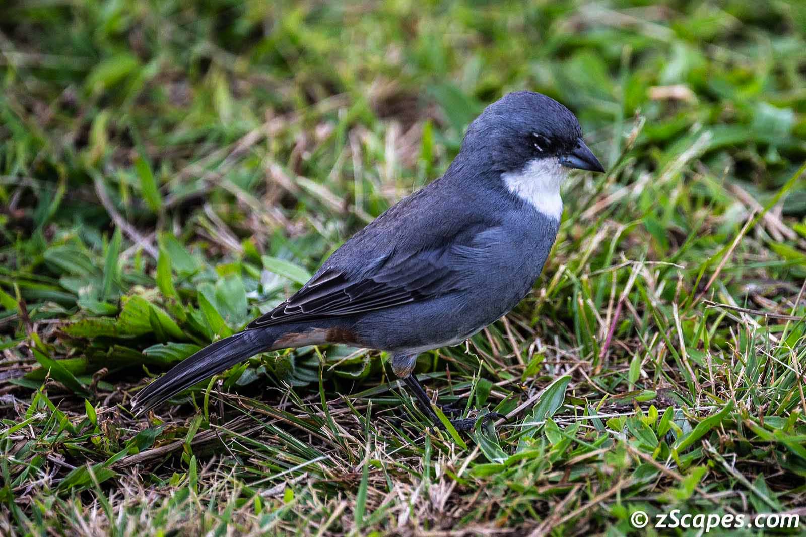
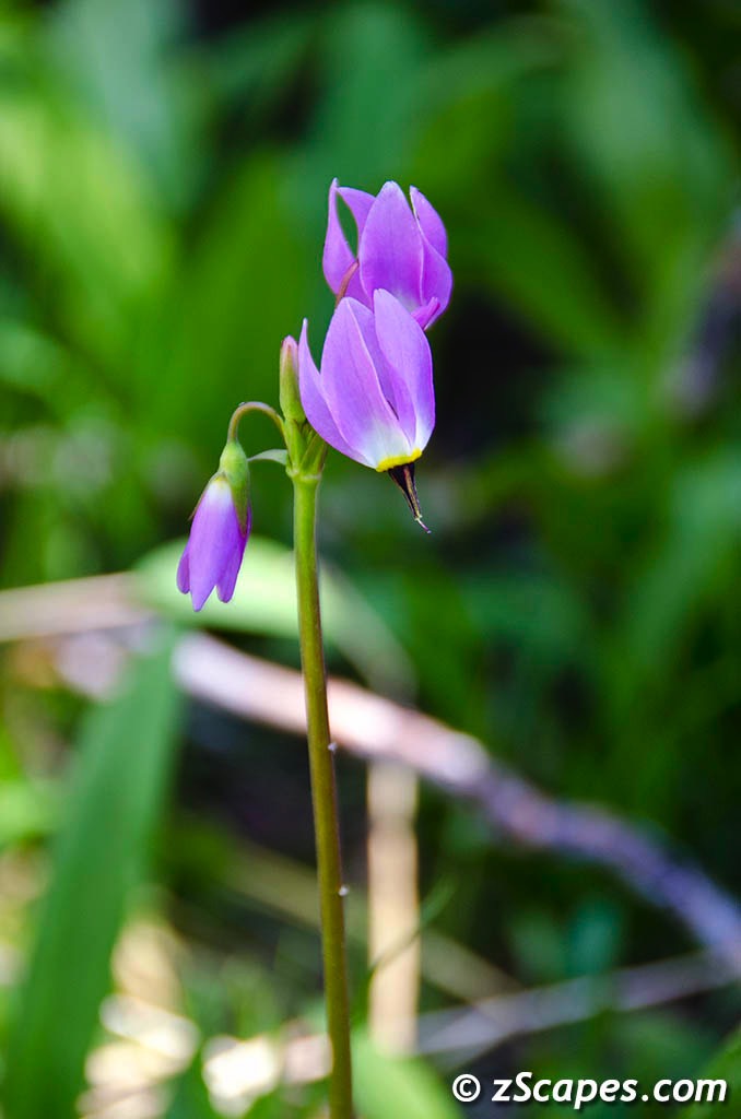
A spot of beauty (Shining Bird of Paradise)
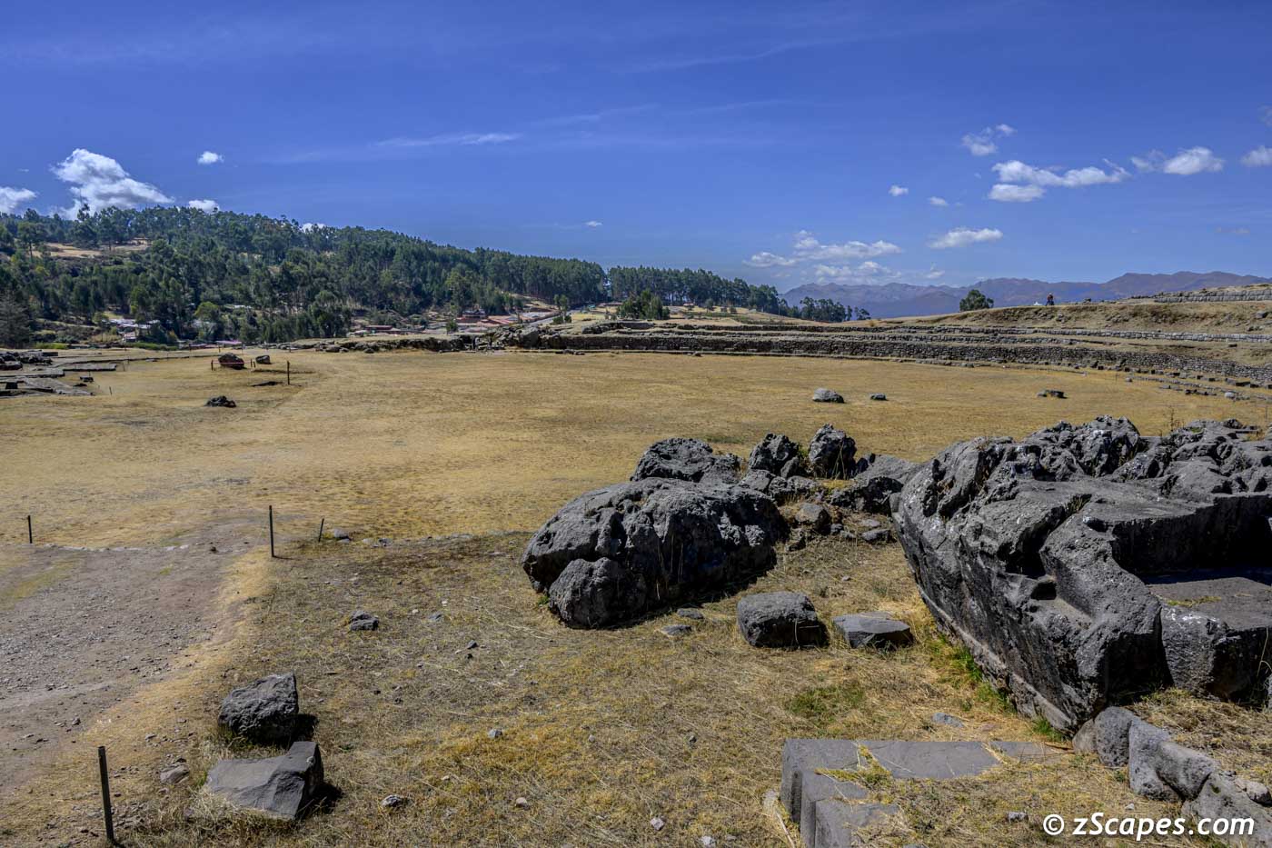
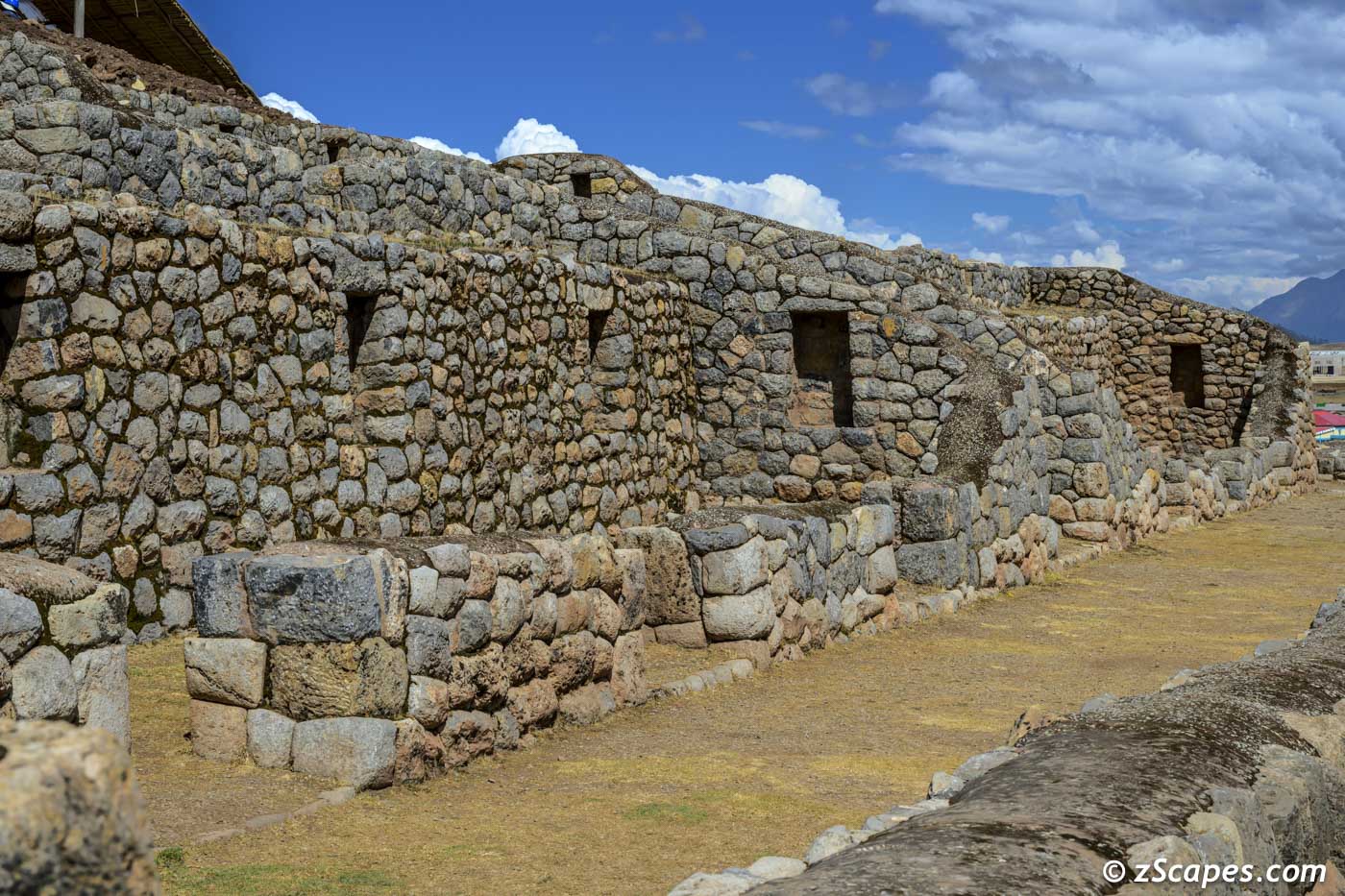
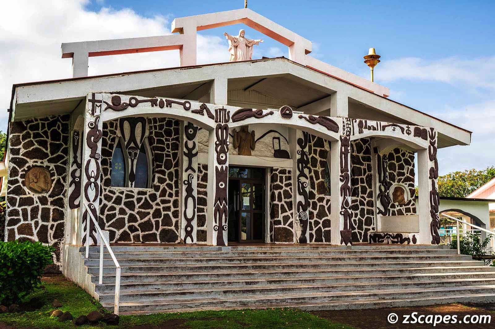
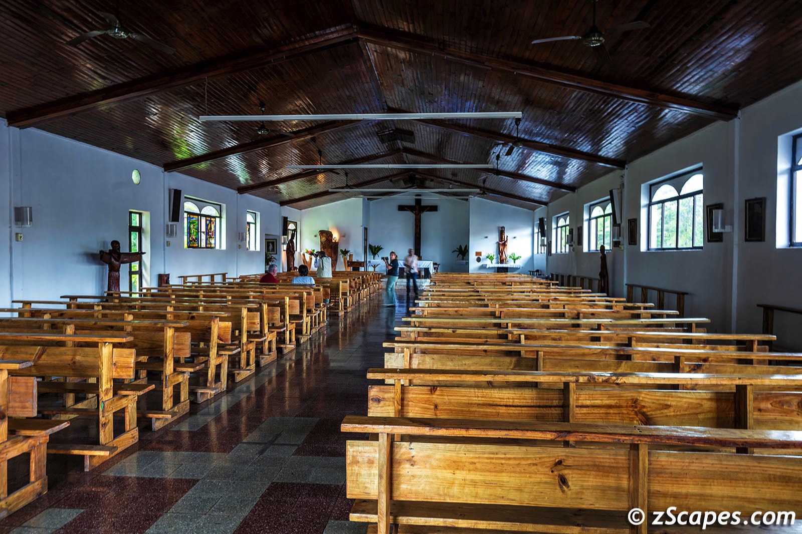
Cusco Capital of the Inca Empire
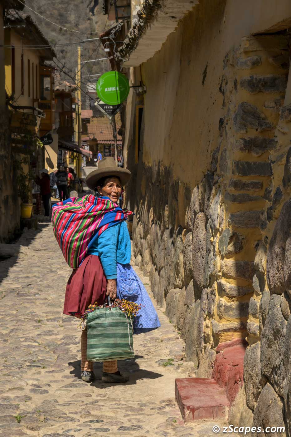
Our itinerary today included exploring the city of Cusco, visiting Saksaywaman and a bit of street & night photography. As the capital of the Inca Empire until the 16th-century Spanish conquest, it was here where the Incas ruled their vast kingdom of the four parts and was the dominant civilization of South America for hundreds of years. When I visited in 1972 the population was ~126k and has now increased to ~512k, quadrupling over the years. Even with the increase, it still maintained the Inca/Spanish vibe of years ago. An ancient place built on layers of civilization as its peoples learned to adapt while remembering their culture and never forgetting where they came from. The red roofs of Cusco will always have special place etched in my memories.
Qocha Chincanas reflective pool for stargazig & predictions and later as a graveyard
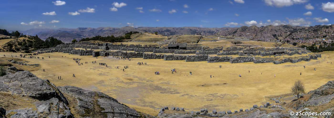
Sacsayhuaman ceremonial center
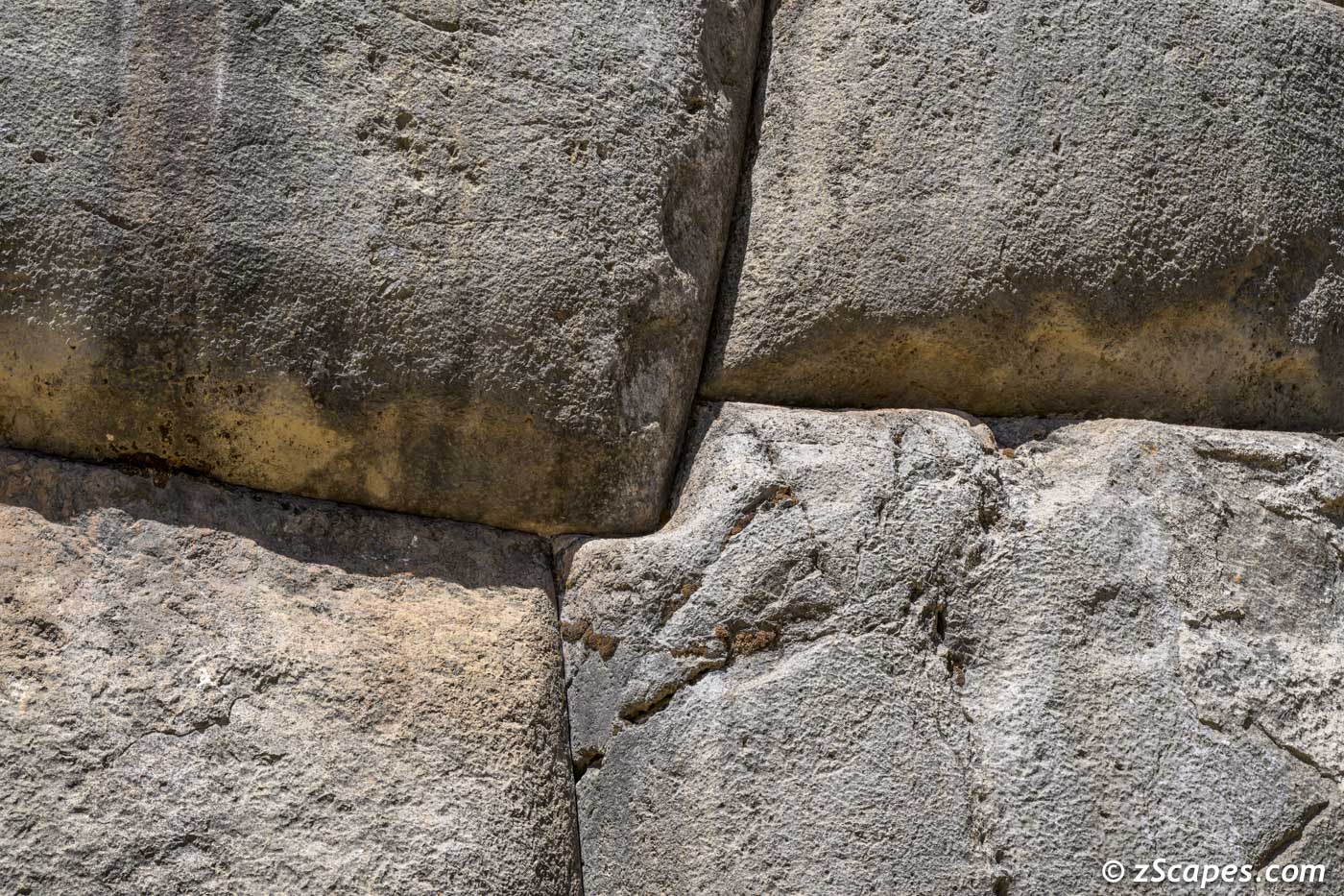
Sacsayhuaman precise stone cutting with only natural fiber ropes, stone hammers, and bronze chisels
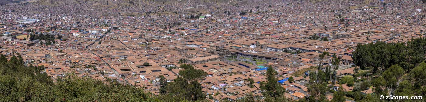
Cusco view from St. Cristobol
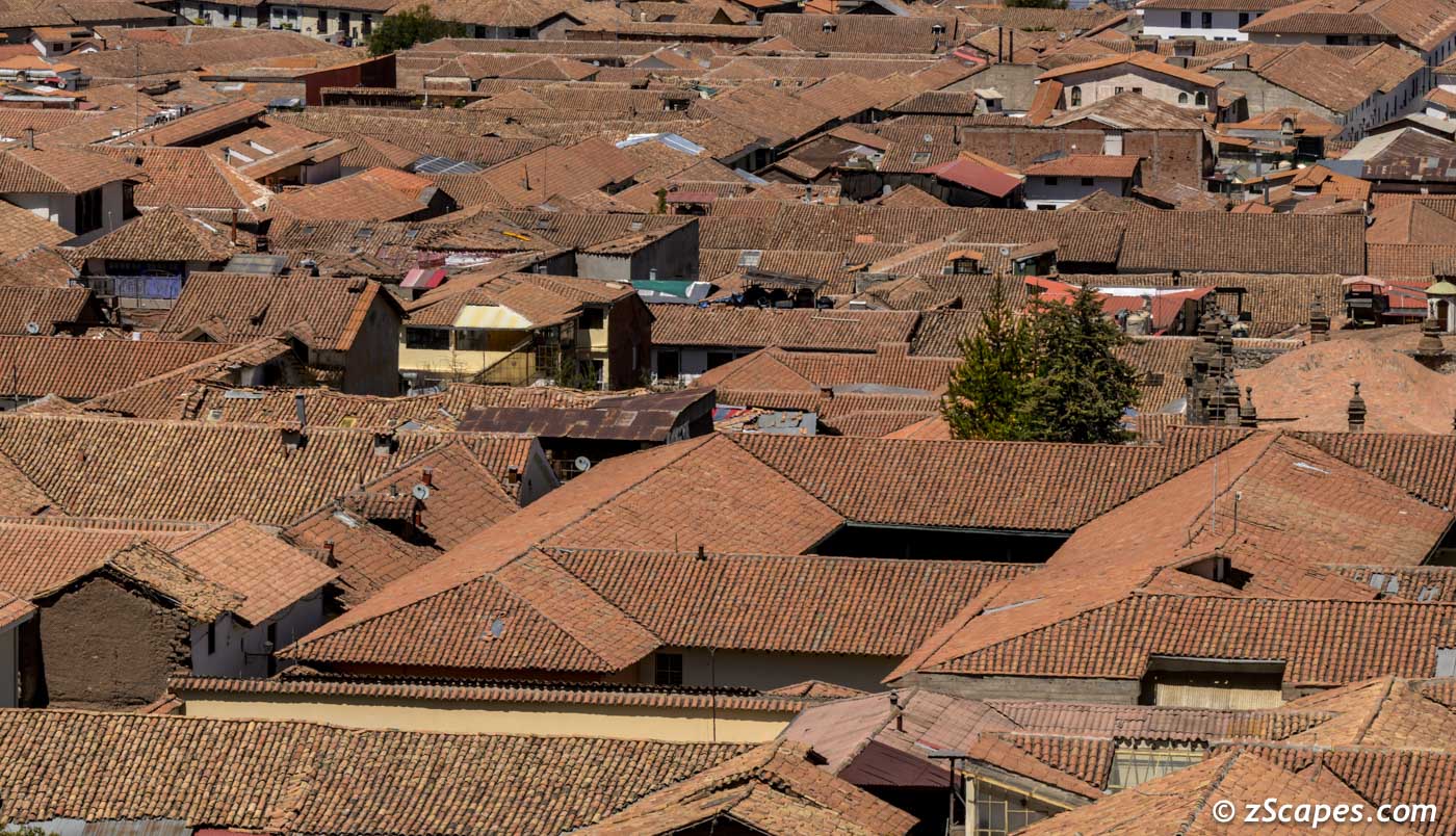
Red Roofs of Cusco
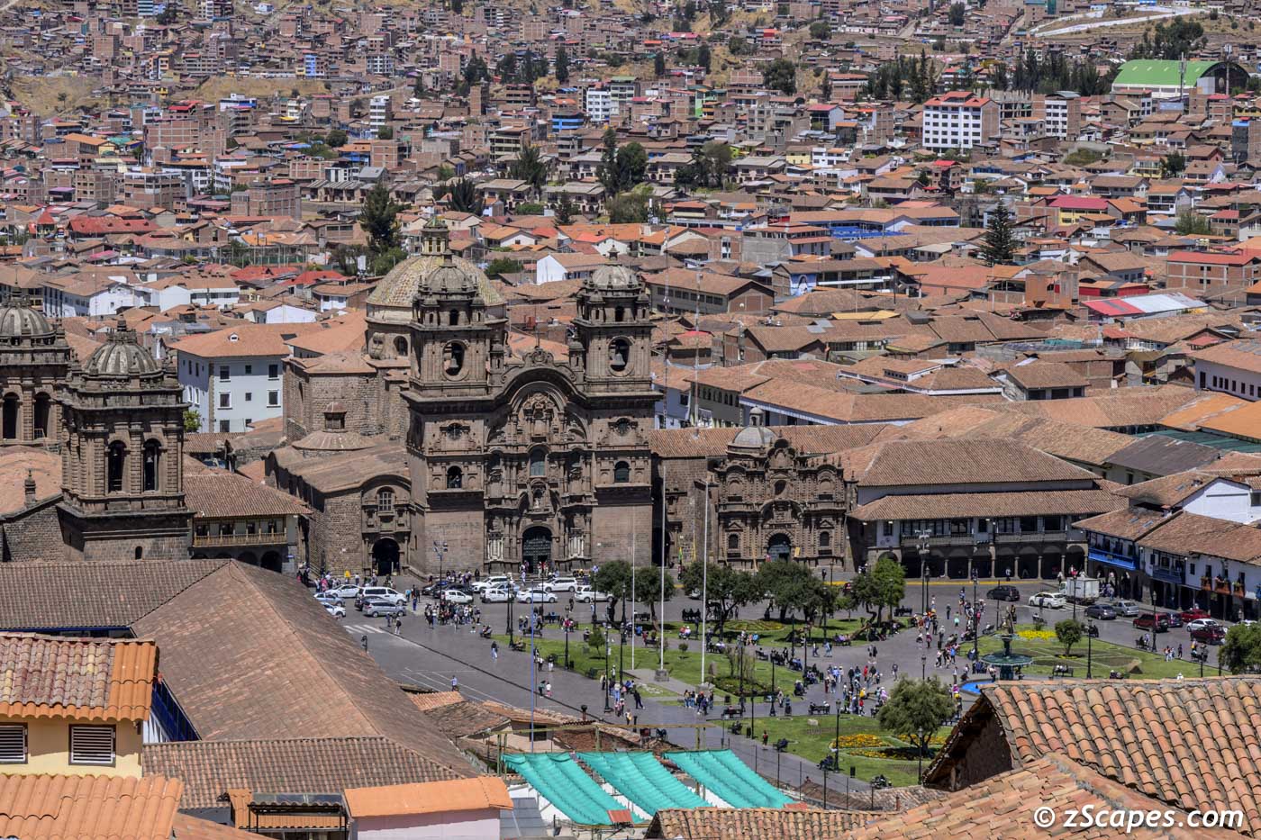
Plaza de Armas view from St. Cristobol
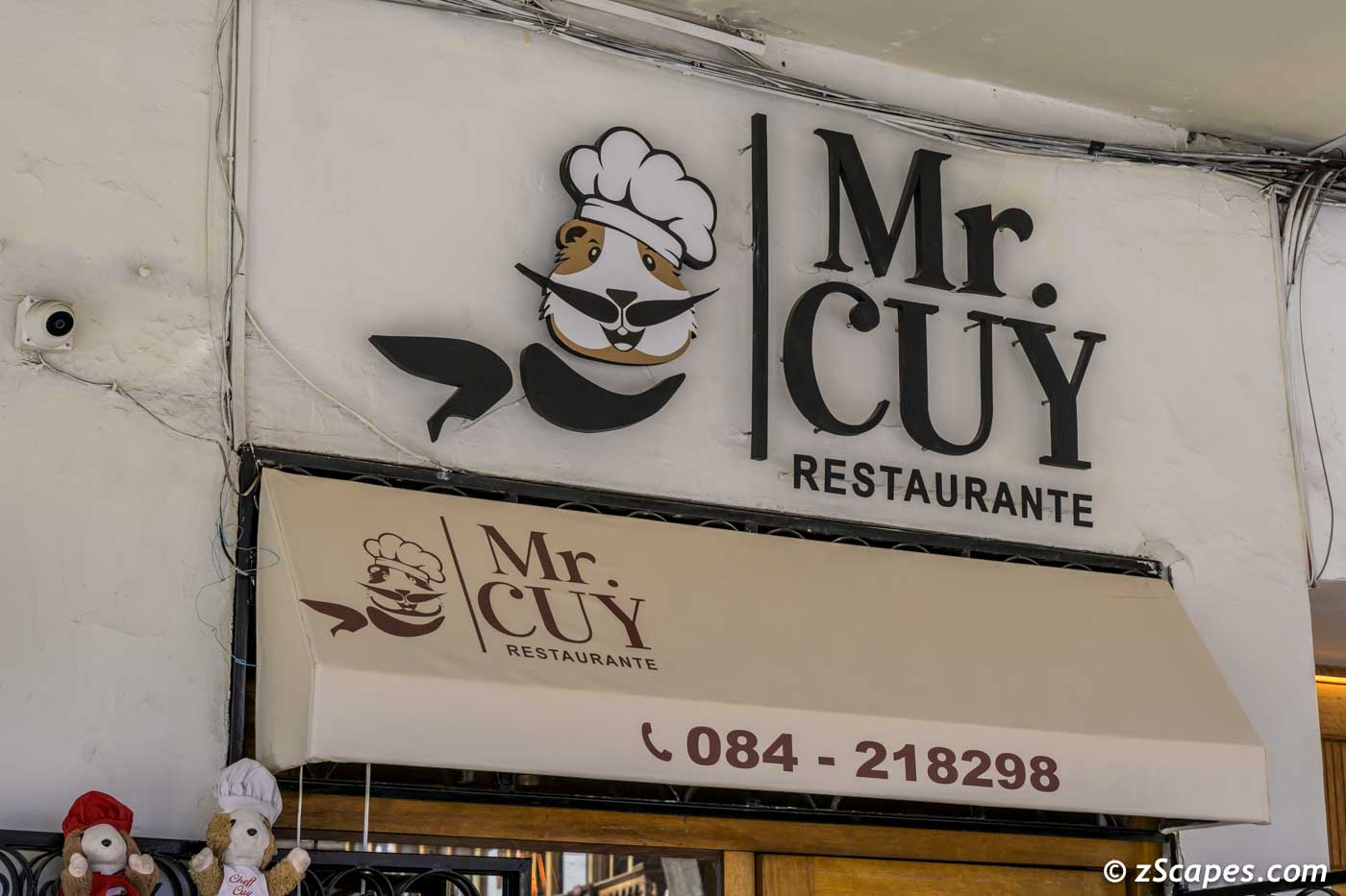
Local Delicasy
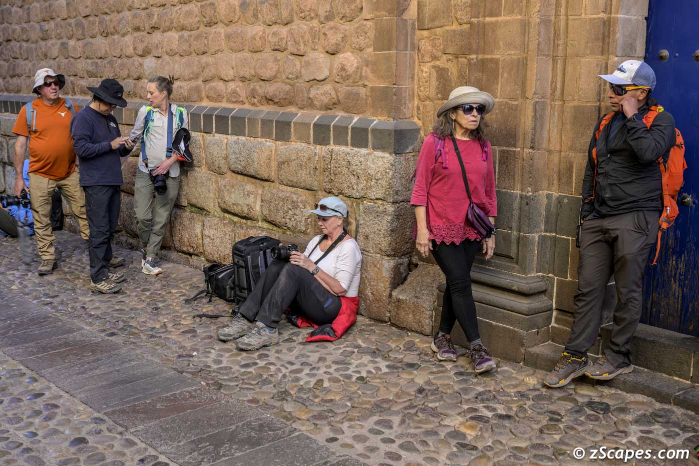
Fellow pgotographers capturing street scenes
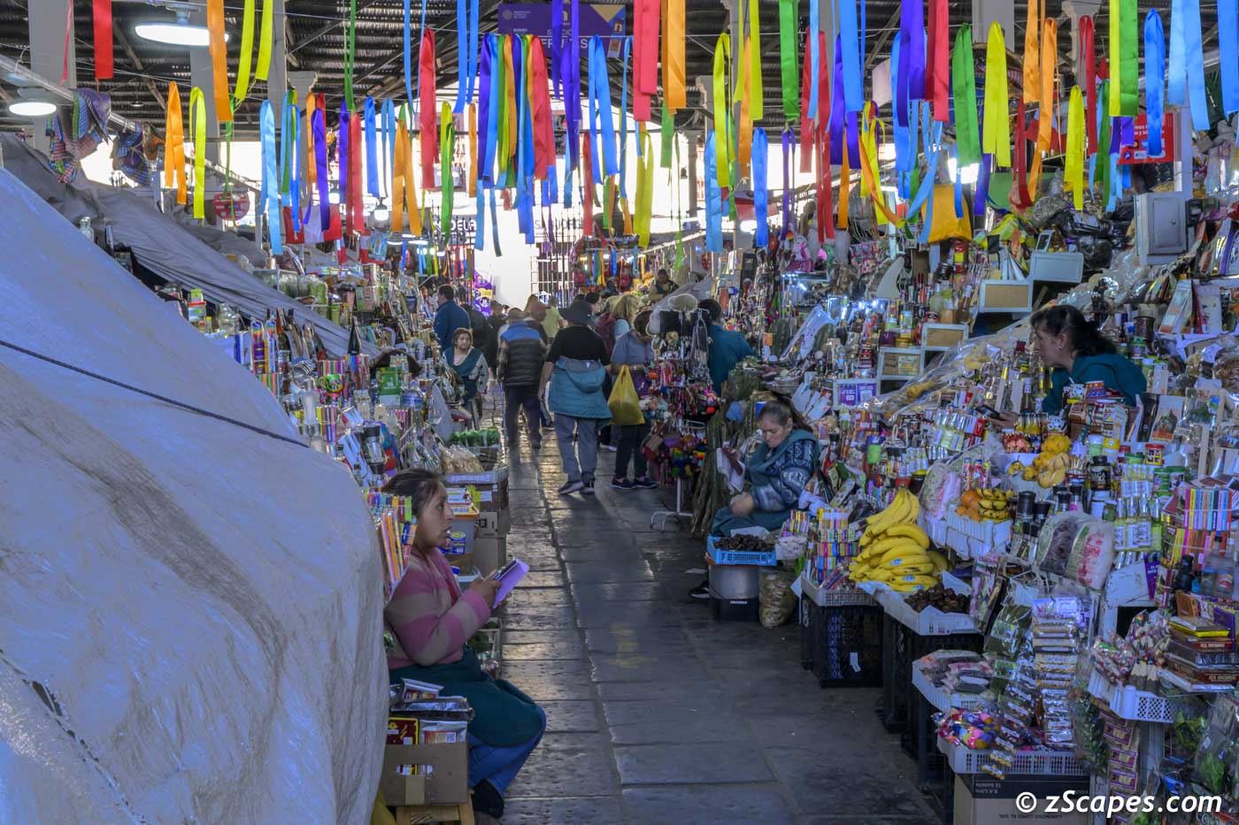
Cusco market
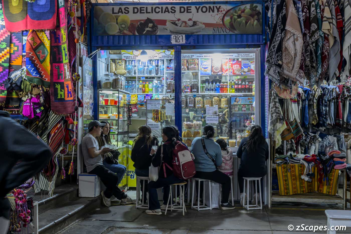
Cusco market sweet shop
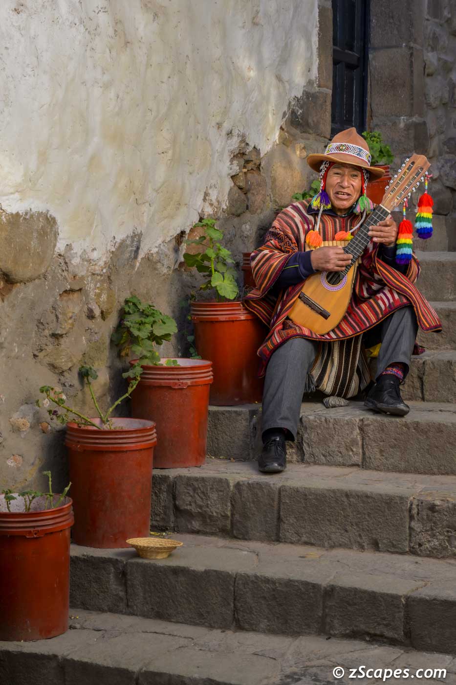
San Bolas musician serenade
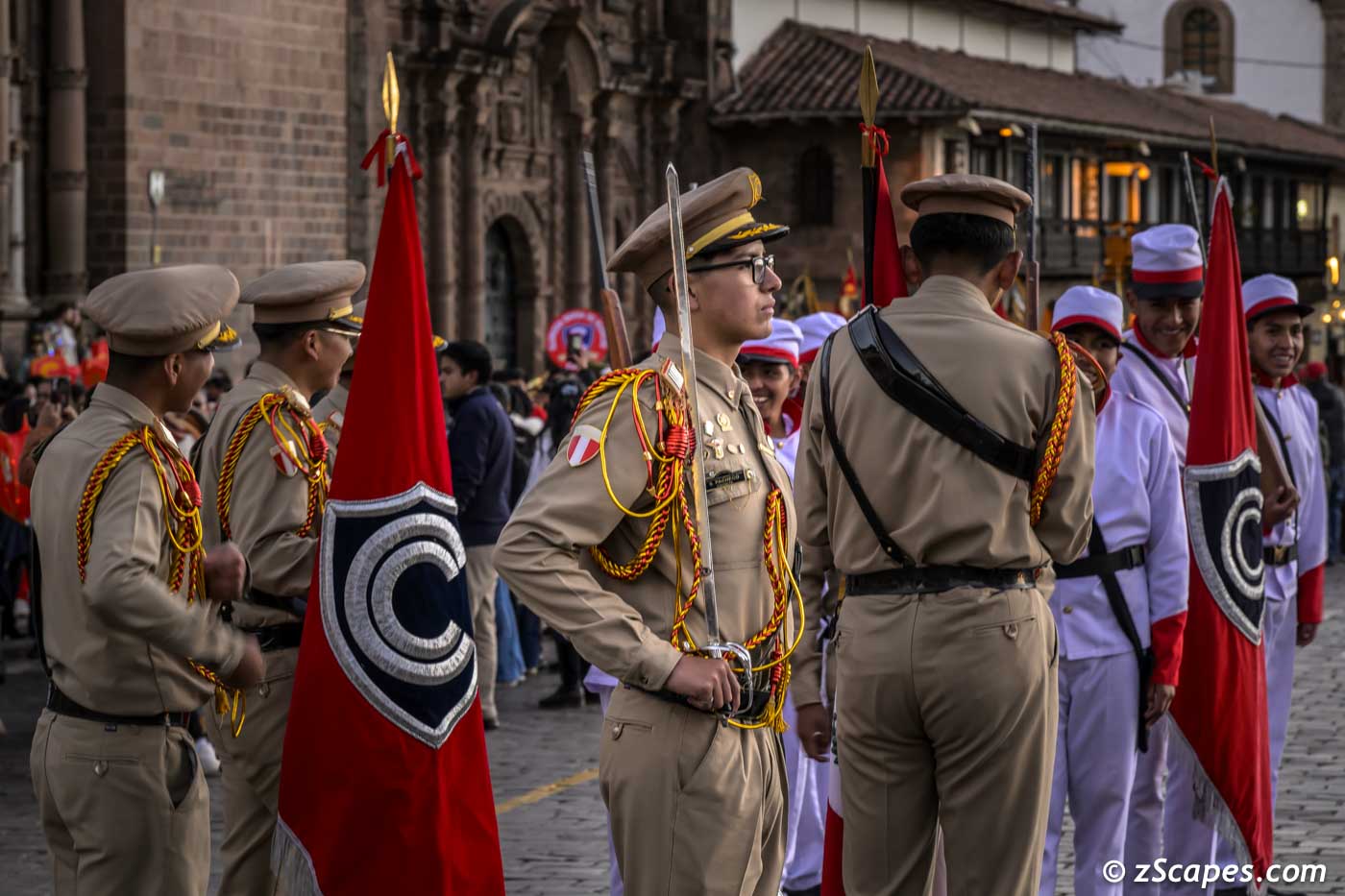
Soldier at a attention during chruch ceremony & parade
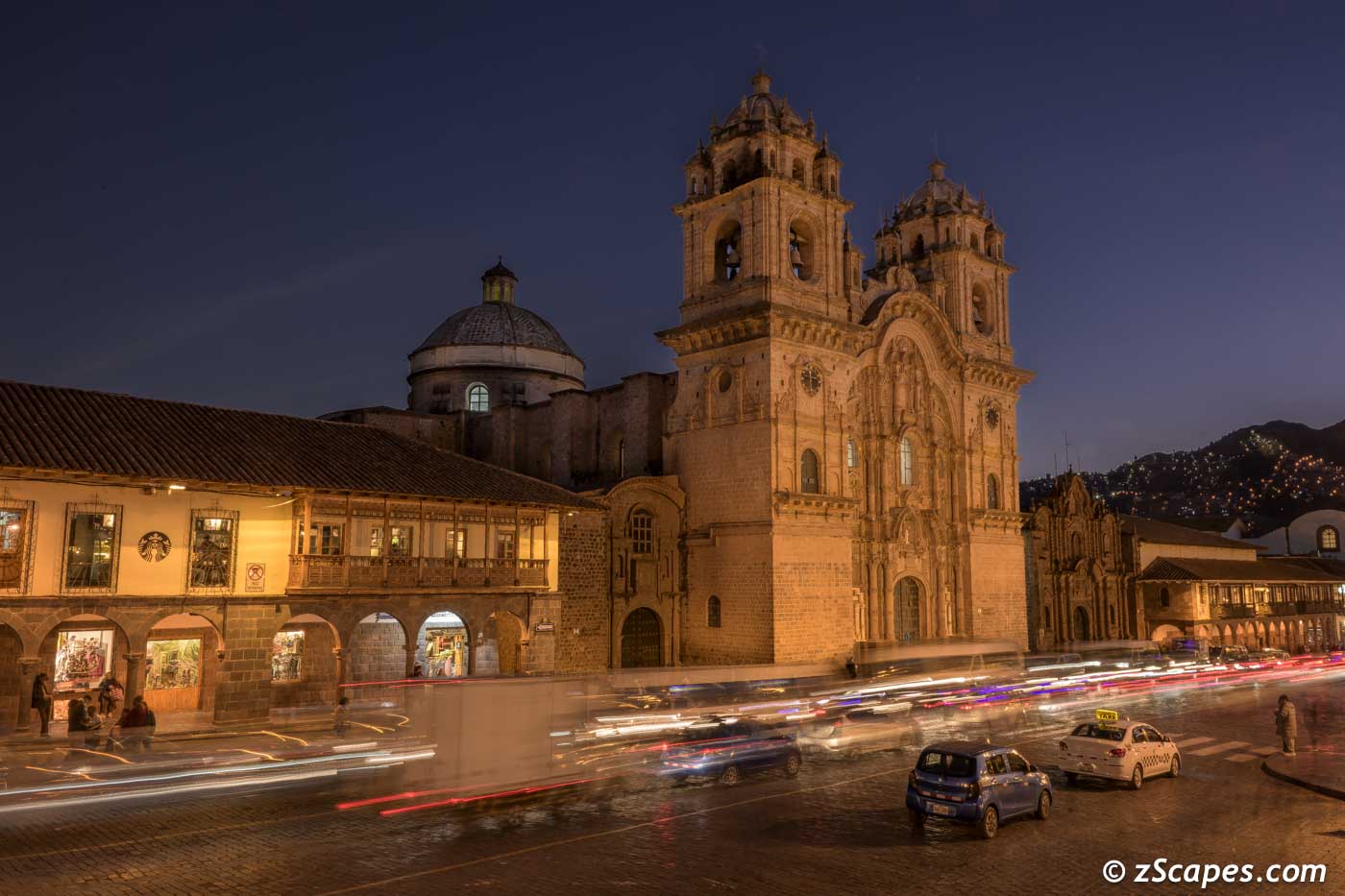
Plaza lightstreams
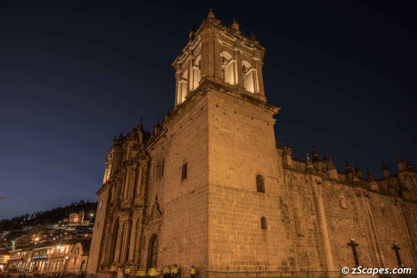
Cusco Catherdal @ Plaza de Aramas
Ollantaytambo Fortress & Sondor Pampa Five Lagoons
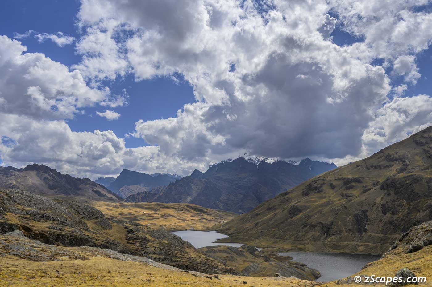
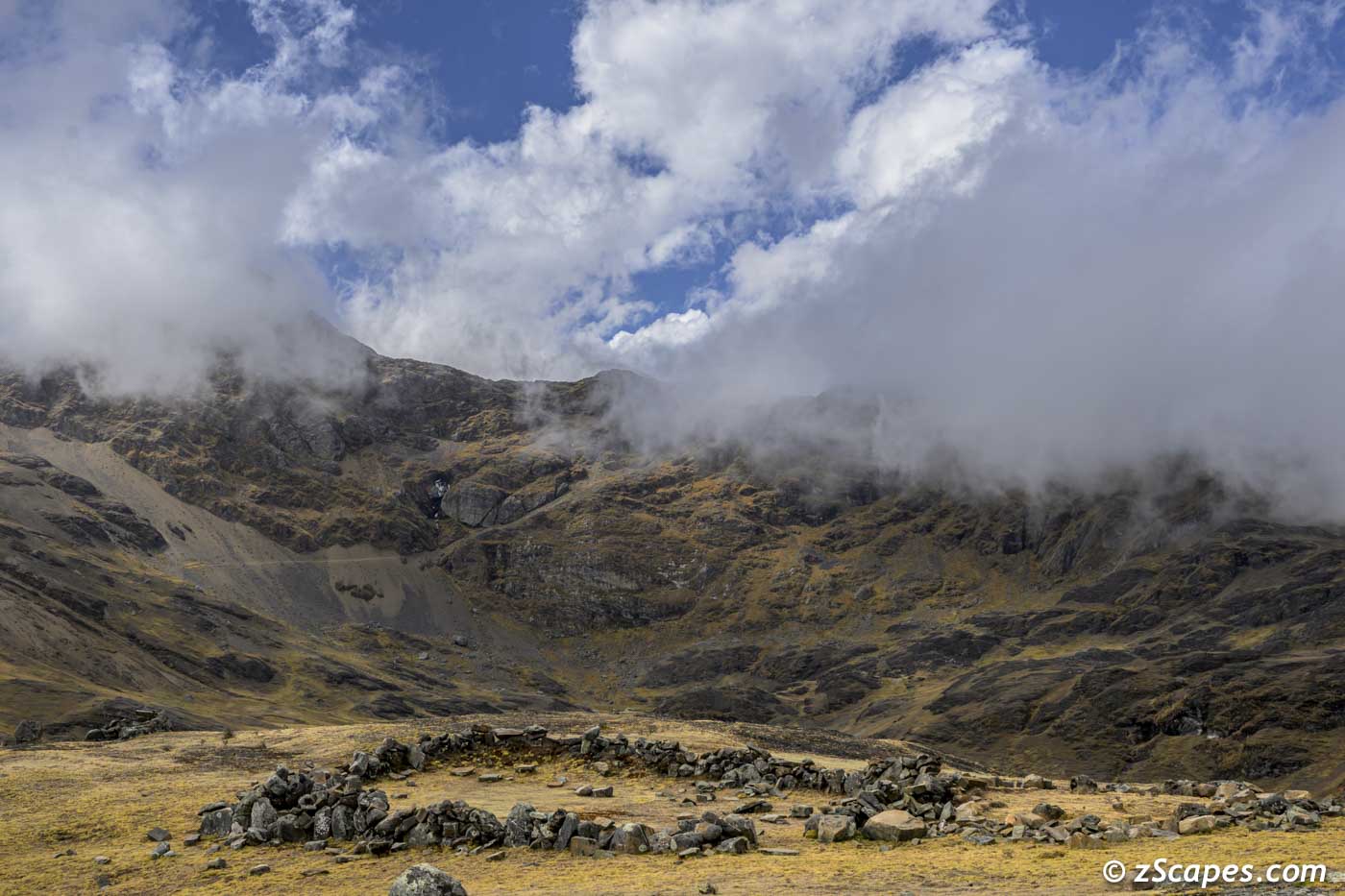
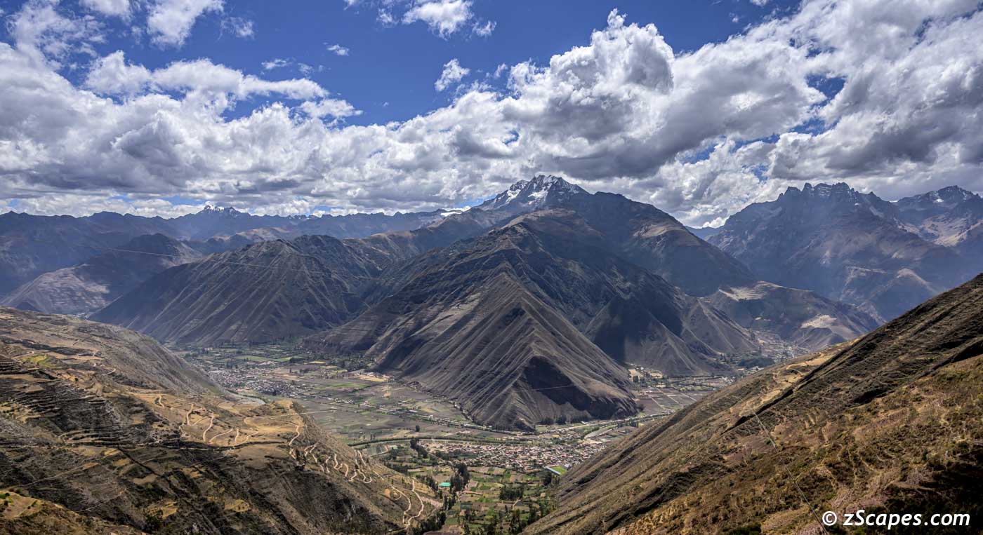
On our sixth day, we started at Ollantaytambo @ 9k ft and ended up on the Sondor Pamapa @ 14k ft taking in the ancient empires last stand and the ancient geology of the Urubamba Valley. Ollantaytambo was utilized as a defensive stop against the advancing Spanish armies and in 1537 the Manco Inca defeated an expedition by flooding the valley, thwarting the horse centric troops. The city eventually fell to Pizarro, as the Manco Inca retreated to the forest outpost Vilcabamba. What really impresses you is the scale of the high terraces and the tactical chokepoint in the valley to guard against invasions.
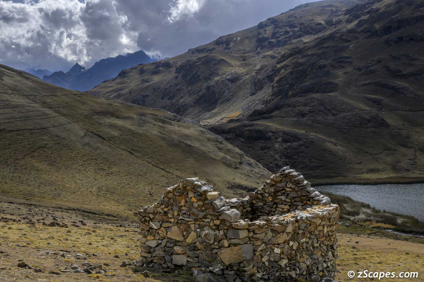
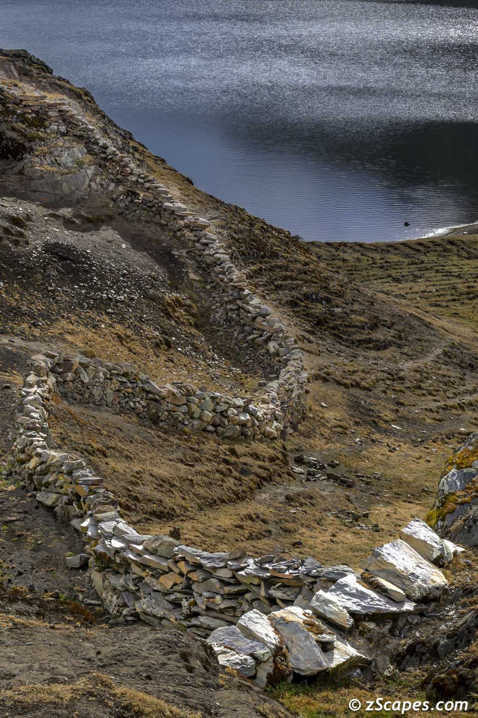
Next stop, up to 14k feet to trek around the Five Lagoons in the Sondor Pampa among the soaring peaks of the Urubamba range in the Andes. There are few scattered small farms and Llama herding supported by the government with electricity, water and a 5G cell signal!
Next stop, up to 14k feet to trek around the Five Lagoons in the Sondor Pampa among the soaring peaks of the Urubamba range in the Andes. There are few scattered small farms and Llama herding supported by the government with electricity, water and a 5G cell signal!
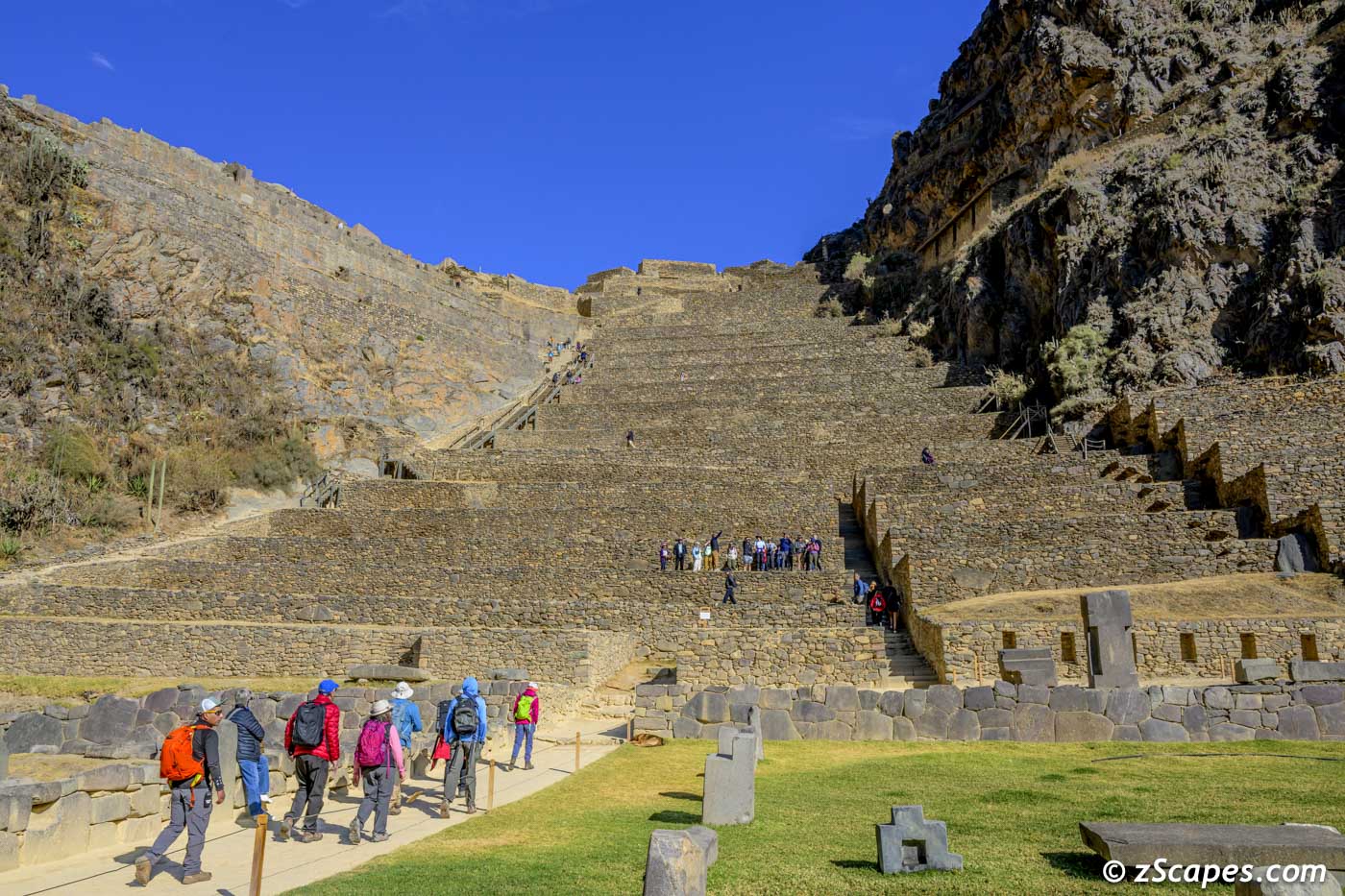
Ollantaytambo protective terraces
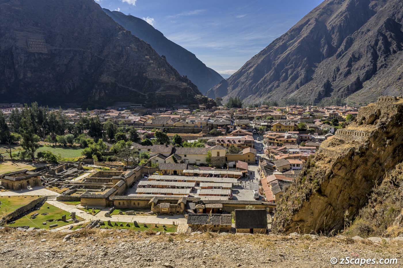
City of Ollantaytambo and valley plain
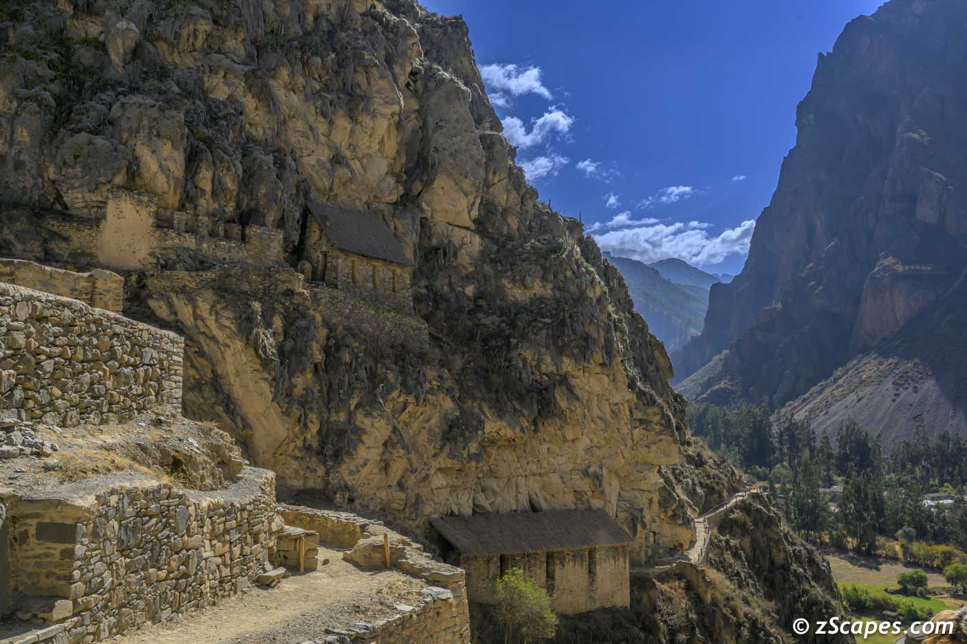
Guard stome houses embeded in the rockface

Another example of the precision stone work
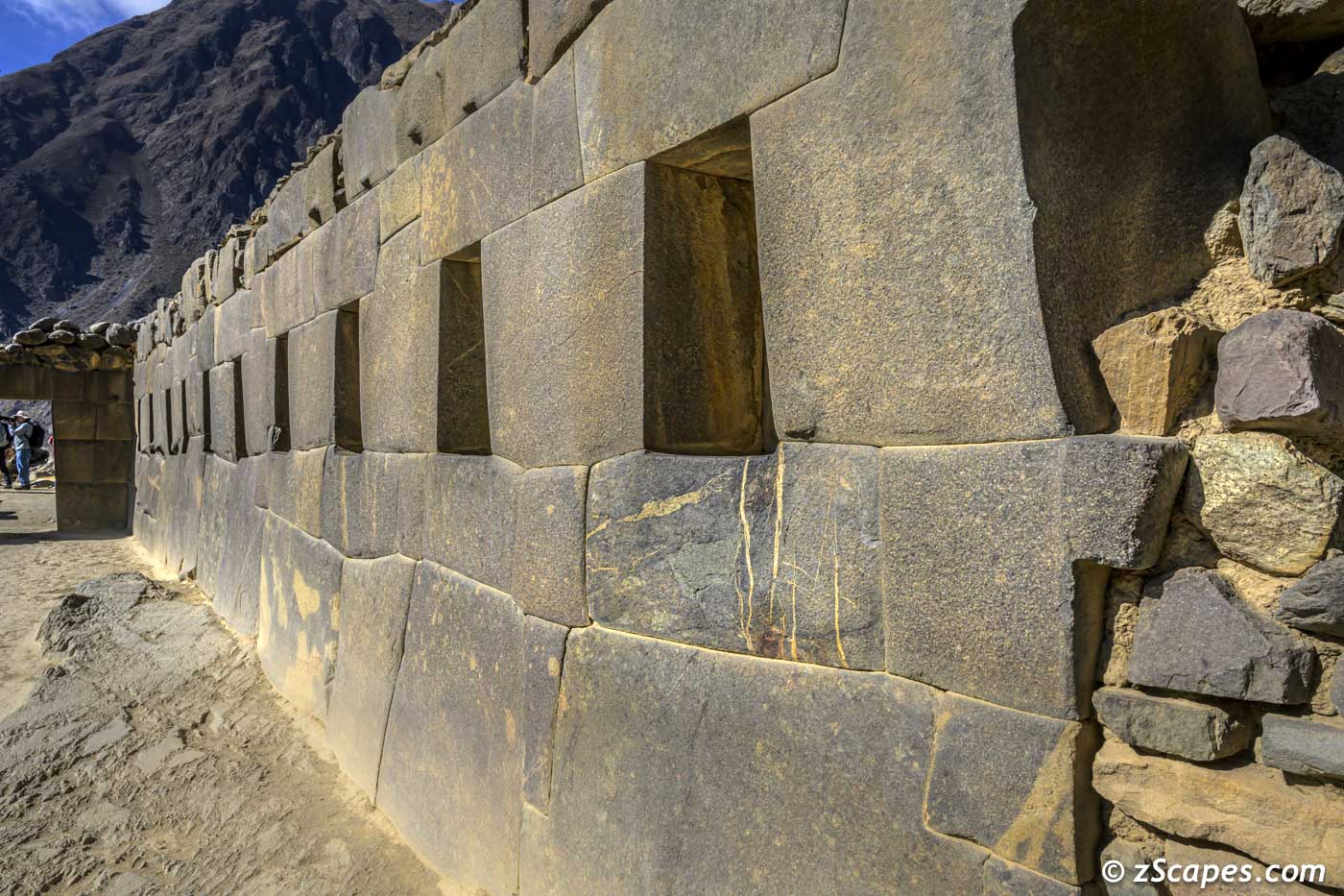
Ollantaytambo wall of windows
Vendor stalls
A ollantaytambo vendor on her way to sell her wares
Chulluncunayoc Peak in the distance and Pampacocha Lake
Rock paddock
Stone house
Stone wall
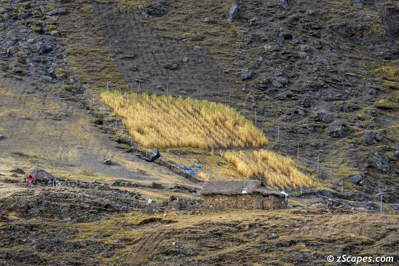
High altitude wheatfields
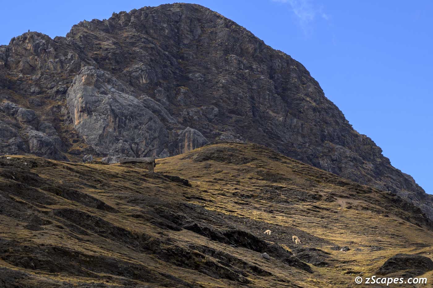
Llama herding
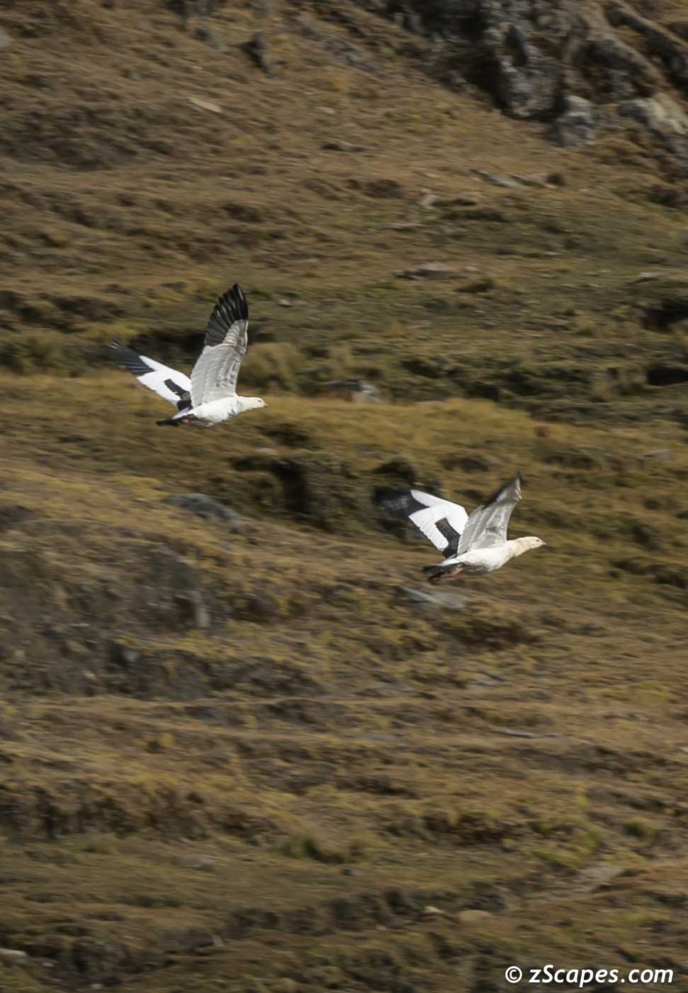
Andean Geese flyaway
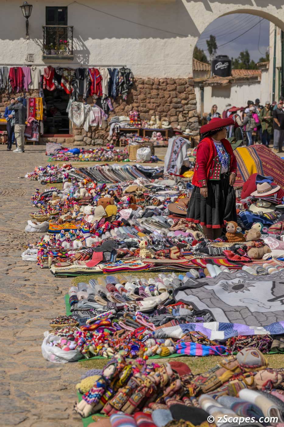
Chinchero Market & Vistas
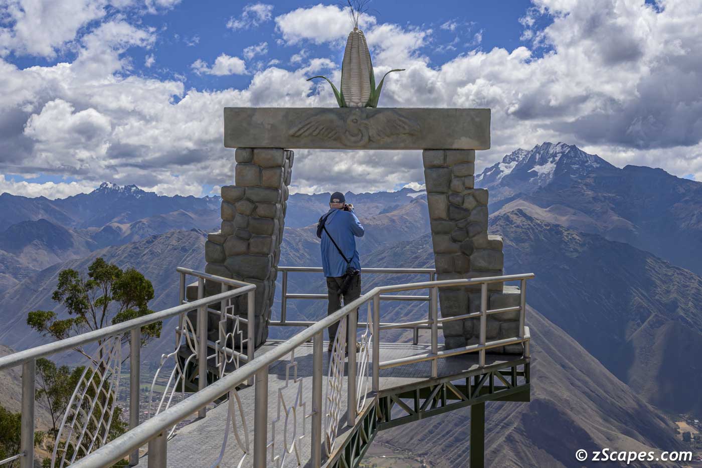
Our last day was allocated to a real early morning start to capture sunrise on Mt. Veronica. However, the weather gods were not cooperating and we diverted to Chinchero, halfway between Cusco and Urubamba Valley at 12,368 feet. There's a grand scheme afloat as a new airport is rising to replace Cusco and allow direct flights to the Cusco Region, bypassing Lima. And this project is not without controversy. Two main sticking points. Major concerns of the increased traffic to Machu Picchu and the viability of operations at over 12,000 feet with major peaks and terrain. However, our focus was on the local Wednesday market were we experienced a vibrant and pulsating scene where all came to buy & sell the commodities needed for day-to-day life. One word, fascinating! We finished the day at an overlook taking in the Urubamba Valley and the ever present Andes backdrop.
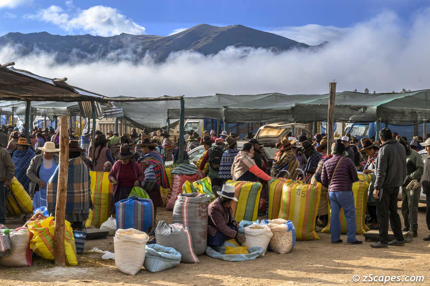
Chinchero Open Air Market
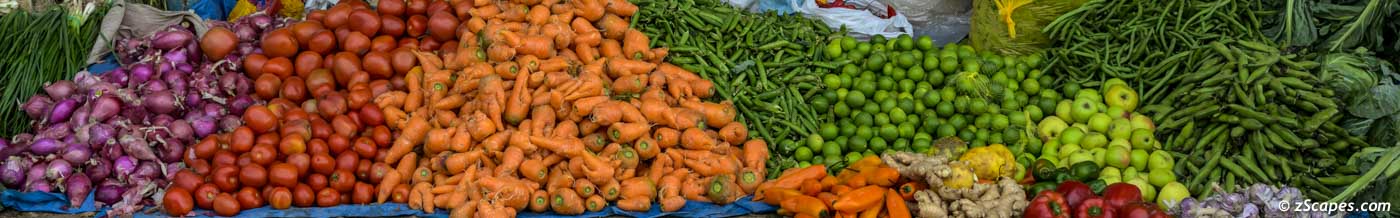
Colors of the market
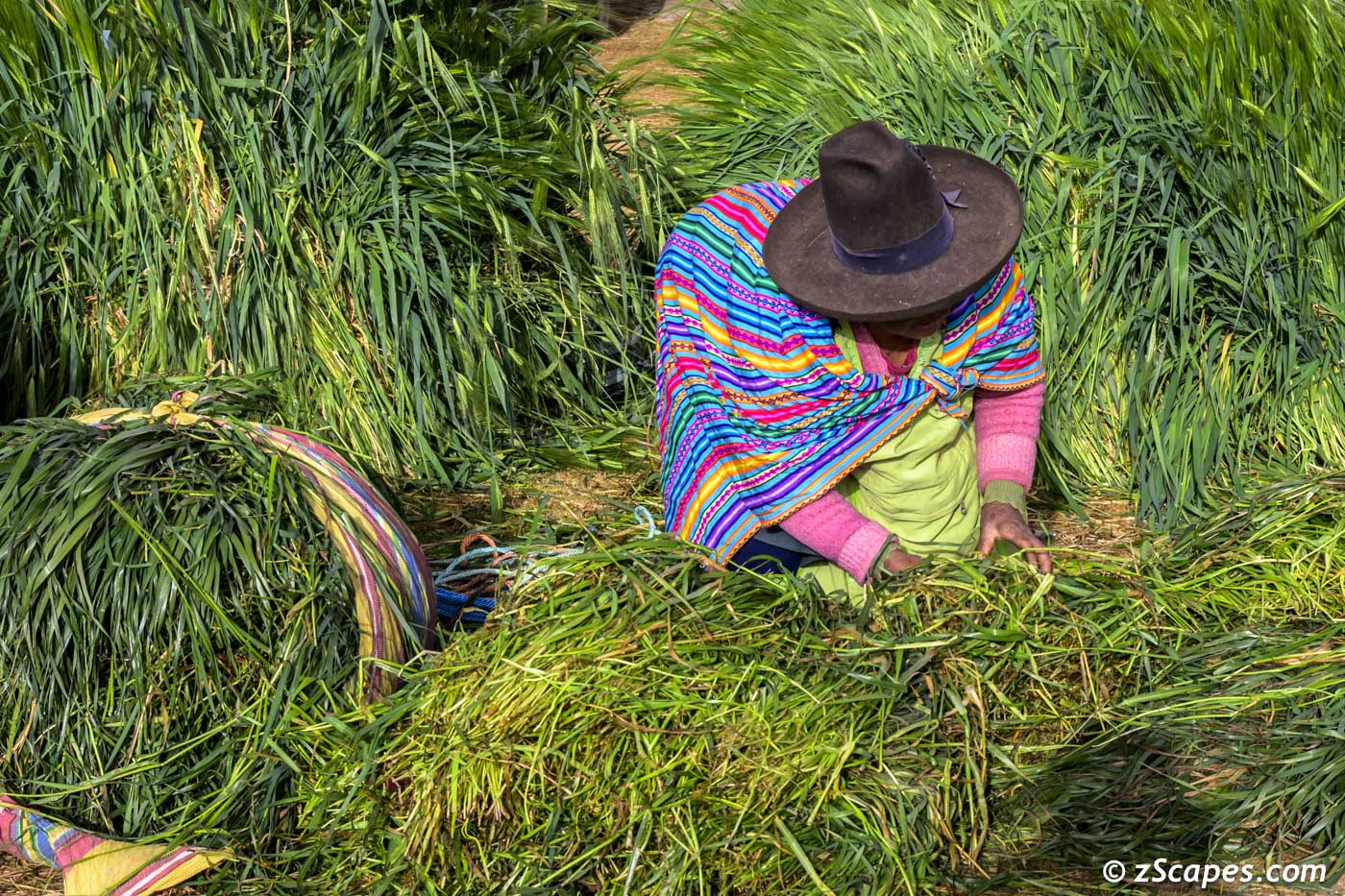
Feed for farm animals
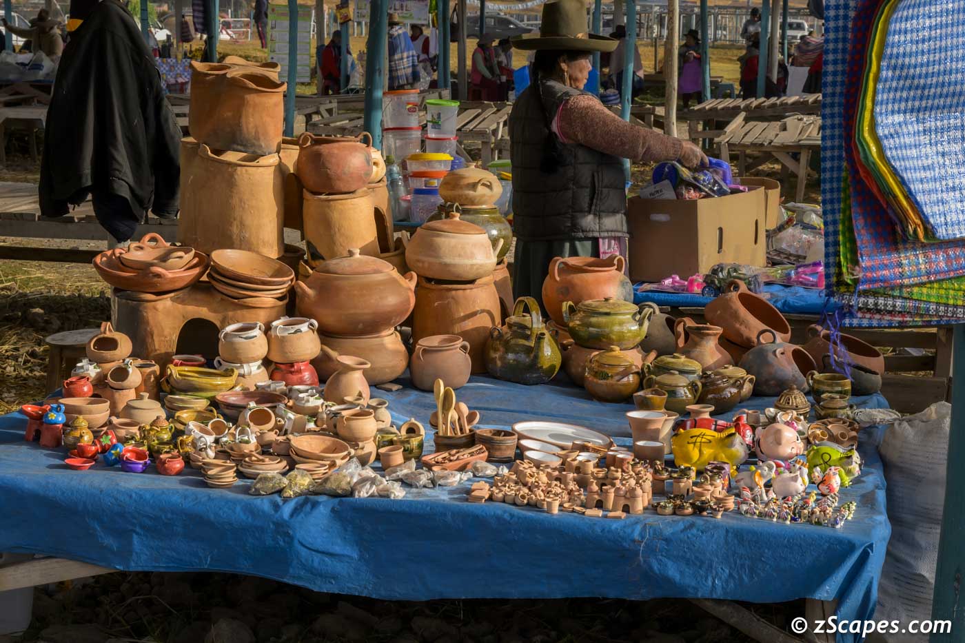
Pottery for sale
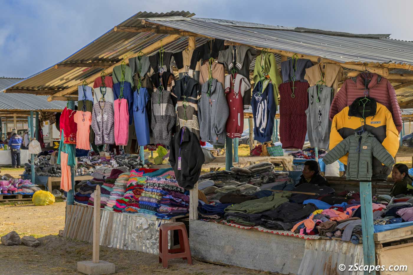
Colthes merchant
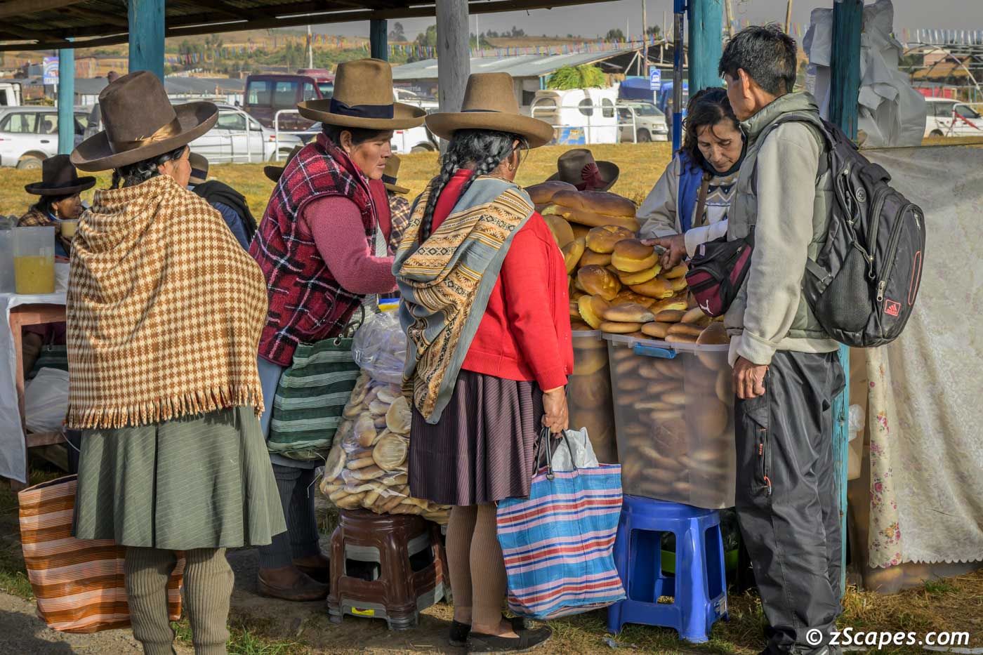
Pandaria line
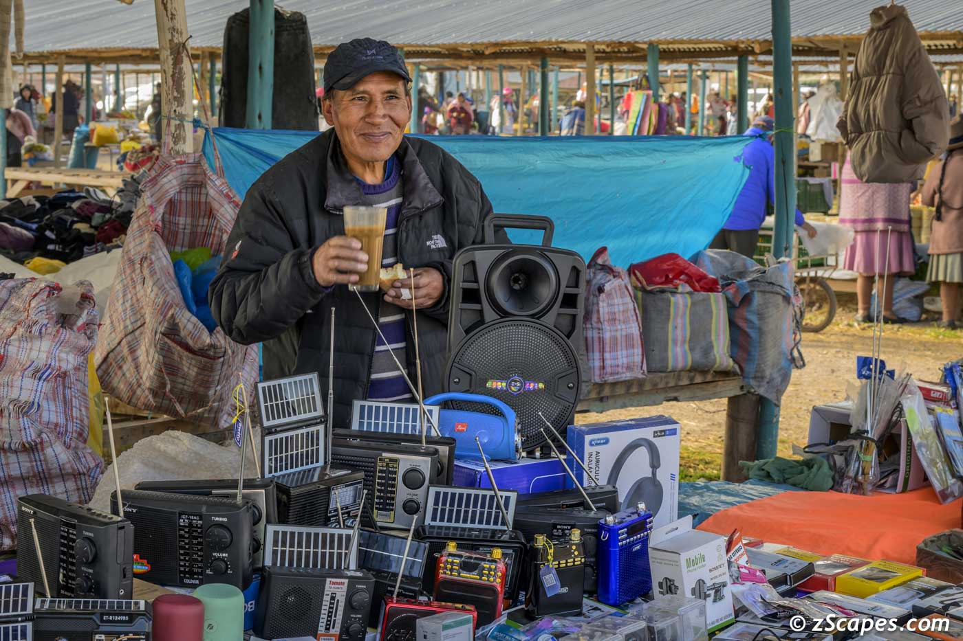
electronics anyone!
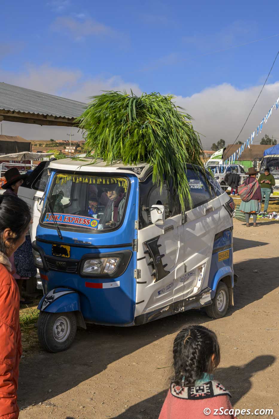
Tuk Tuk delivery
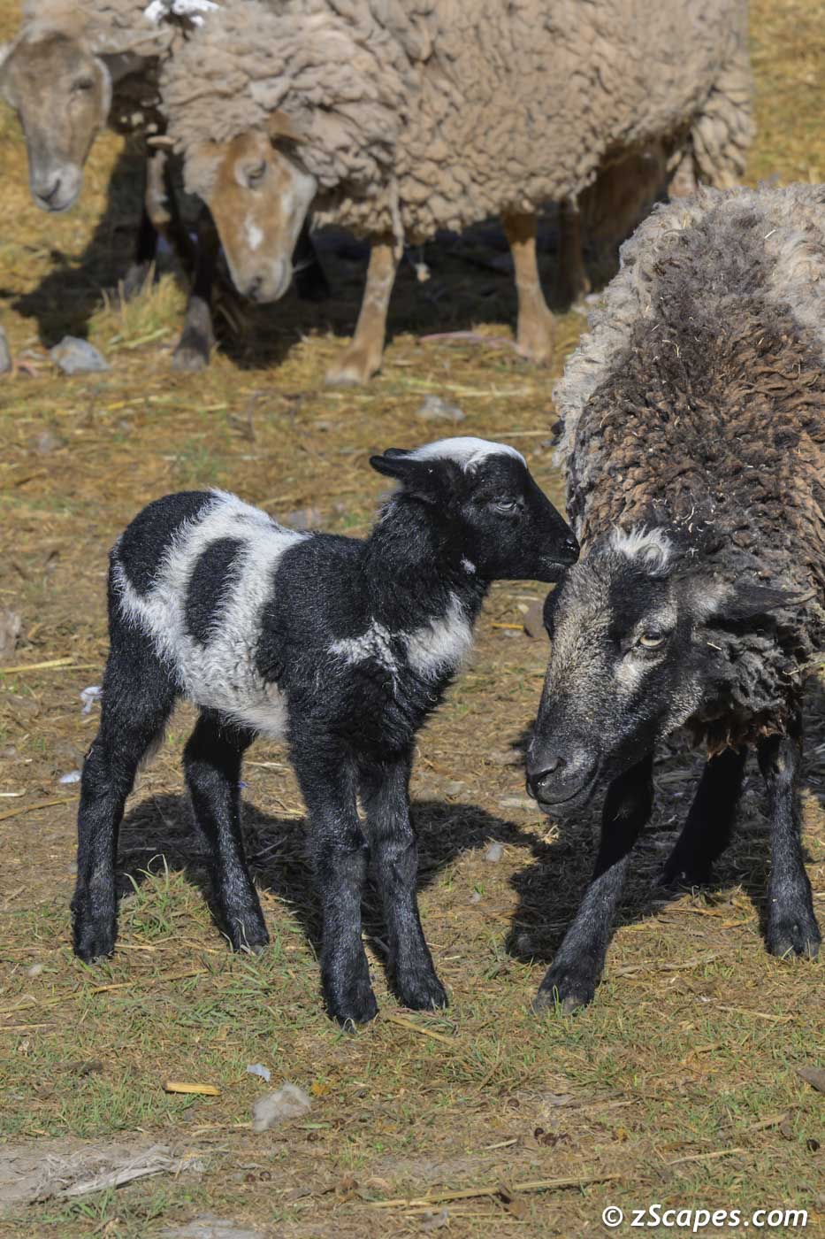
Lamb & Mother
Church marketplace
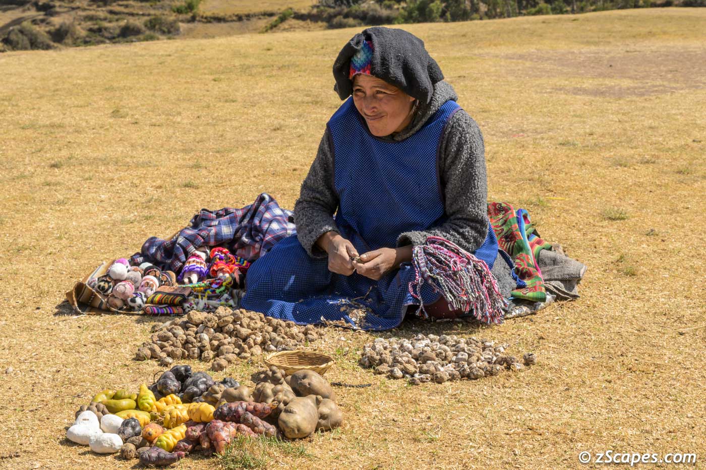
Traditonal potato & goruds
Inca wall foundation
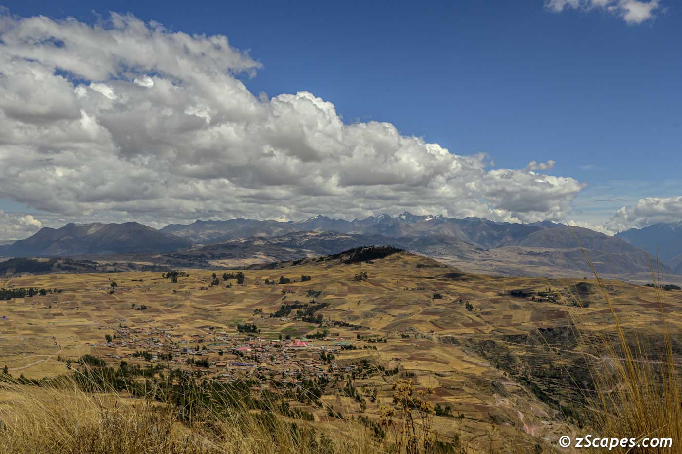
View of the Andes from Chinchero
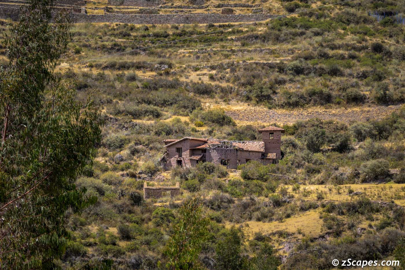
Abandoned hacienda
Urubamba Valley & Chincon
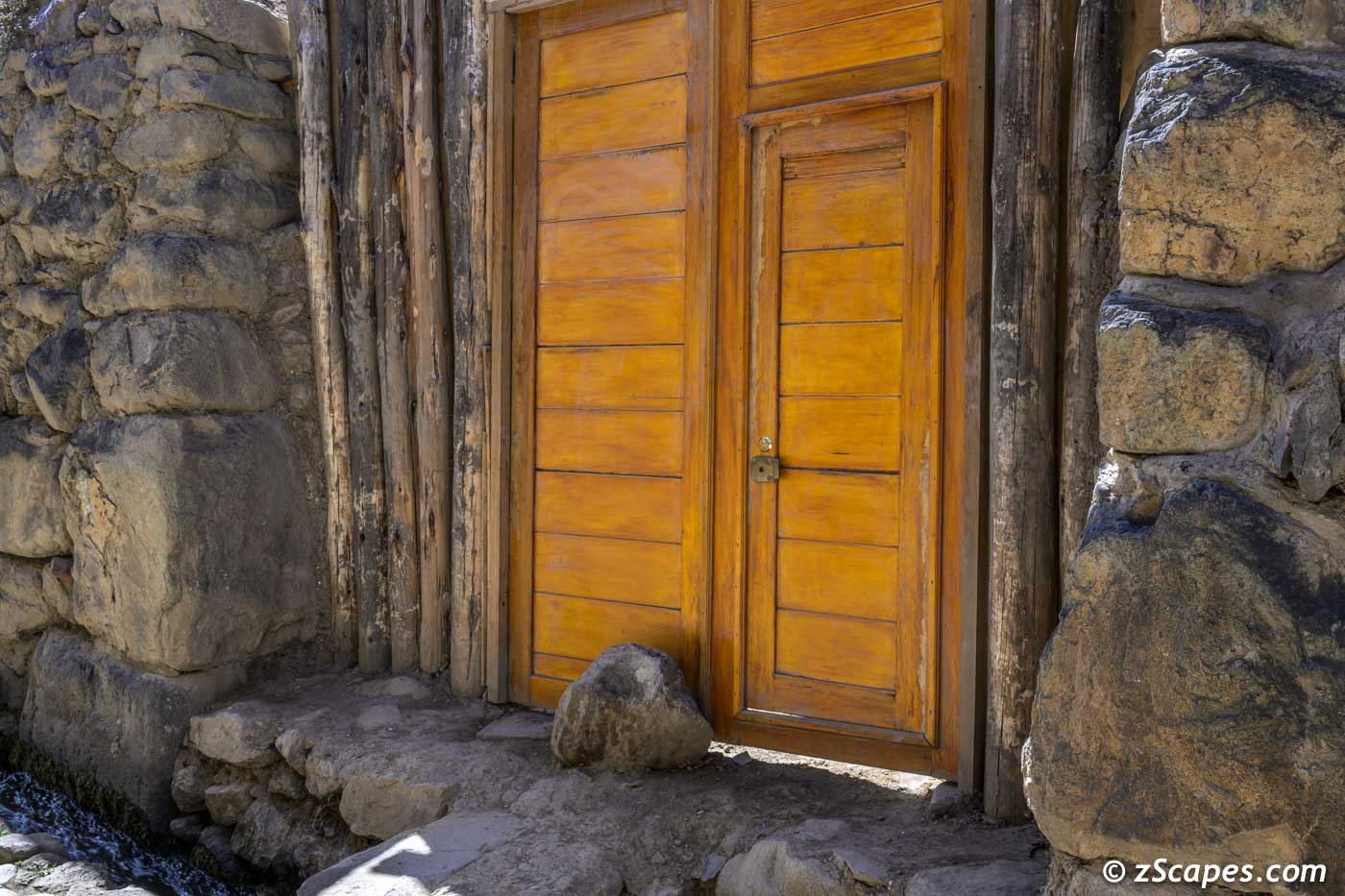
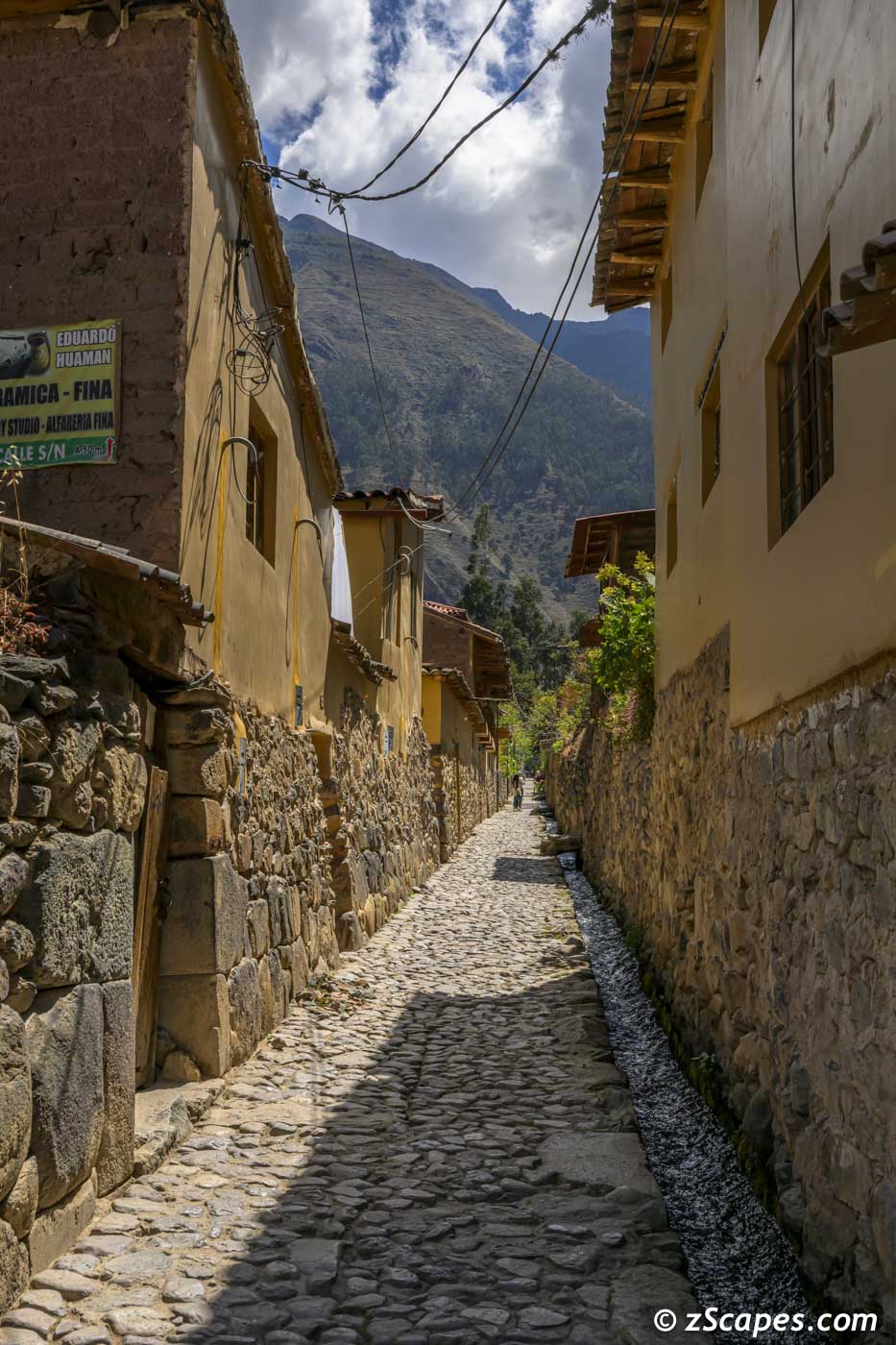
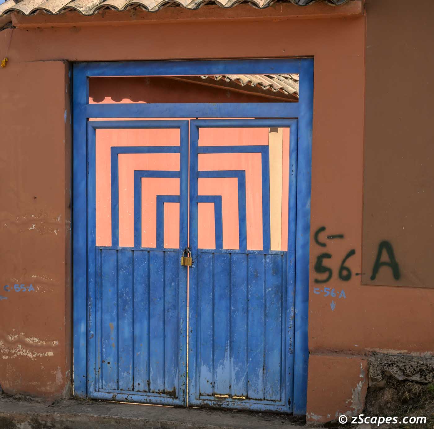
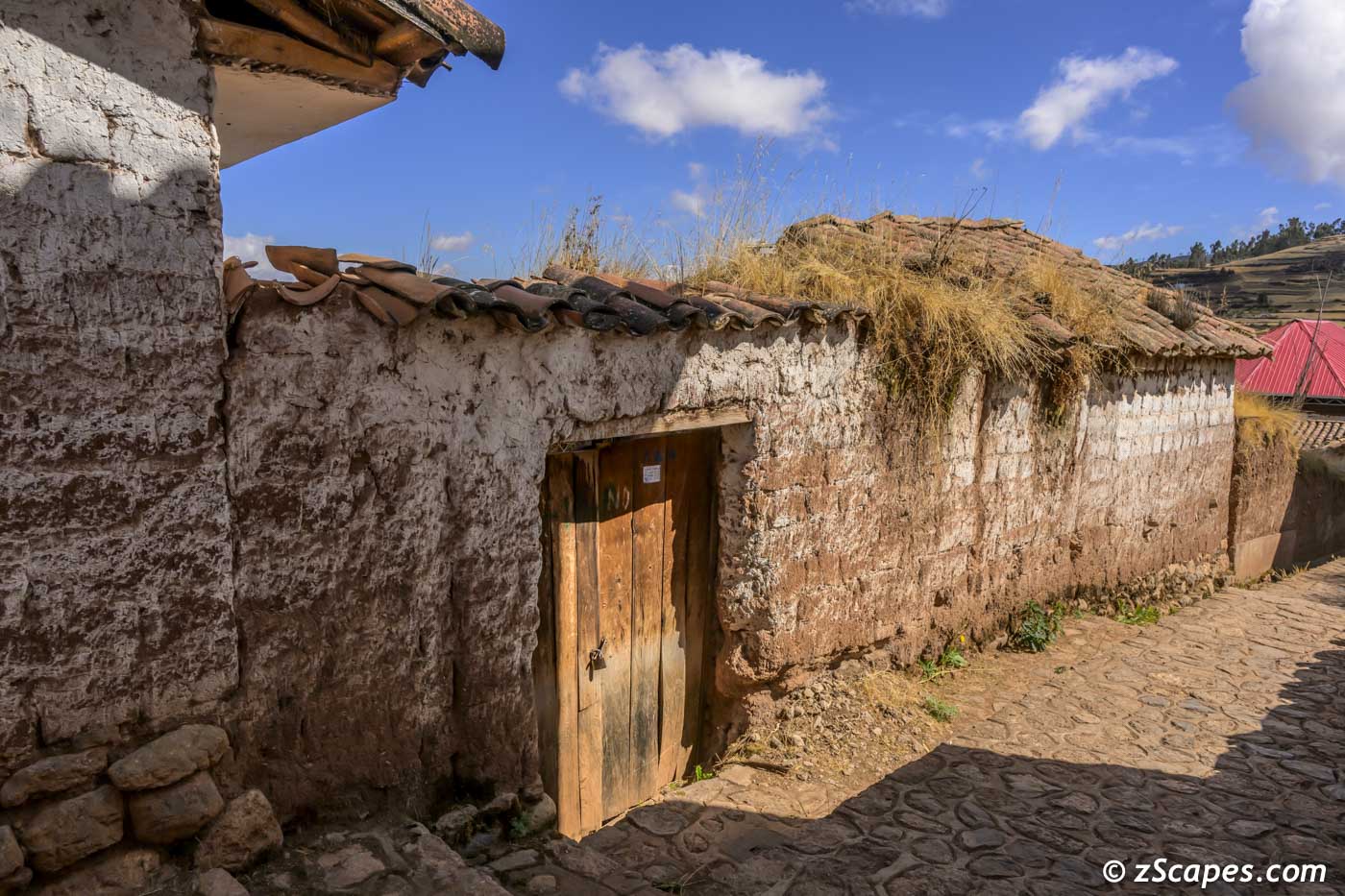
Doors, Alleyways and Streets of Cusco and the Sacred Valley
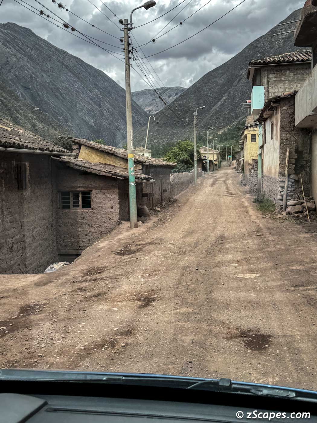
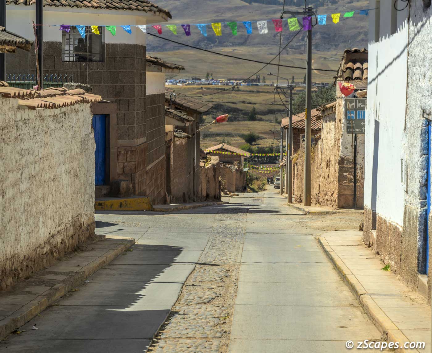
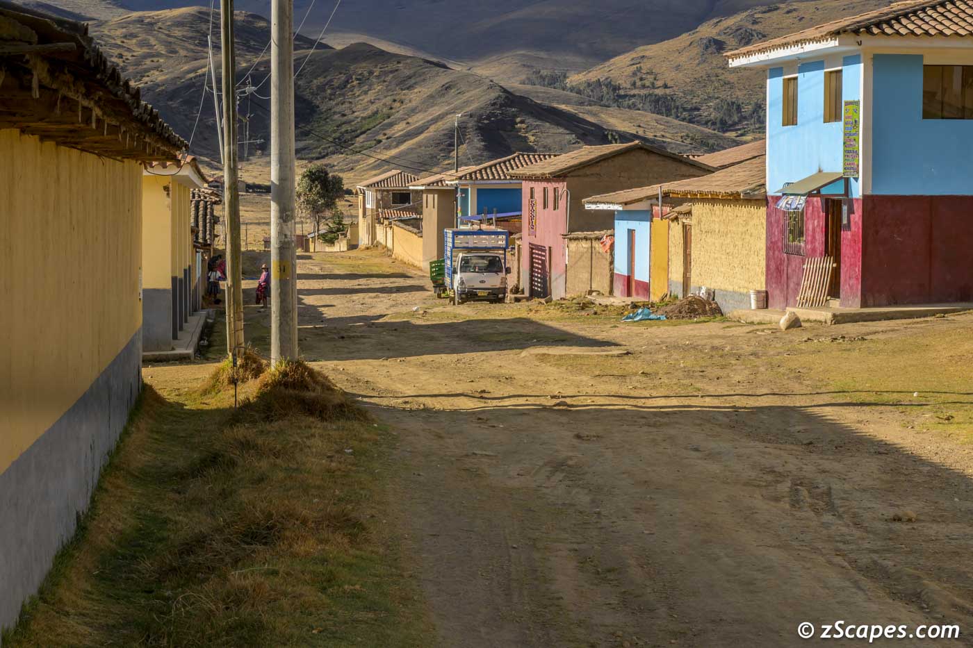
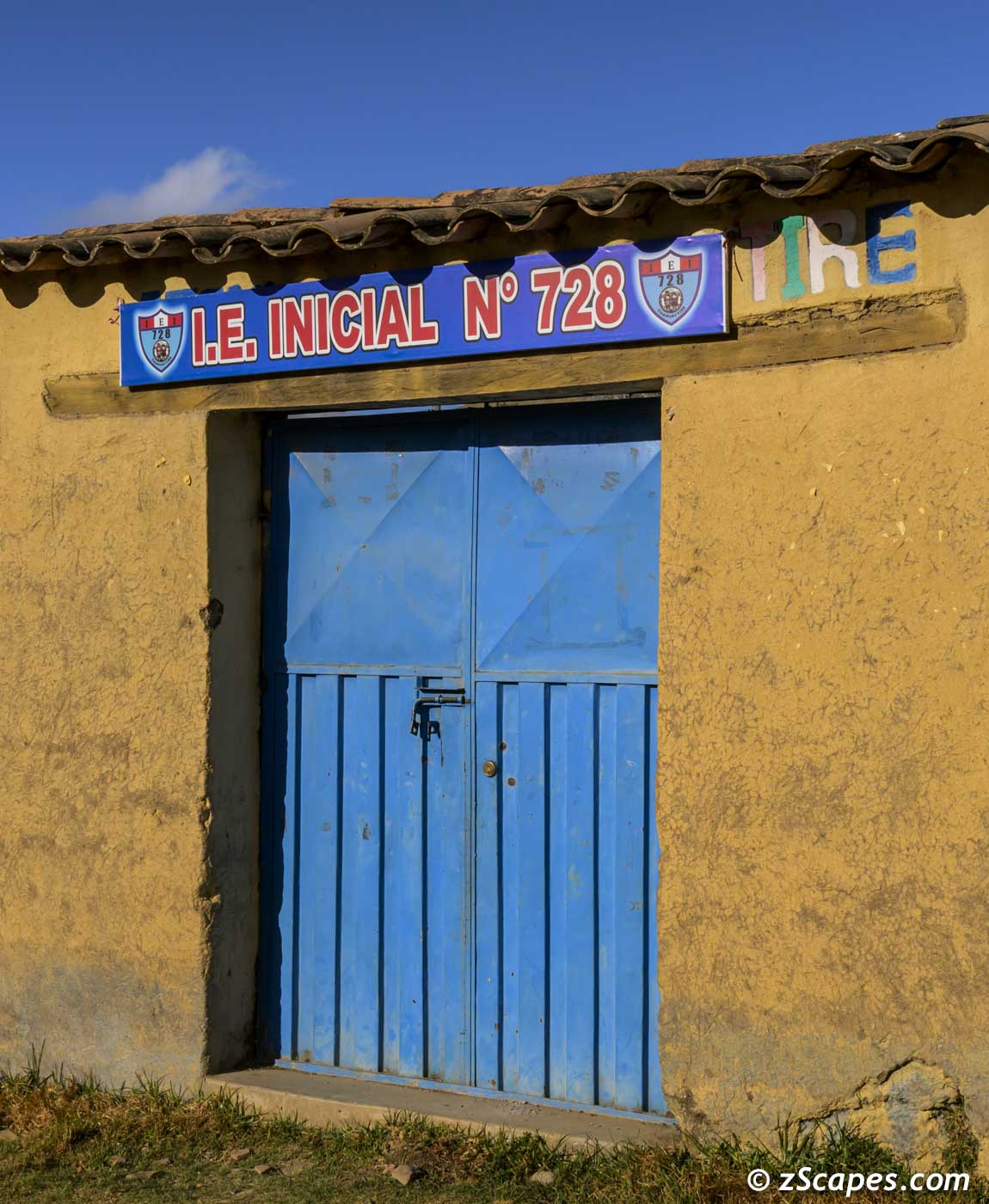
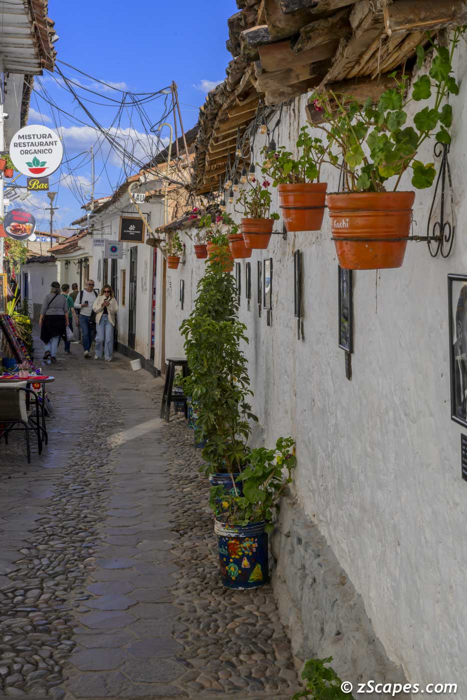
Time to go. The days & nights went by real fast, but the memories will not fade. It was a great group to trek with and our guide & teacher, Katsuyoshi Tanaka made the magic happen. Looking forward to my next trip, just have to pinpoint what's next. May you never run out of places to trek!
May our paths & errands meet
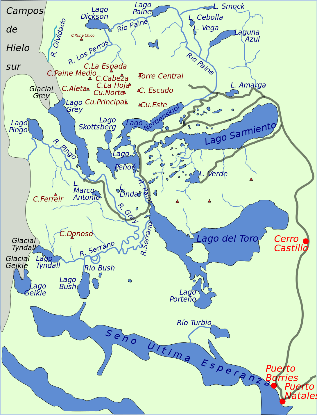
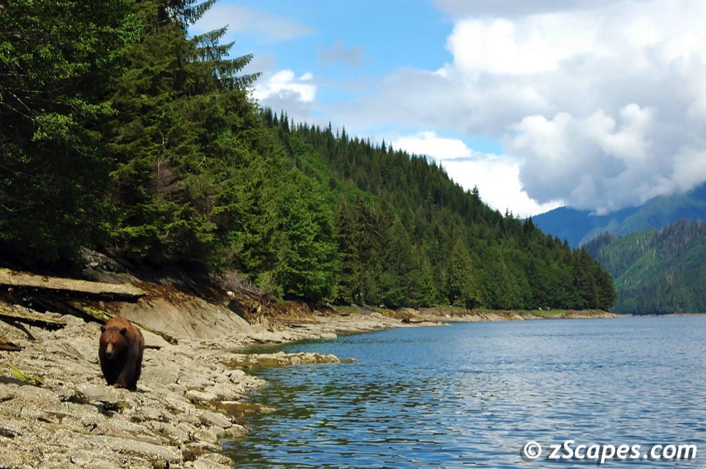
Patagonia & Torres del Paine Chile
A once in a lifetime opportunity with encouragement from Betsey, and I was off to Chile on a Nikon sponsored photo workshop with Katsuyoshi Tanaka, a well accomplished photographer and extraordinaire teacher. The itinerary included Easter Island (Rapa Nui) and Patagonia with overnight stays in Santiago.
Patagonia (Spanish pronunciation: [pataˈɣonja]) is a geographical region that encompasses the southern end of South America, governed by Argentina and Chile. The region comprises the southern section of the Andes Mountains with lakes, fjords, temperate rainforests, and glaciers in the west and deserts, tablelands, and steppes to the east. Patagonia is bounded by the Pacific Ocean on the west, the Atlantic Ocean to the east, and many bodies of water that connect them, such as the Strait of Magellan, the Beagle Channel, and the Drake Passage to the south.
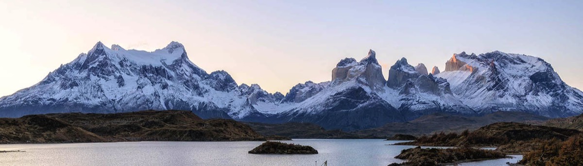
Our focus was on Torres del Paine National Park and the Cordillera Paine.
Patagonia (Spanish pronunciation: [pataˈɣonja]) is a geographical region that encompasses the southern end of South America, governed by Argentina and Chile. The region comprises the southern section of the Andes Mountains with lakes, fjords, temperate rainforests, and glaciers in the west and deserts, tablelands, and steppes to the east. Patagonia is bounded by the Pacific Ocean on the west, the Atlantic Ocean to the east, and many bodies of water that connect them, such as the Strait of Magellan, the Beagle Channel, and the Drake Passage to the south.
Our focus was on Torres del Paine National Park and the Cordillera Paine.
| Patagonia |
| Location | Magallanes Region, Chile |
| Nearest city | Puerto Natales |
| Coordinates | 51°0′0″S 73°0′0″W |
| Area | 181,414 ha (448,280 acres) |
| Established | May 13, 1959 |
| Visitors | 304,947 (in 2019) |
| Governing body | Corporación Nacional Forestal |
| Torres del Paine |
| Cerro Paine Grande | Elevation ~ 2,884 m (9,462 ft) |
| North Tower | Elevation ~ 2,260 m (7,410 ft) |
| Central Tower | Elevation ~ 2,460 m (8,070 ft) |
| South Tower | Elevation ~ 2,500 m (8,200 ft) |
| Cuerno Principal | Elevation ~ 2,100 m (6,900 ft) |
| Cerro Paine Chico | Elevation ~ 2,650 m (8,690 ft) |
| Geology | Granite ~ 12 million years old |
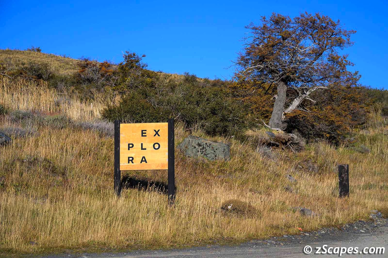
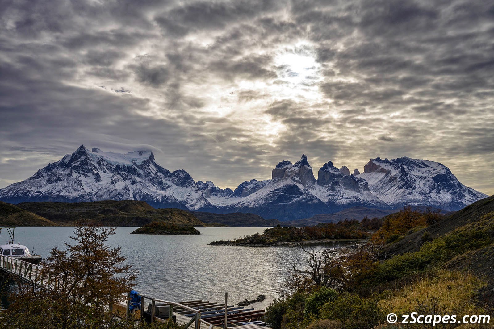
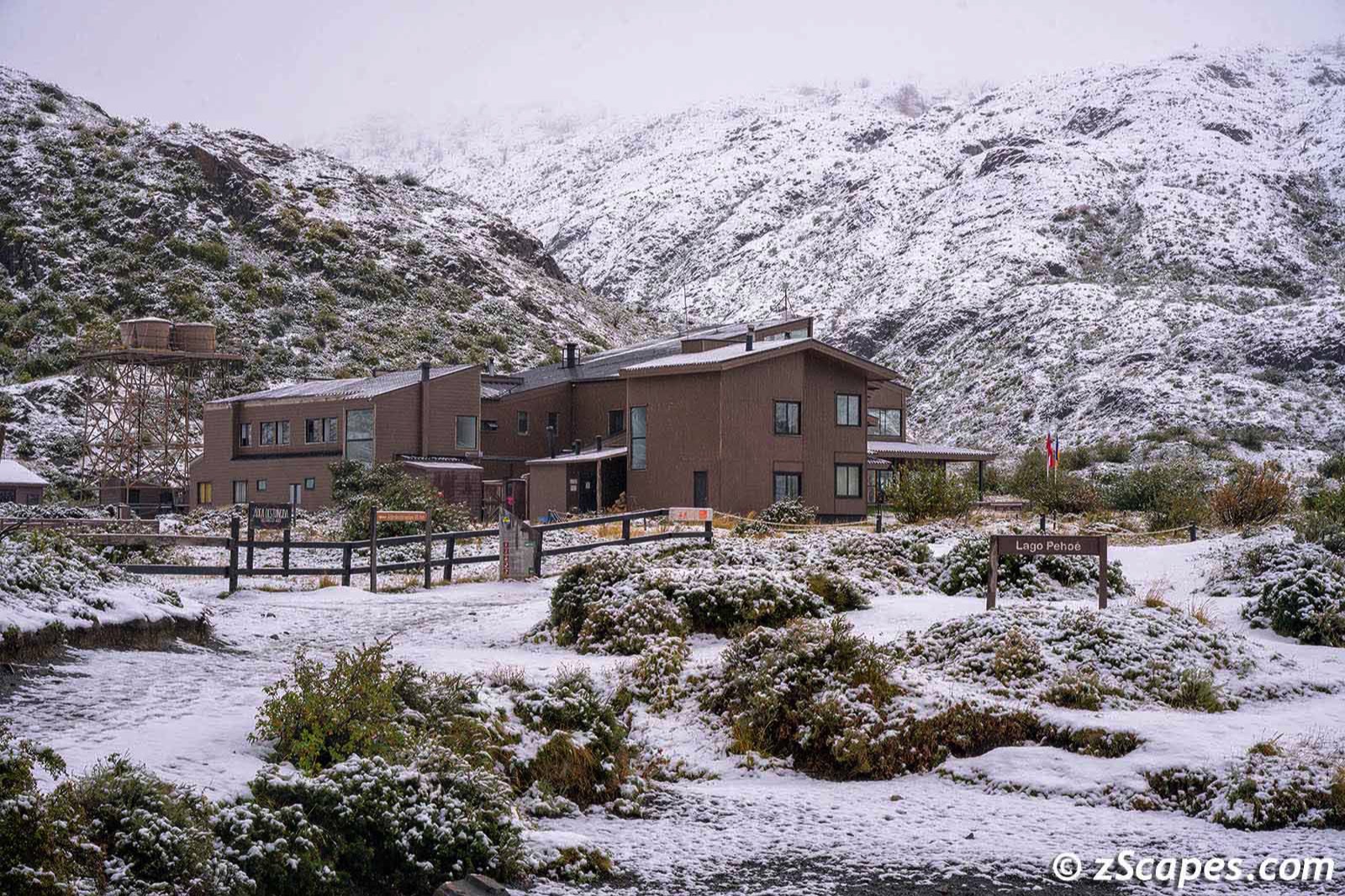
Puerto Natales & Explora Resort
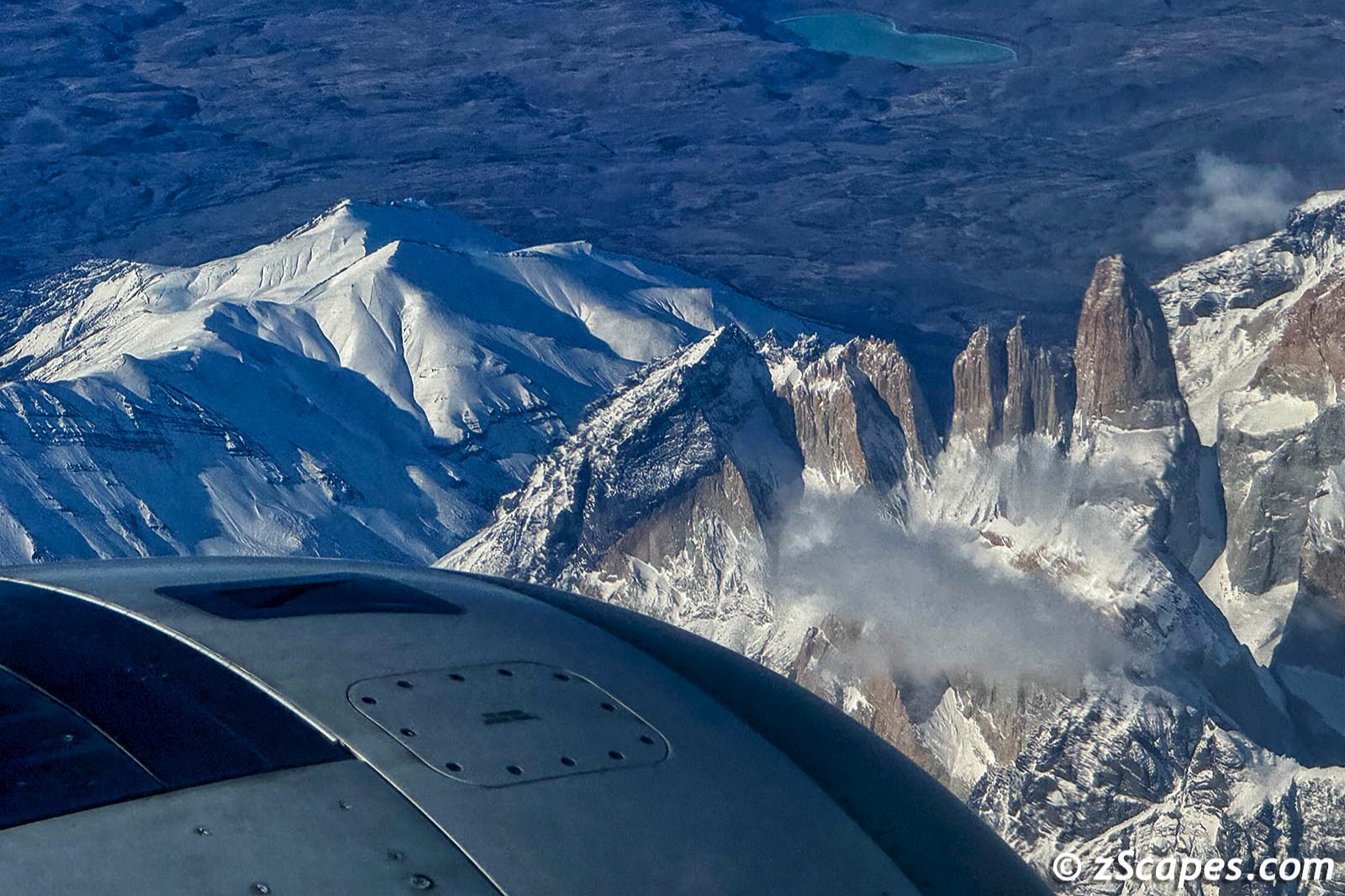
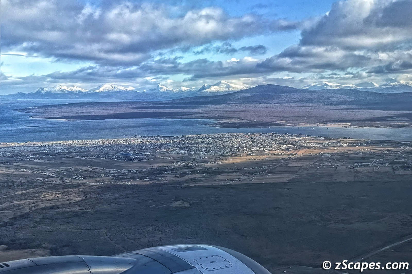
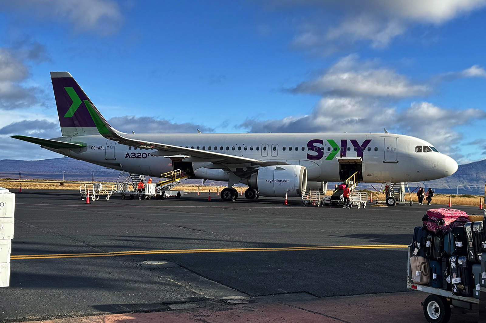
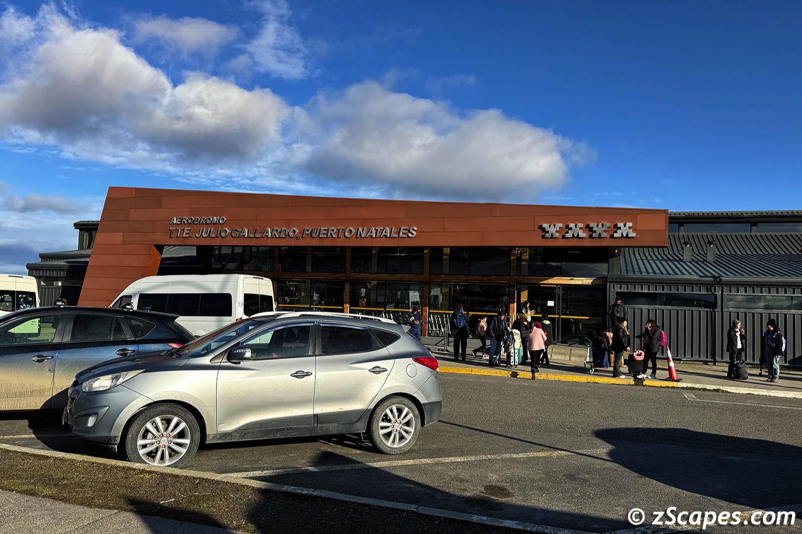
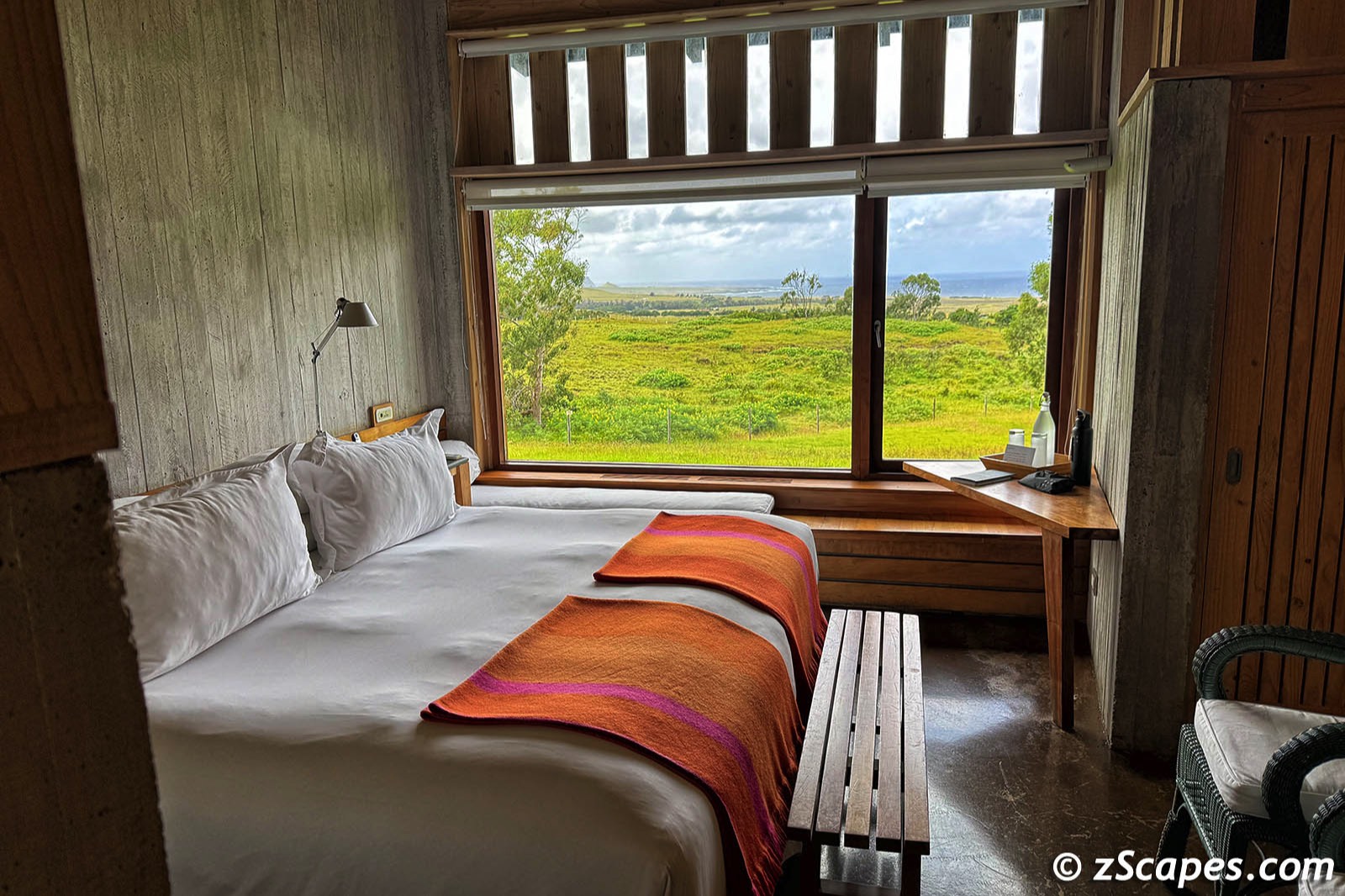
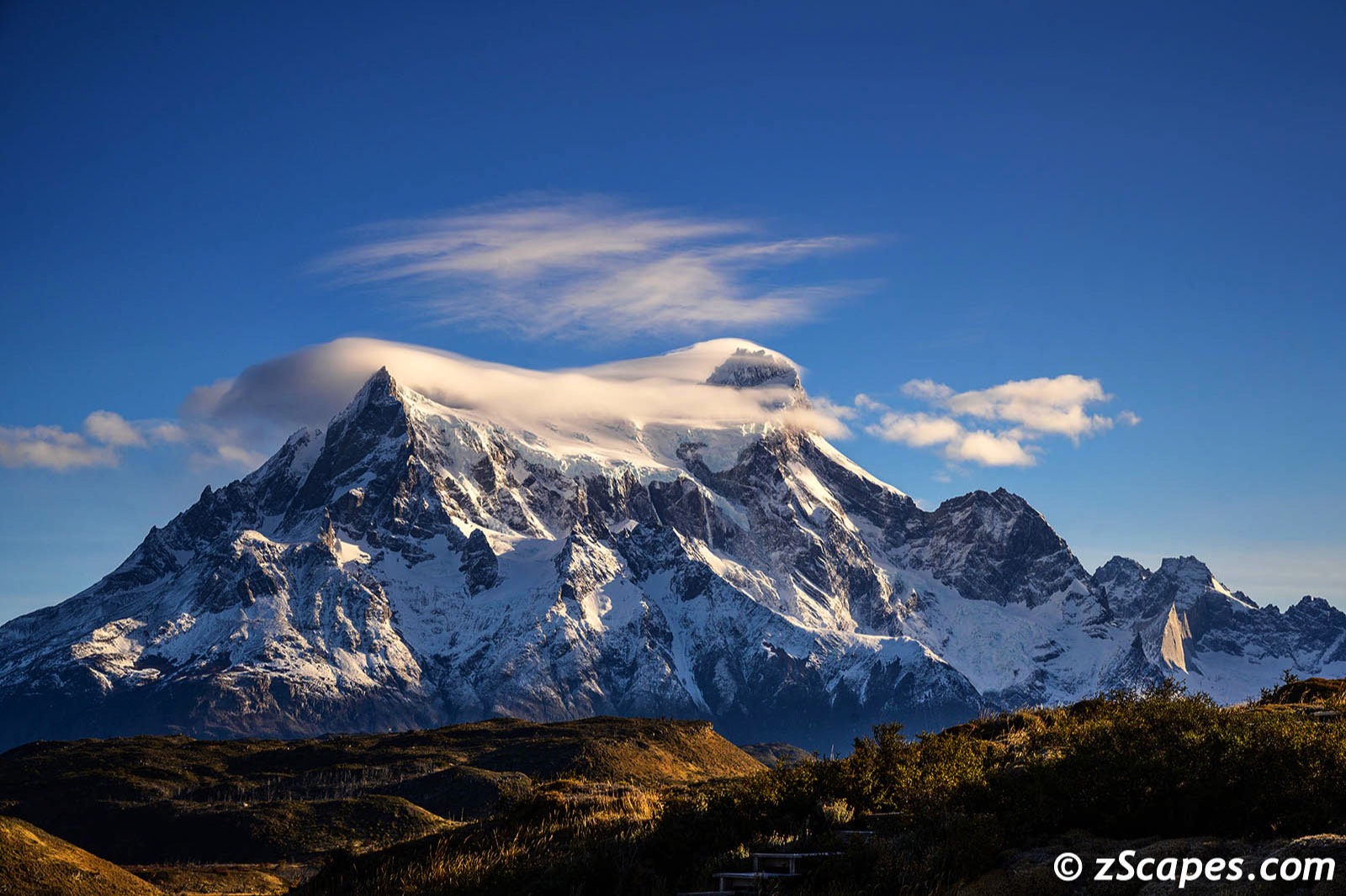
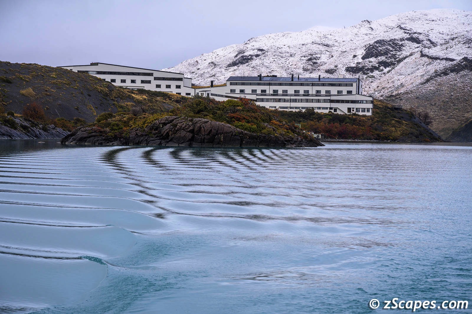
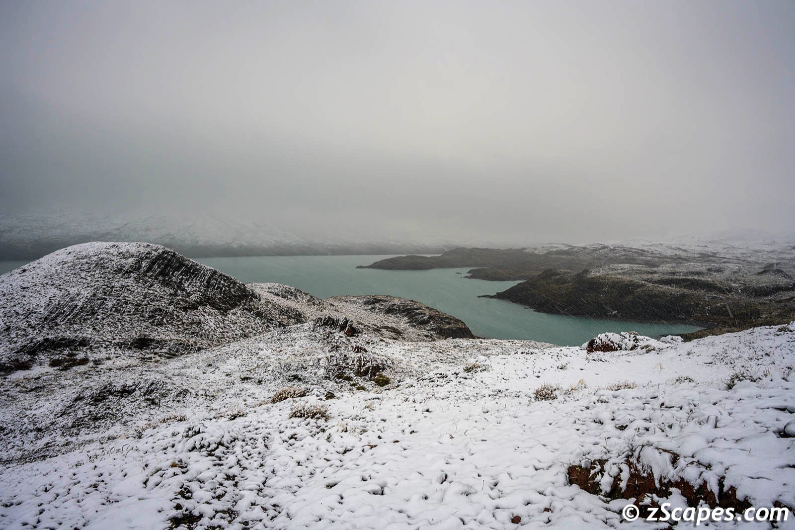
Our journey began early in the morning after an overnight stay at the Santiago Airport Holiday Inn, for convenience sake. We hoped on Sky Airlines stoping @ Puerto Mont before our final destination, Puerto Natales. My family visited Puerto Mont several times while we were here in the late 60's. Like Santiago, it has grown immensely. I selected a window seat crossing my fingers as we crossed the Andes that I would have a view of Torres del Paine. I was not disappointed. The Explora team was there to pick us up for the 1 hour & 45 minute ride, with jaw dropping scenery along the way. The hotel is in a superb location and is nestled into the landscape, emphasizing natural wood construction using local Lena, cypress and almendrillo. All the rooms face the Cordillera Paine, a feast for the eyes.
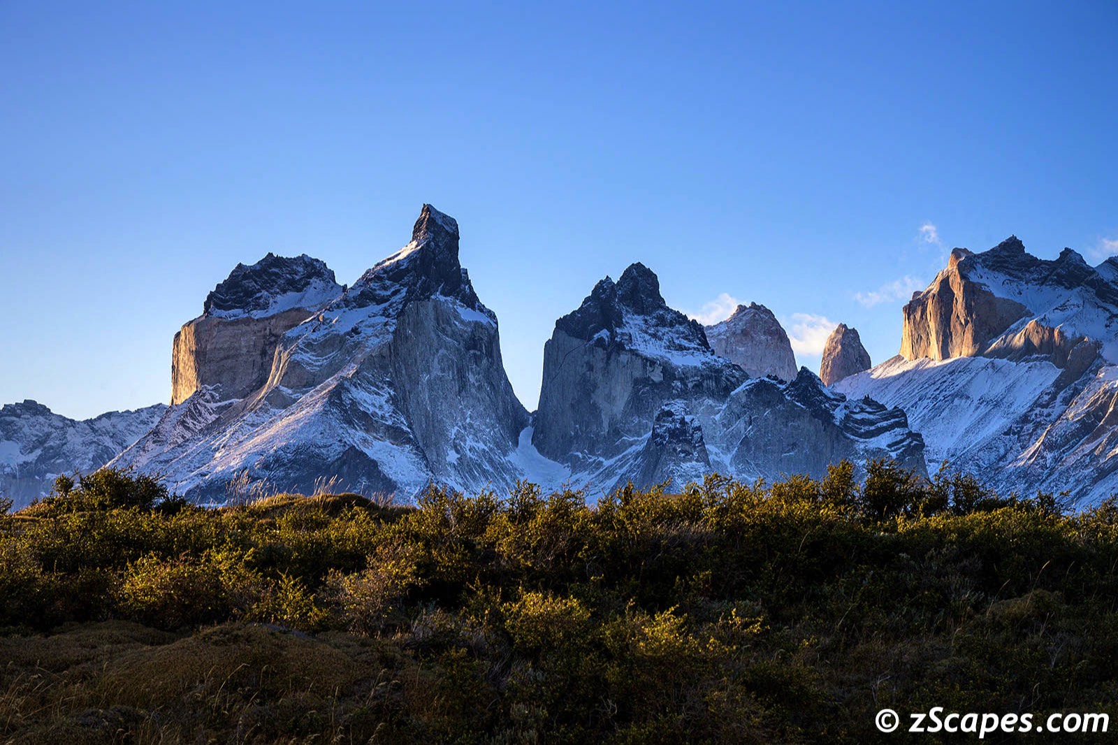
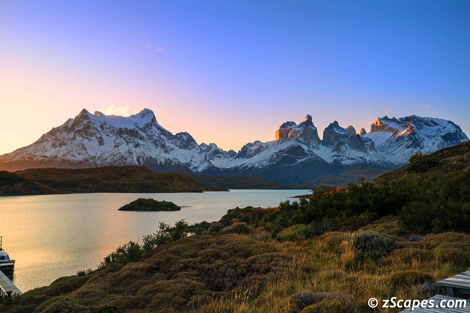
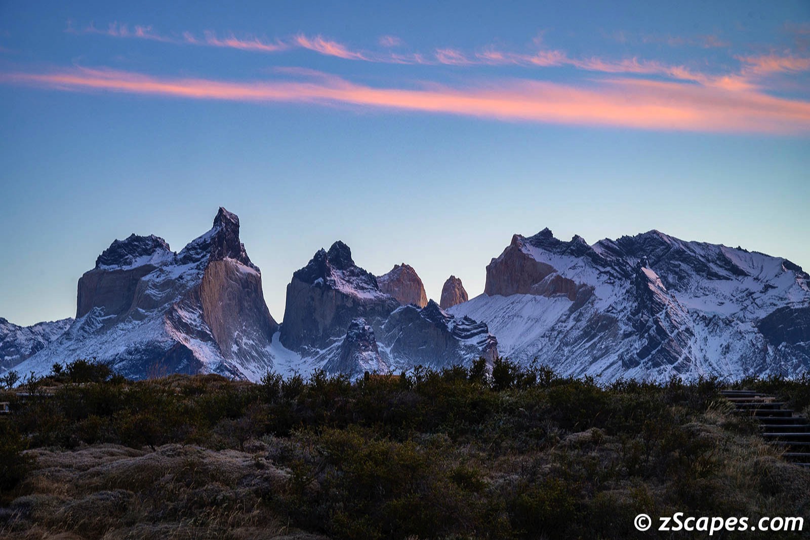
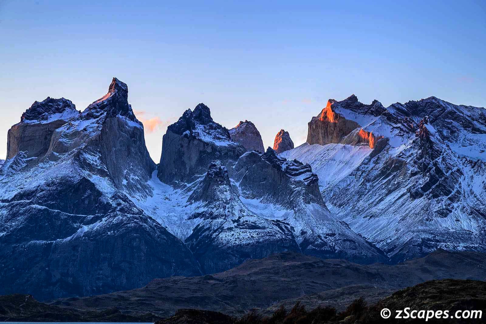
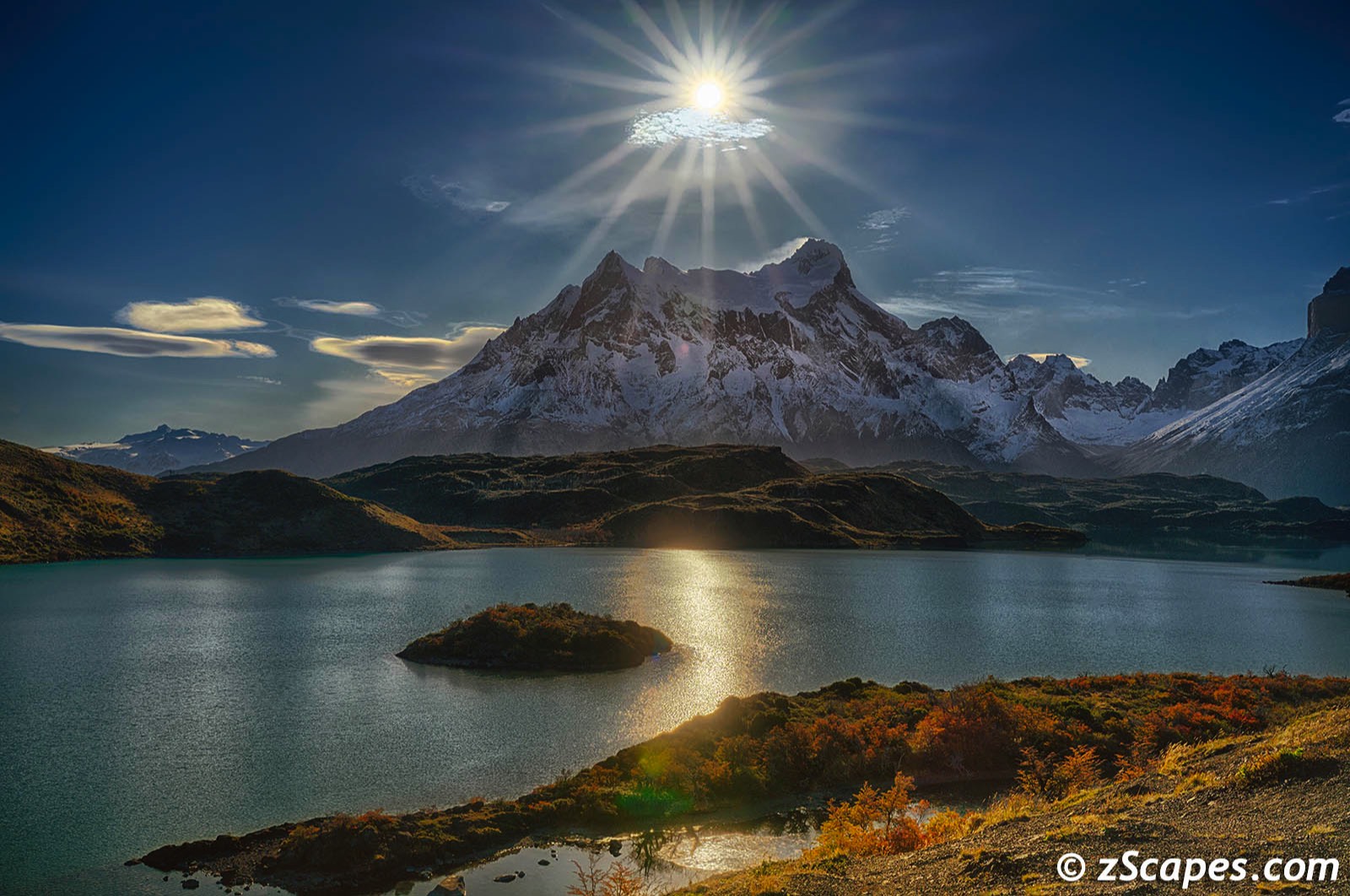
Cordillera Paine
For me, Torres del Paine evokes raw, wild, jagged mountains and has been on my list for many moons. From the first glimpse flying over, to standing at the Explora Hotel and seeing the panorama for the first time with my own eyes was a magical moment. I have been privileged to visit many parts of this blue globe and this ranks in the top three. For a photographer, it is mesmerizing and you could spend all day perched in one spot and capture a lifetime of images. One unfortunate happenstance, I picked up a bug/virus somewhere and came down with a nasty chest cold that kept me indoors for a few days. I was limited to poking around the hotel and/or shooting from the window, so I missed several days exploring other parts of the park. The images below reflect the 'mood of the mountains' over those days.
One interesting geological factoid to bring some perspective. As the Cordillera Paine is dated at 12 million years old, in comparison, the youngest mountain in Yosemite National Park (Johnson Peak) was formed 85 million years ago, with the majority of the Sierra Nevada in the 240 million year age range. Definitely a youngster on the block!
One interesting geological factoid to bring some perspective. As the Cordillera Paine is dated at 12 million years old, in comparison, the youngest mountain in Yosemite National Park (Johnson Peak) was formed 85 million years ago, with the majority of the Sierra Nevada in the 240 million year age range. Definitely a youngster on the block!
Local Meanderings
Some random images as I explored around the resort and ventured across the waters of Lake Pehoe to one of the Paine W trek hostel/campgrounds. They are very serious about 'anywhere camping' in this park and I applaud them in the name of preservation. Well done!

They are everywhere! (Nod to my past life)
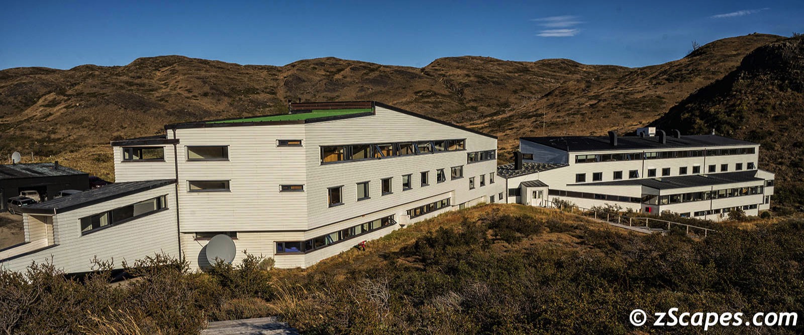
Explora Hotel Front View
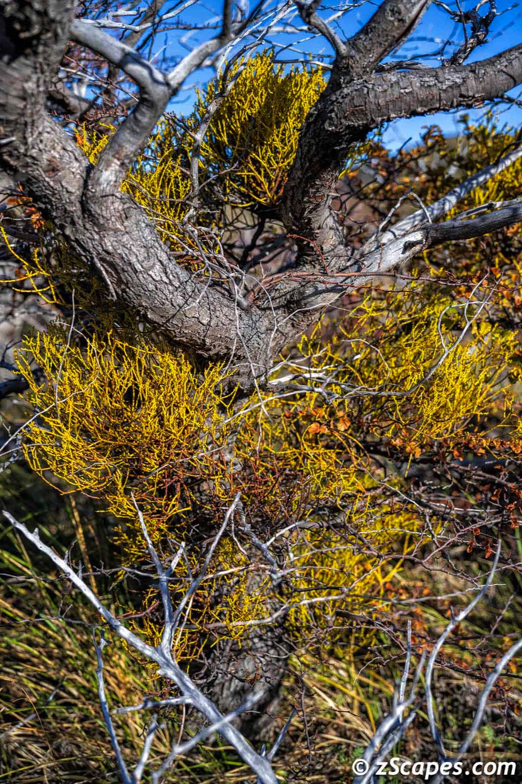
Juniper Mistletoe
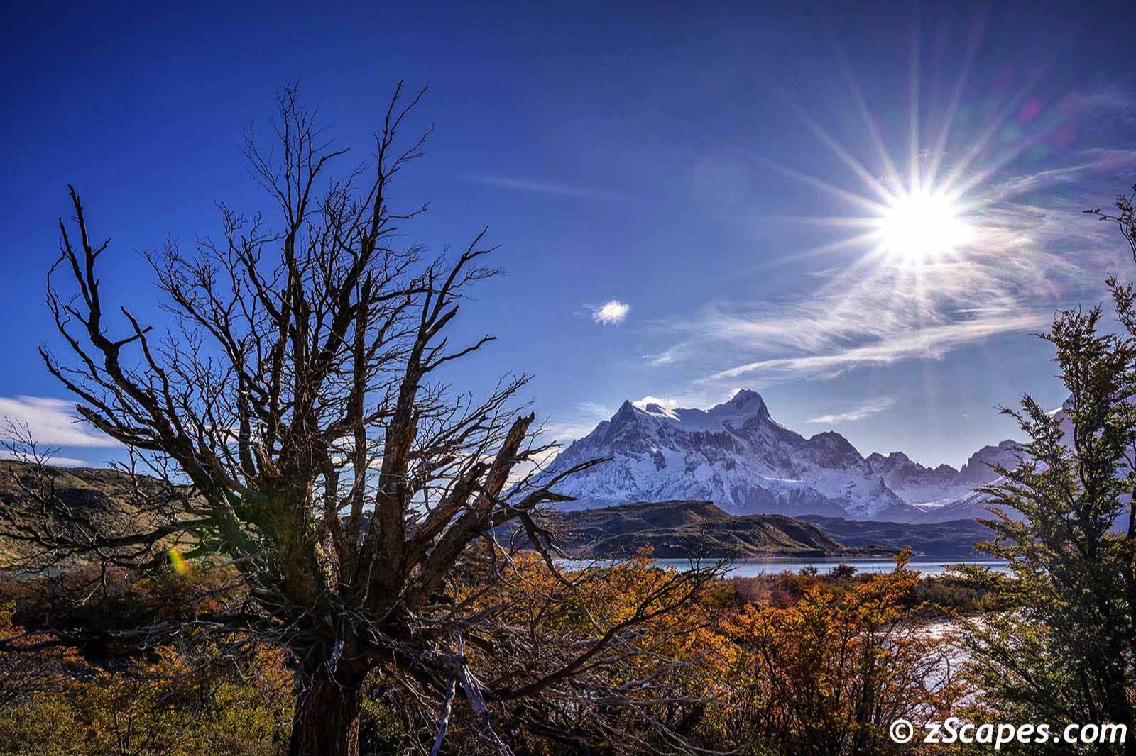
Ghost Tree & Cierra Paine Grande
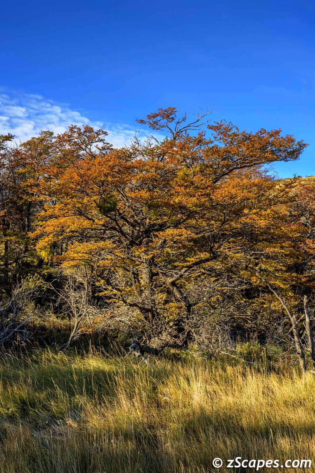
Lenga Beech Tree
Leaving for Paine Grande Camp
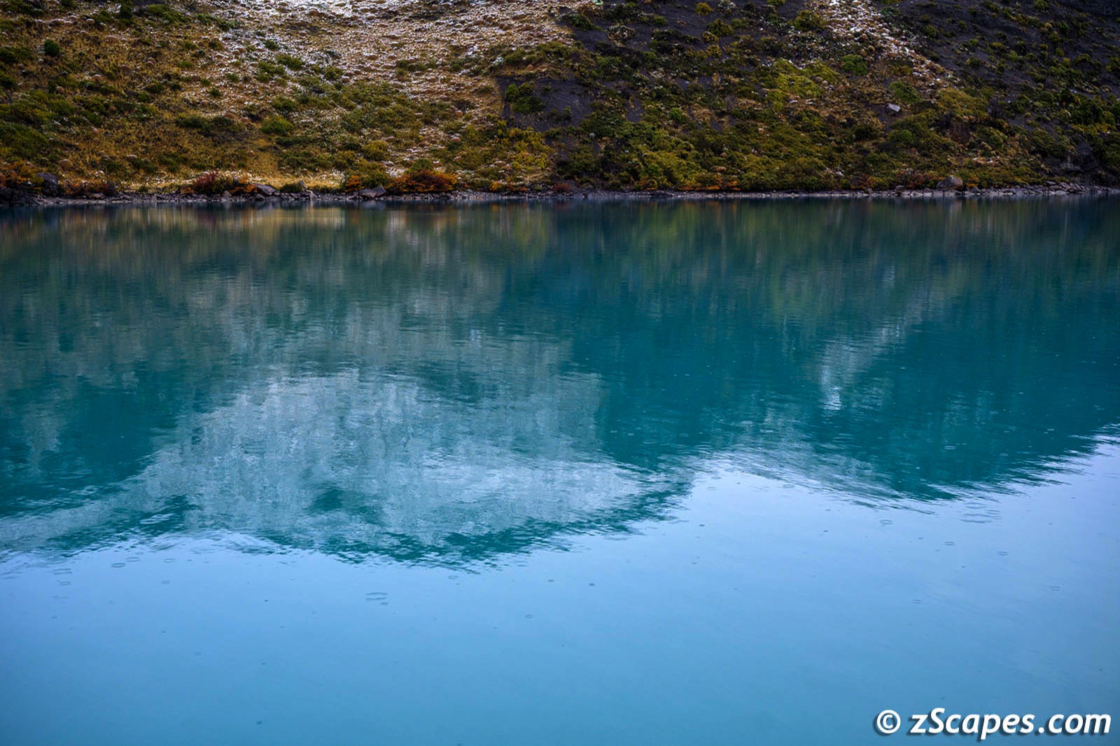
Lake Pehoe Turquoise Waters
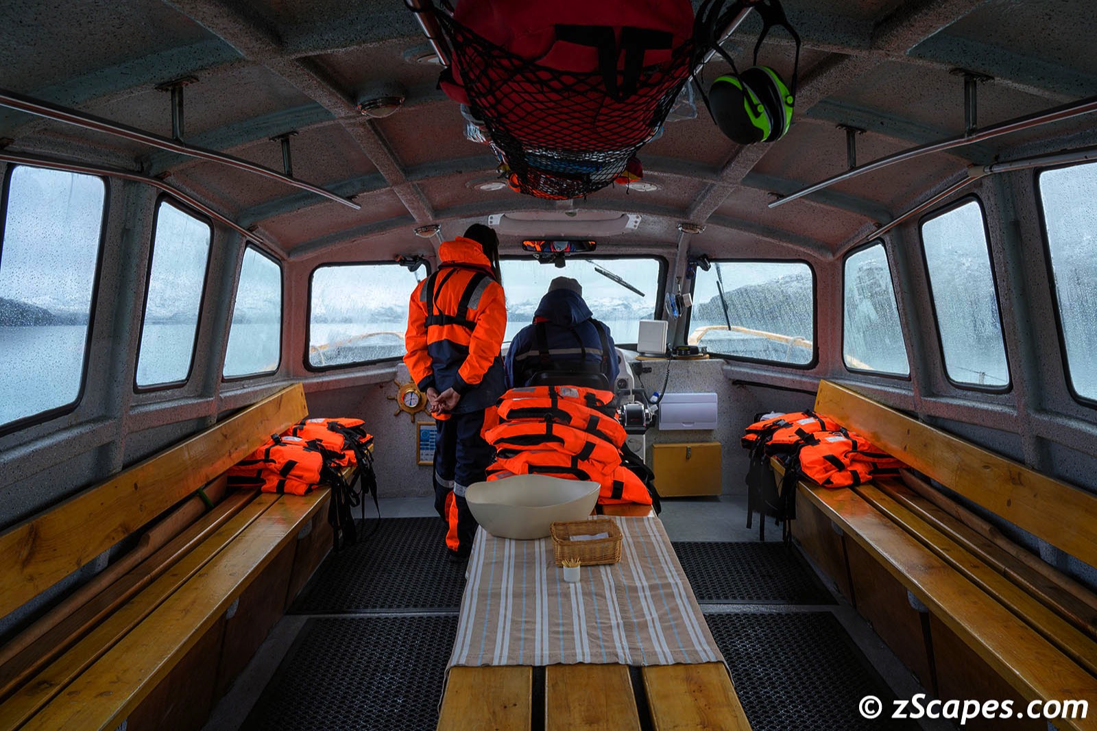
Lake Trip Crew
Paine Grande Camplodge
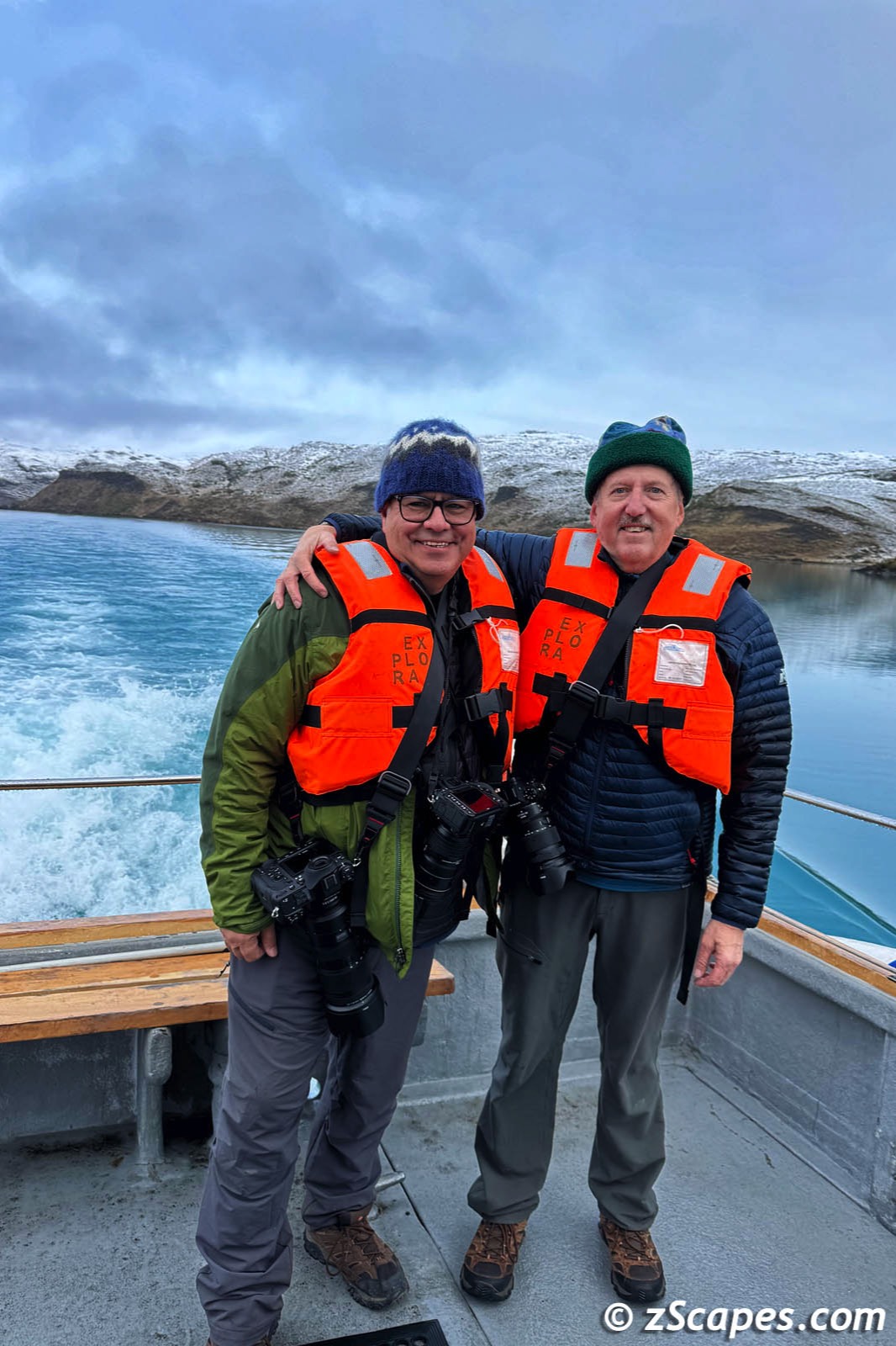
Jon & Mark Lago Pehoe
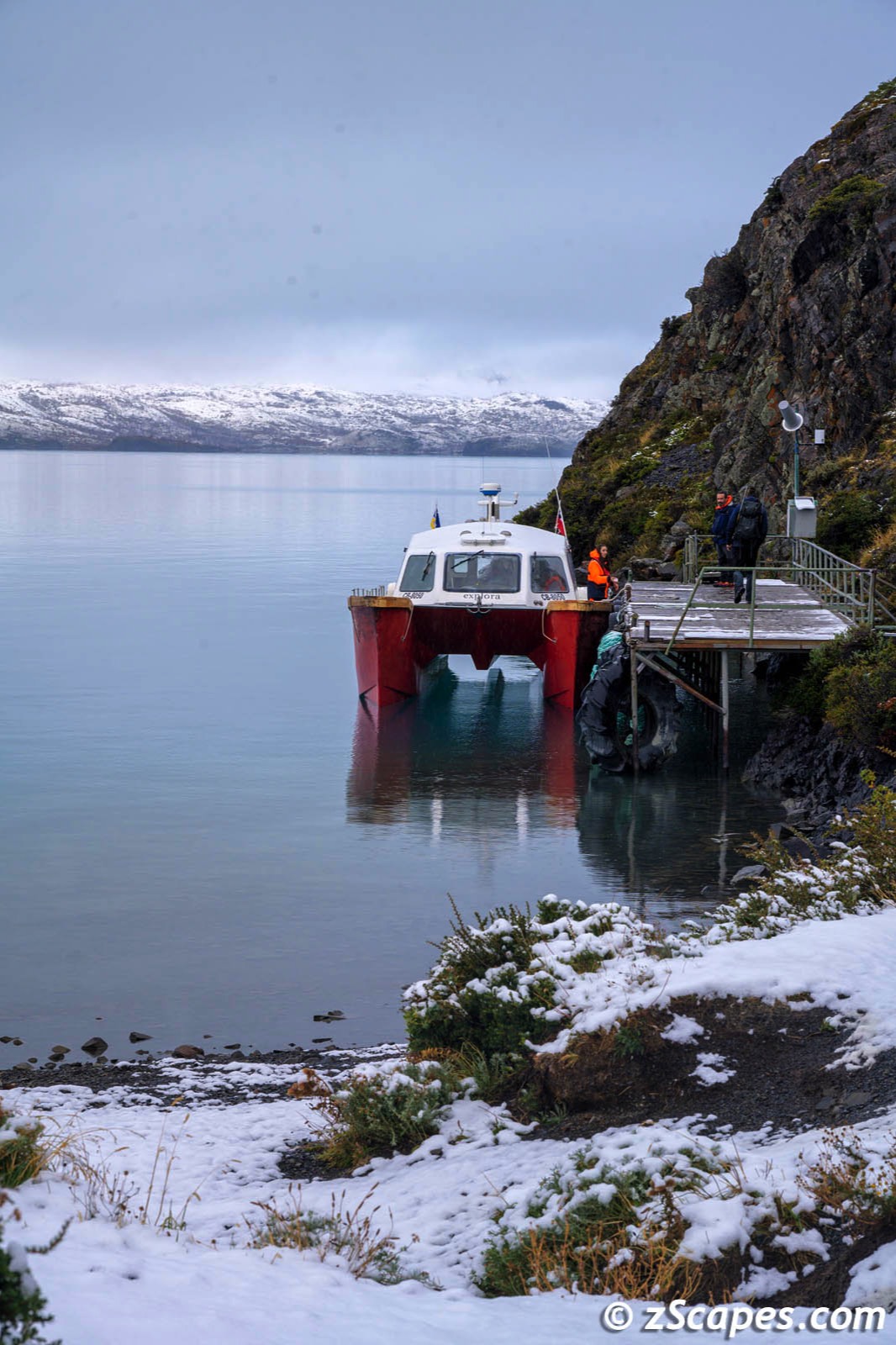
Paine Grande Dock & Explora Catamaran
Lake Pehoe Shoreline Flora
Salto Chico Waterfall
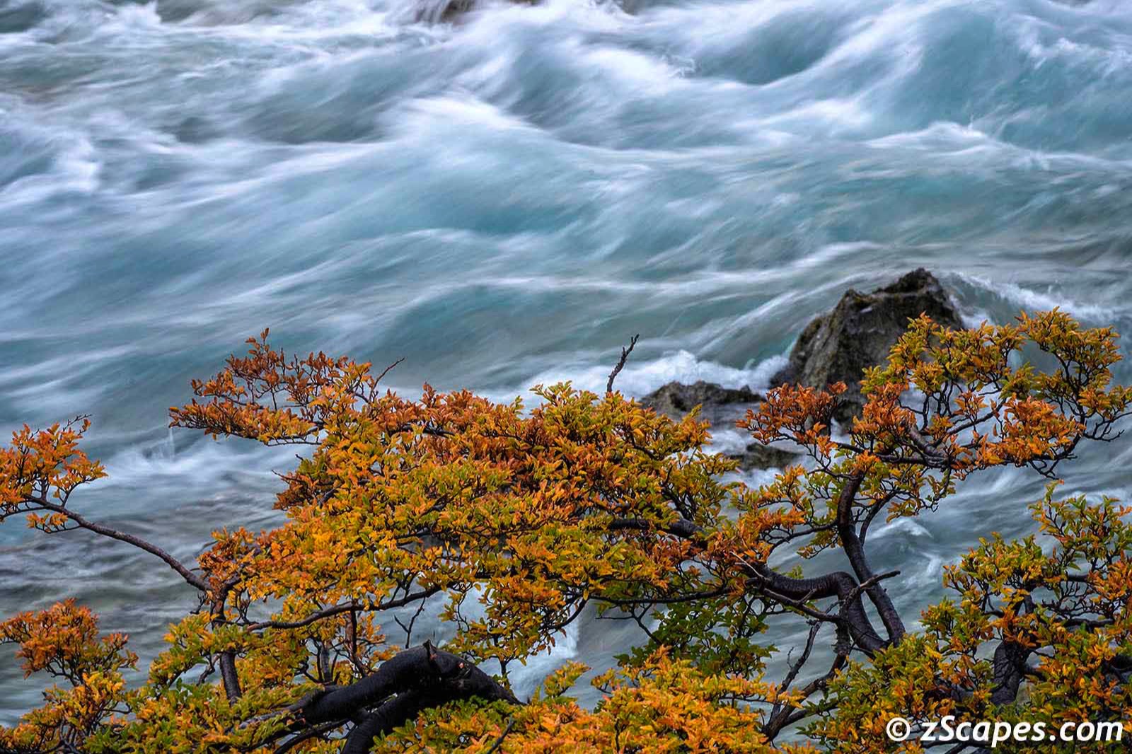
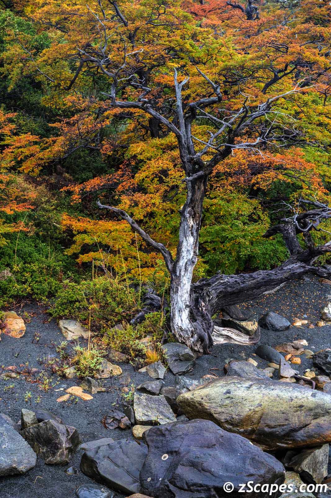
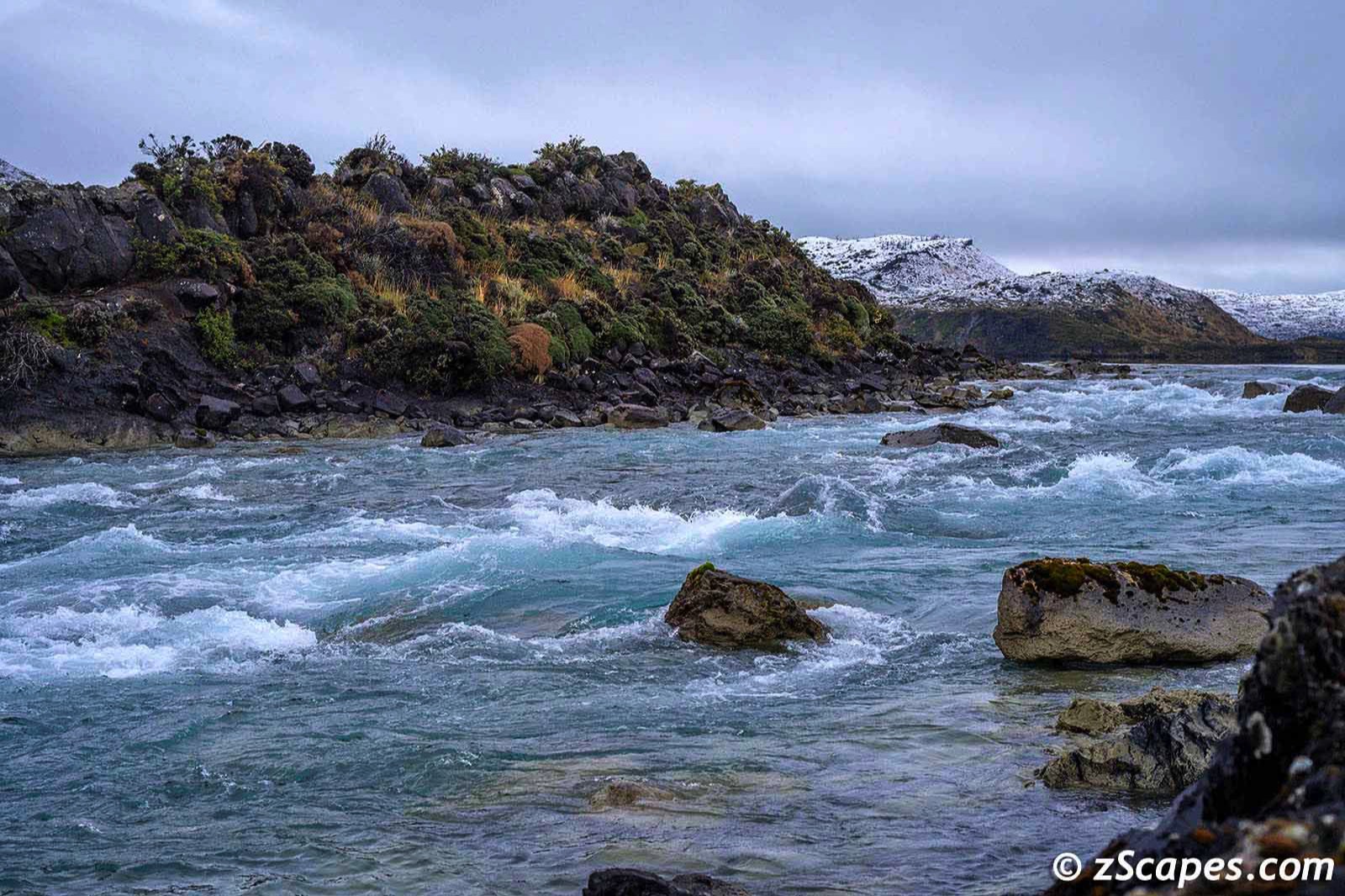
Rio Paine Autumn Colors
Last Day Luck
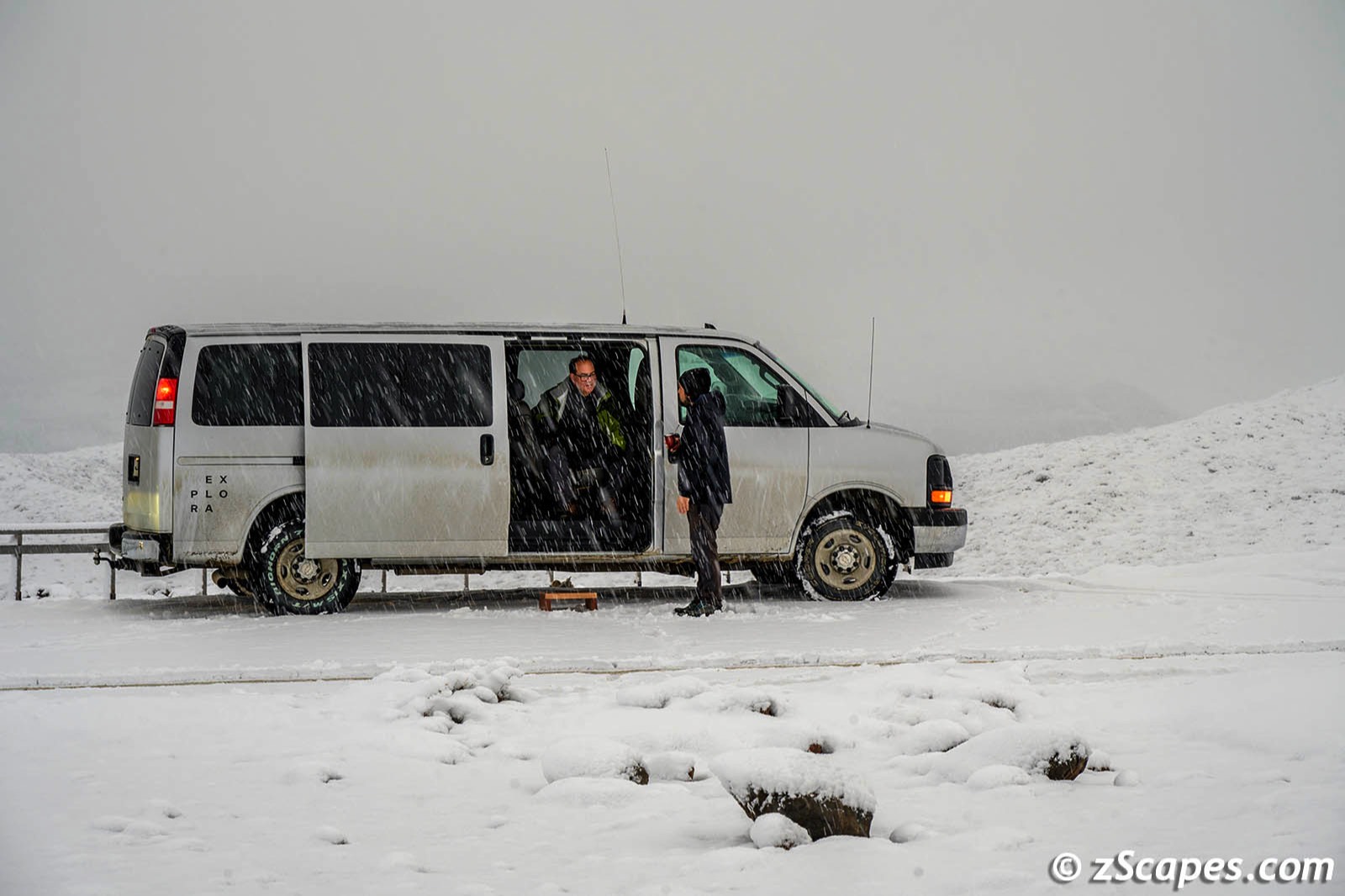
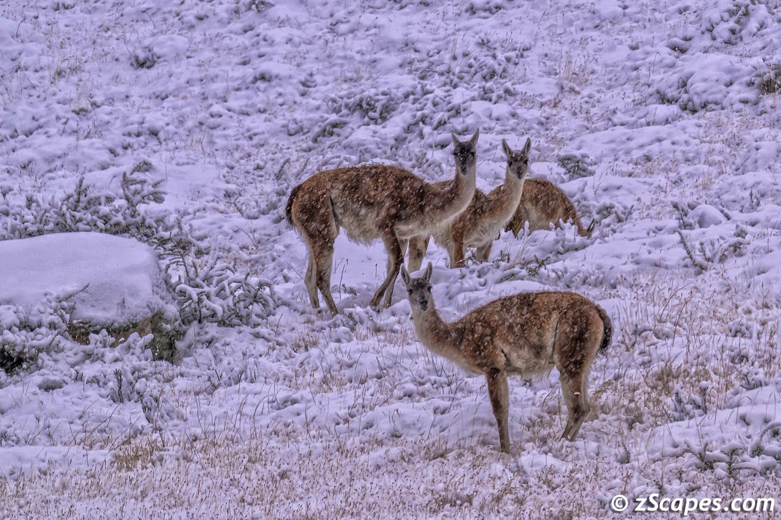
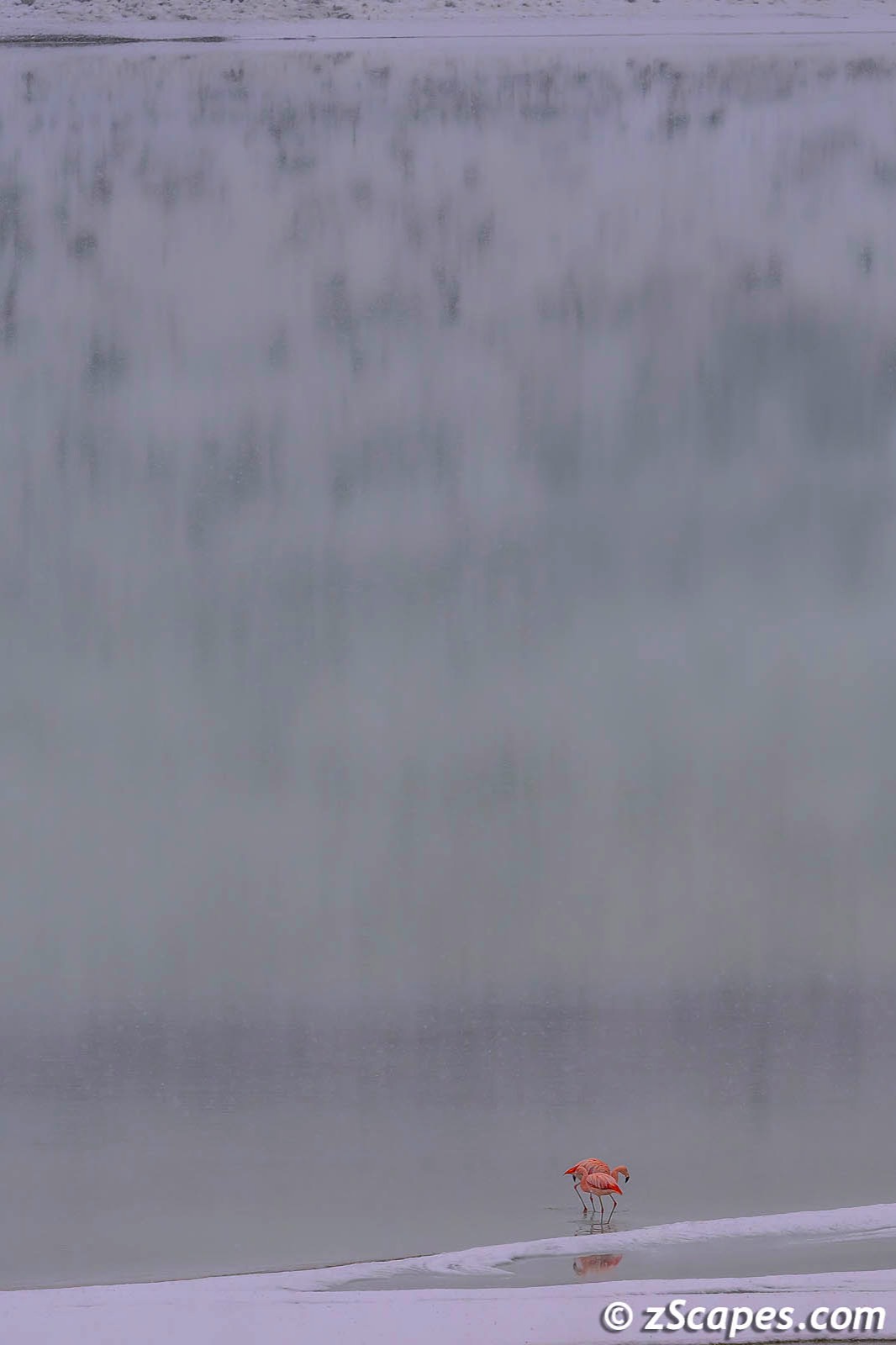
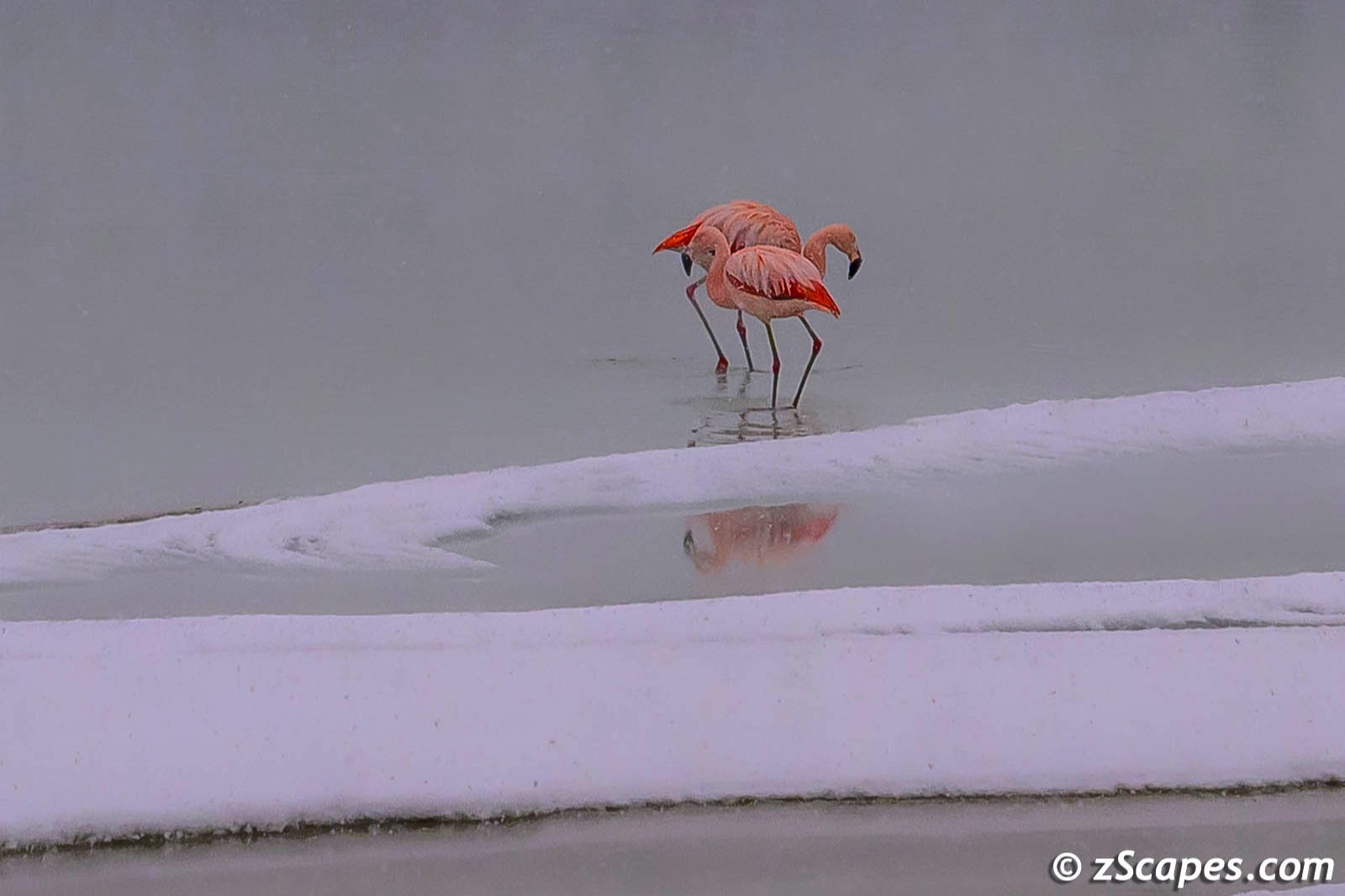
As I mentioned earlier, I was unable to venture too far for a few days, however, by the last day I had improved enough to get out. The plan for that day was a hike into the French Valley to shoot the Torres del Paine towers. However, given my recovery was not complete and the hike would be under snowing conditions with little chance to see the spires due to the weather and overcast, Katsu offered to have a guide and driver take me around to see some of the locales I missed. One of my compatriots, Jon, decided he was not up for the hike either and took advantage of the offer as well. It was snowing lightly, heavy overcast so no chance to get any spectacular mountain scenes, But it was good to get out and off we went to explore. We caught up with Guanaco herds, pictured landscape and saved the best for last.
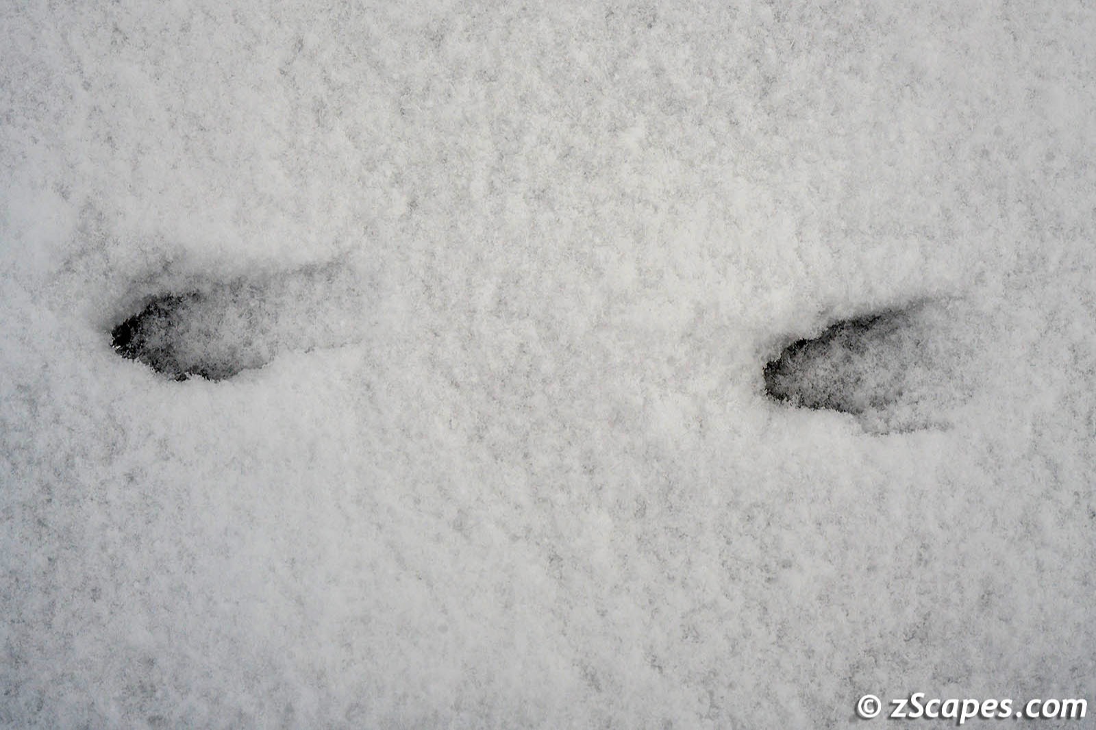

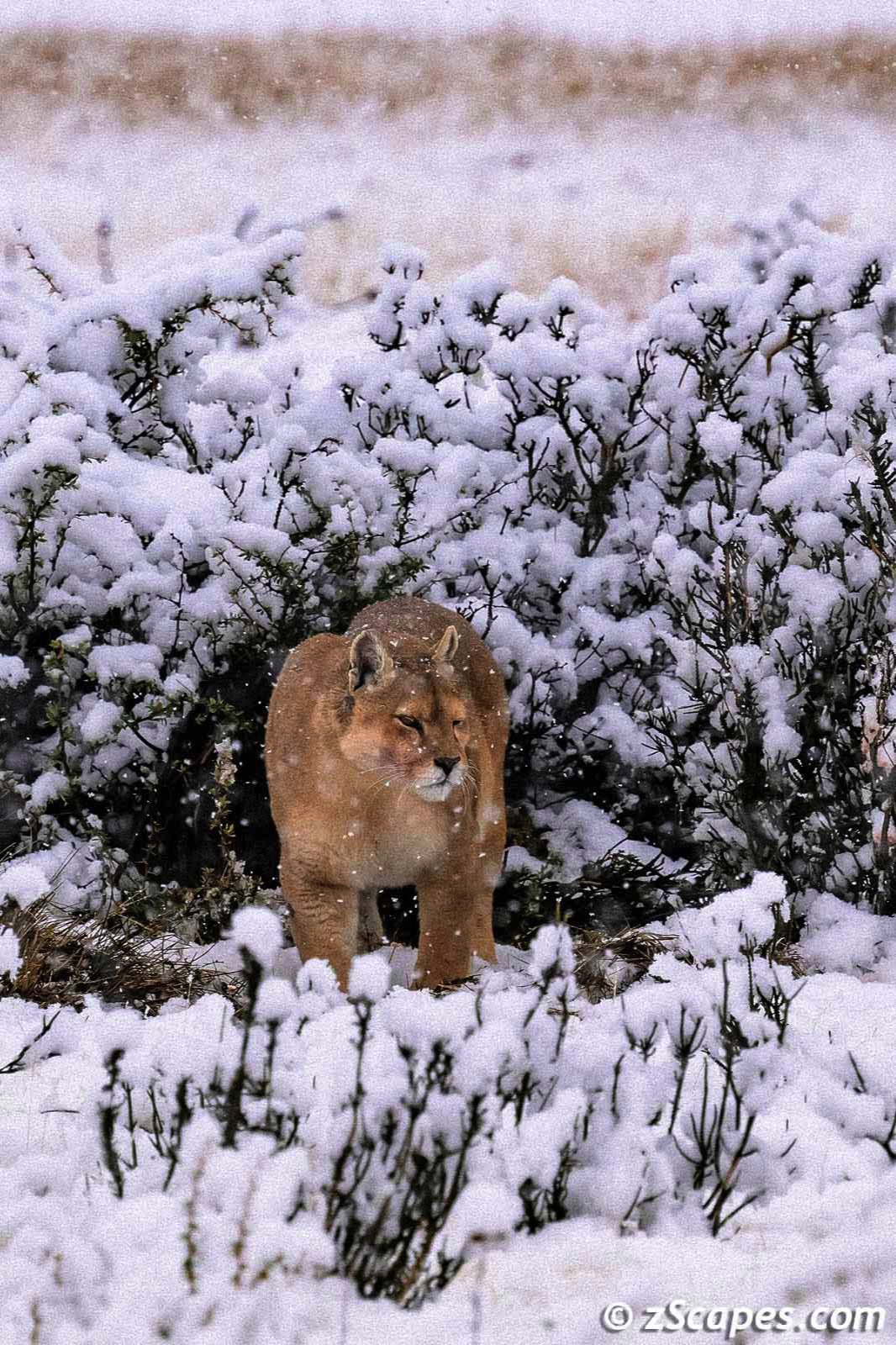
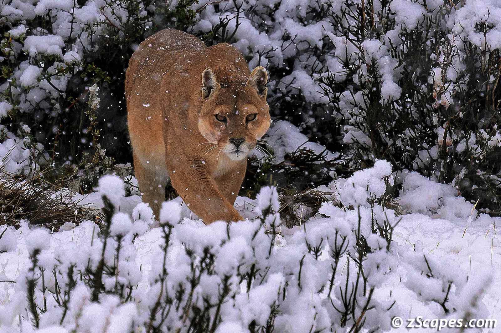
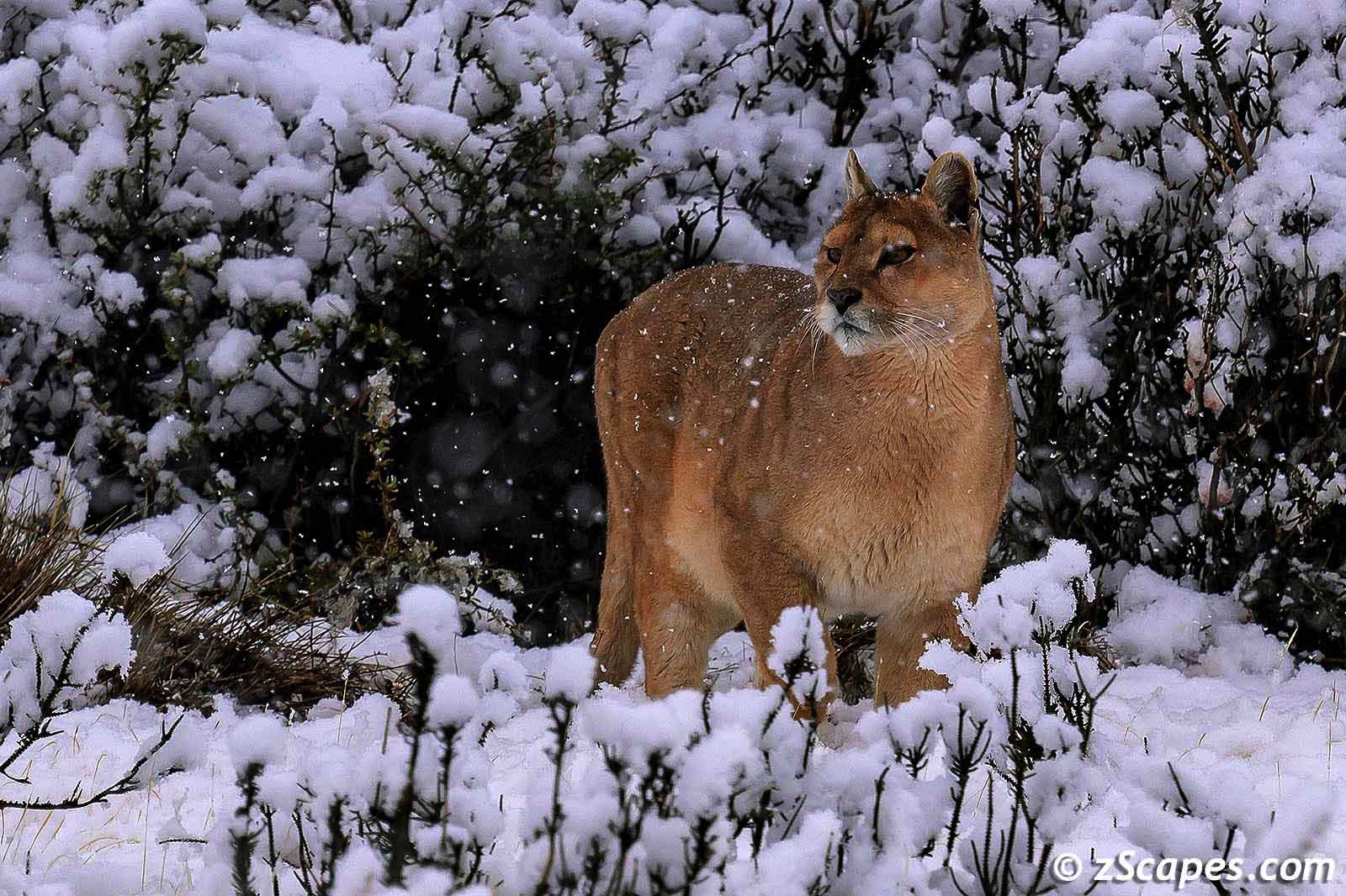
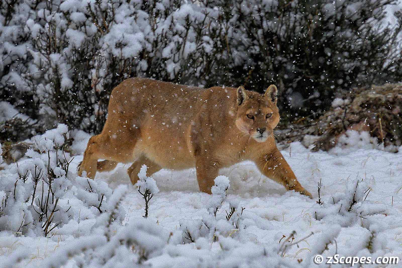
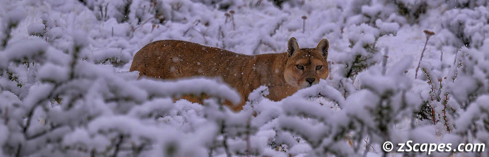
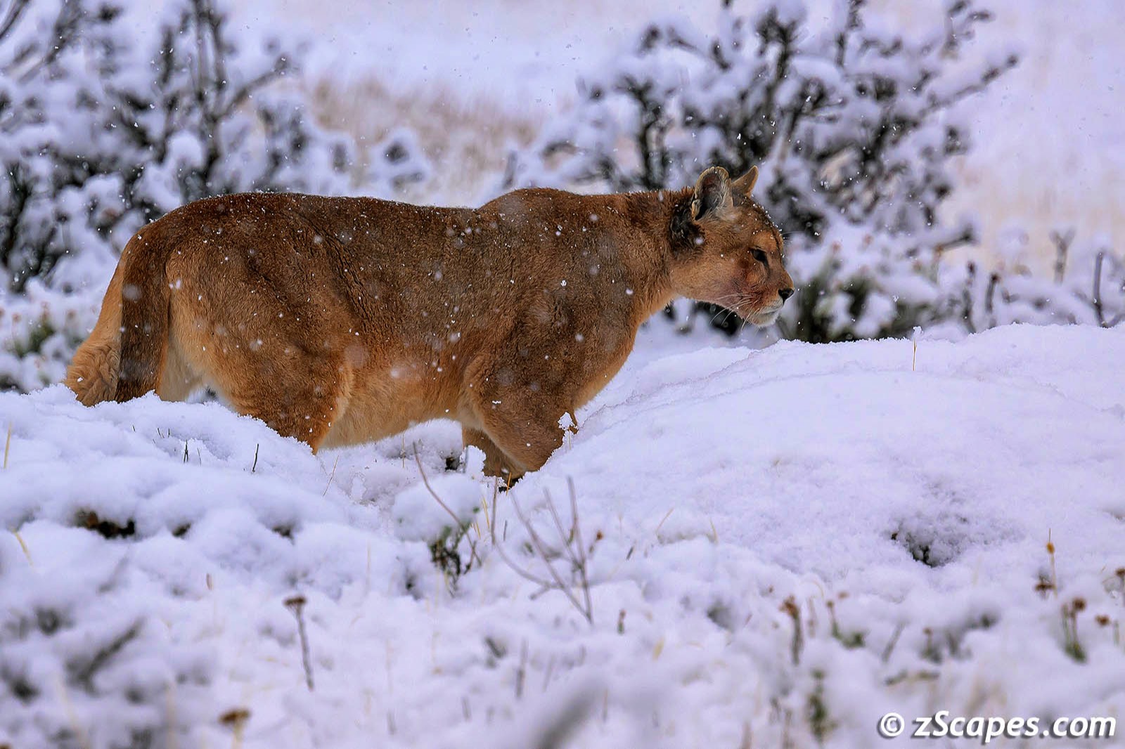
As we started our drive back to the resort, our guide yelled out, Puma! Jon I both turned to where he was looking and had difficulty to acquire the target as the van moved in reverse. Finally, she came into view under a snow covered bush riding out the poor weather. At first she retreated further into the bush and then cautiously made her way out to move along. And the staff at the hotel told us she looked pregnant as the images below will attest. What a thrill and honor to capture the essence of this magnificent creature. And how ironic, I have been backpacking the high Sierra Nevada for 35+ years in search of seeing a Cougar and only coming up with tracks and scat.
May our paths & errands meet
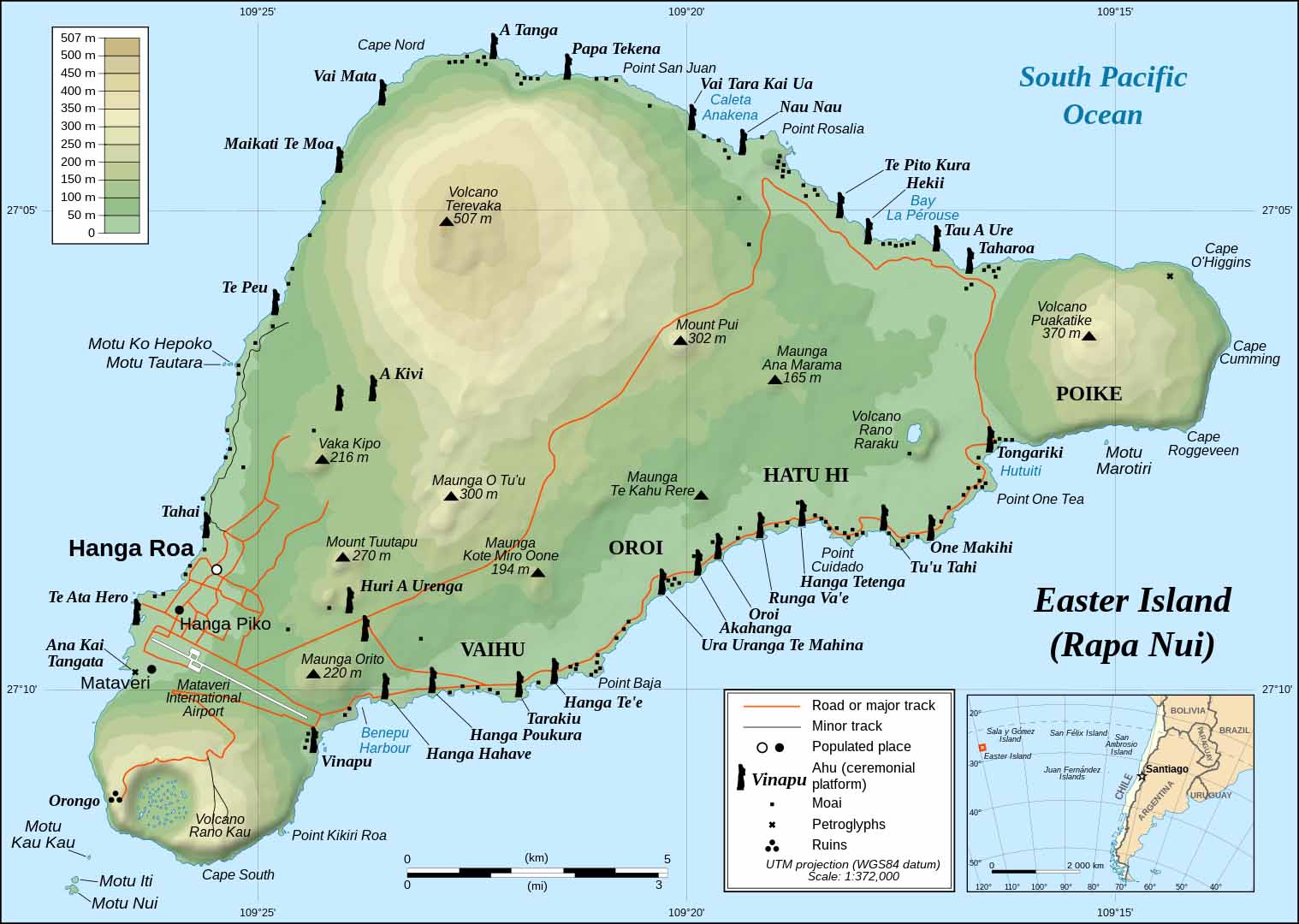
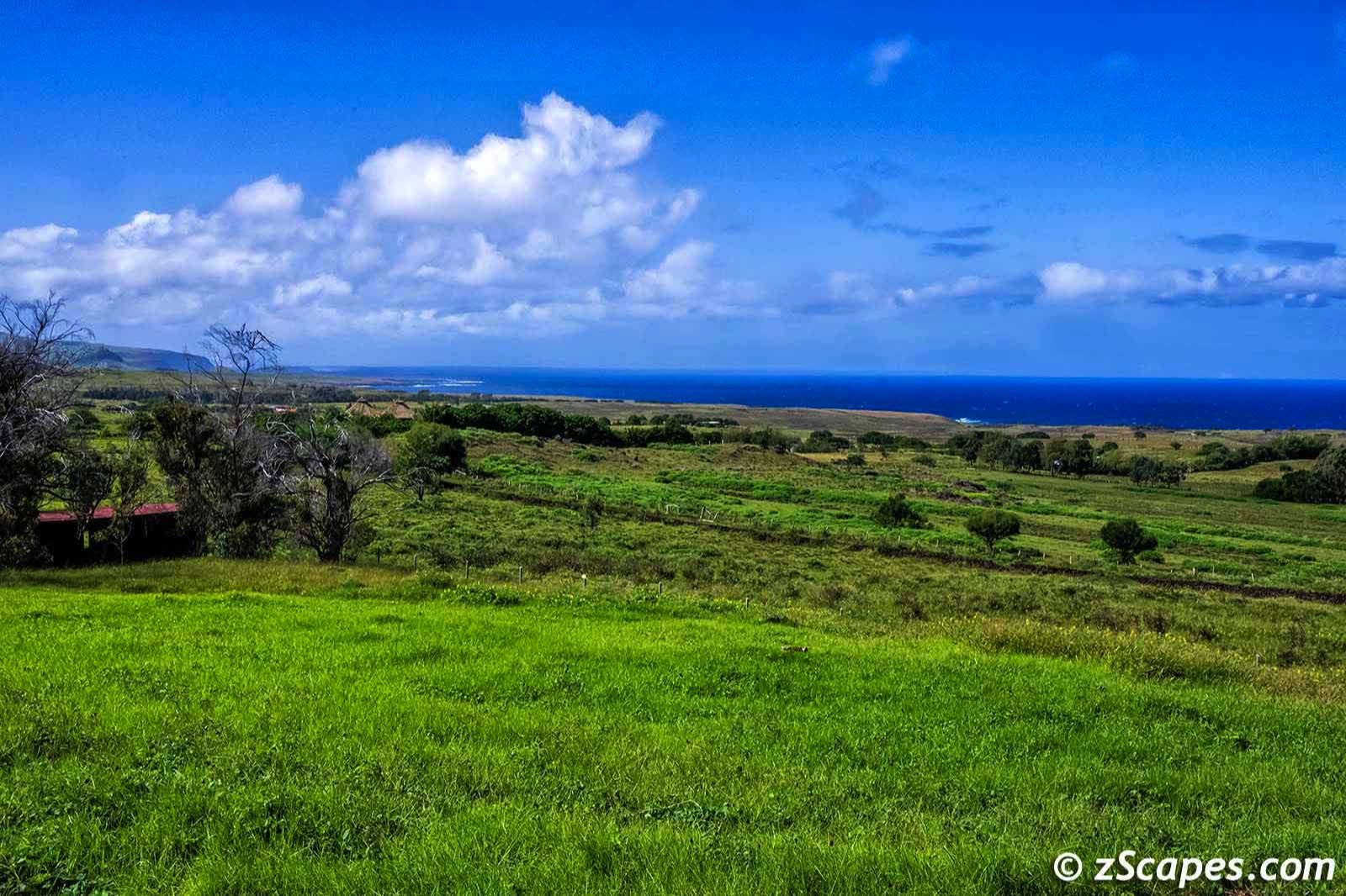
Rapa Nui (Easter Island) Chile
A once in a lifetime opportunity with encouragement from Betsey, and I was off to Chile on a Nikon sponsored photo workshop with Katsuyoshi Tanaka, a well accomplished photographer and extraordinaire teacher. The itinerary included Easter Island (Rapa Nui) and Patagonia with overnight stays in Santiago.
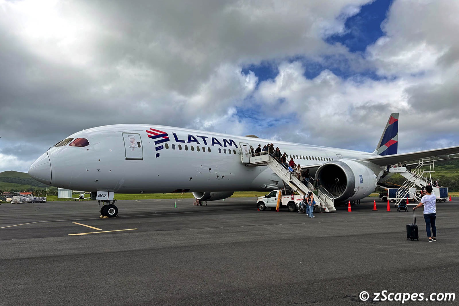
Rapa Nui is a special territory of Chile and was our first landing point via LATAM on their single daily flight. Access to the island is tightly controlled by DPI (Department of Police Investigations) as this island became a refuge for 'not so nice people' during the pandemic who disappeared into the countryside.
Some interesting facts (Wikipedia) ::
- Populated around the year 800 (recent research indicates closer to 1200) the first Polynesians created a thriving and industrious culture
- The Rapa Nui carved numerous enormous stone moai and other artifacts, with close to 1000 in various stages of creation and completion remaining
- Deforestation crept in as the land was cleared for cultivation and the introduction of the Polynesian rat denuded the landscape
- European arrivals, disease, Peruvian slave rading and emigration to other island depleted the population to 111 by 1877
- The 2017 Chilean census registered 7,750 people on the island, of whom 3,512 (45%) considered themselves Rapa Nui.
- At just 63.2 square miles, Rapa Nui is smaller than any of the major Hawaiian Islands except for Kahóolawe (Target island)
- The island is the most southeastern point of the Polynesian Triangle in Oceania
- Nearest inhabited land (around 50 residents in 2013) is Pitcairn Island, 2,075 kilometers (1,289 mi) away
- Nearest town with a population over 500 is Rikitea, on the island of Mangareva, 2,606 km (1,619 mi) away
- Nearest continental point lies in central Chile, 3,512 km (2,182 mi) away.
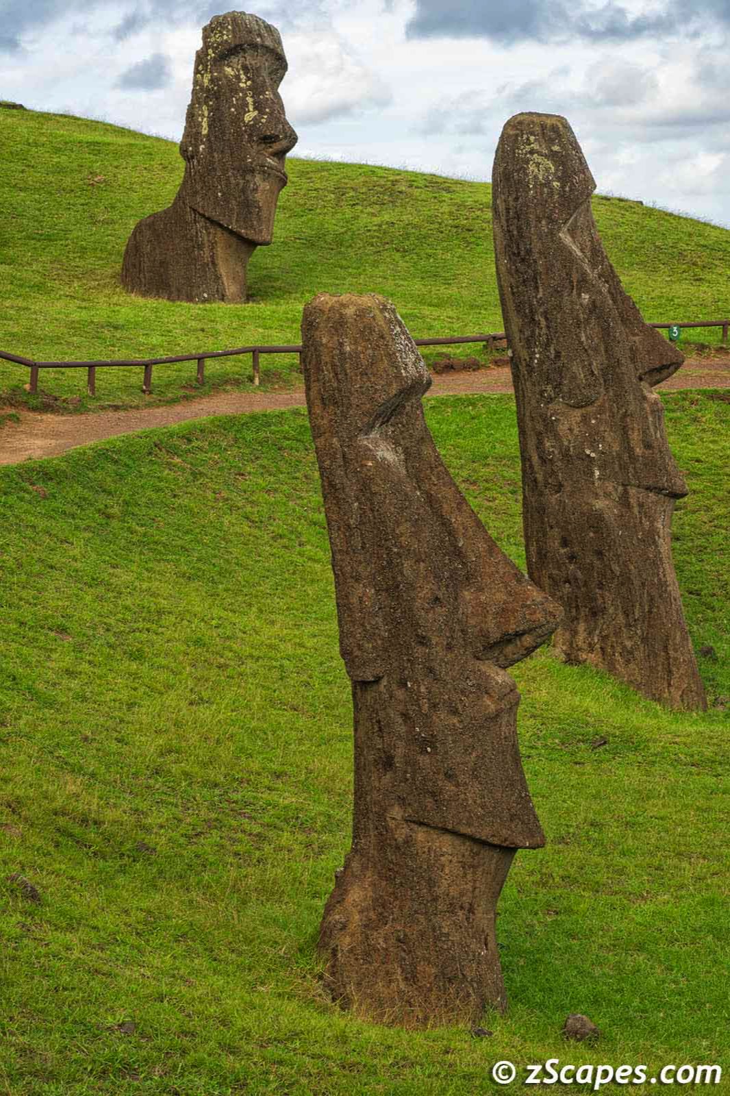
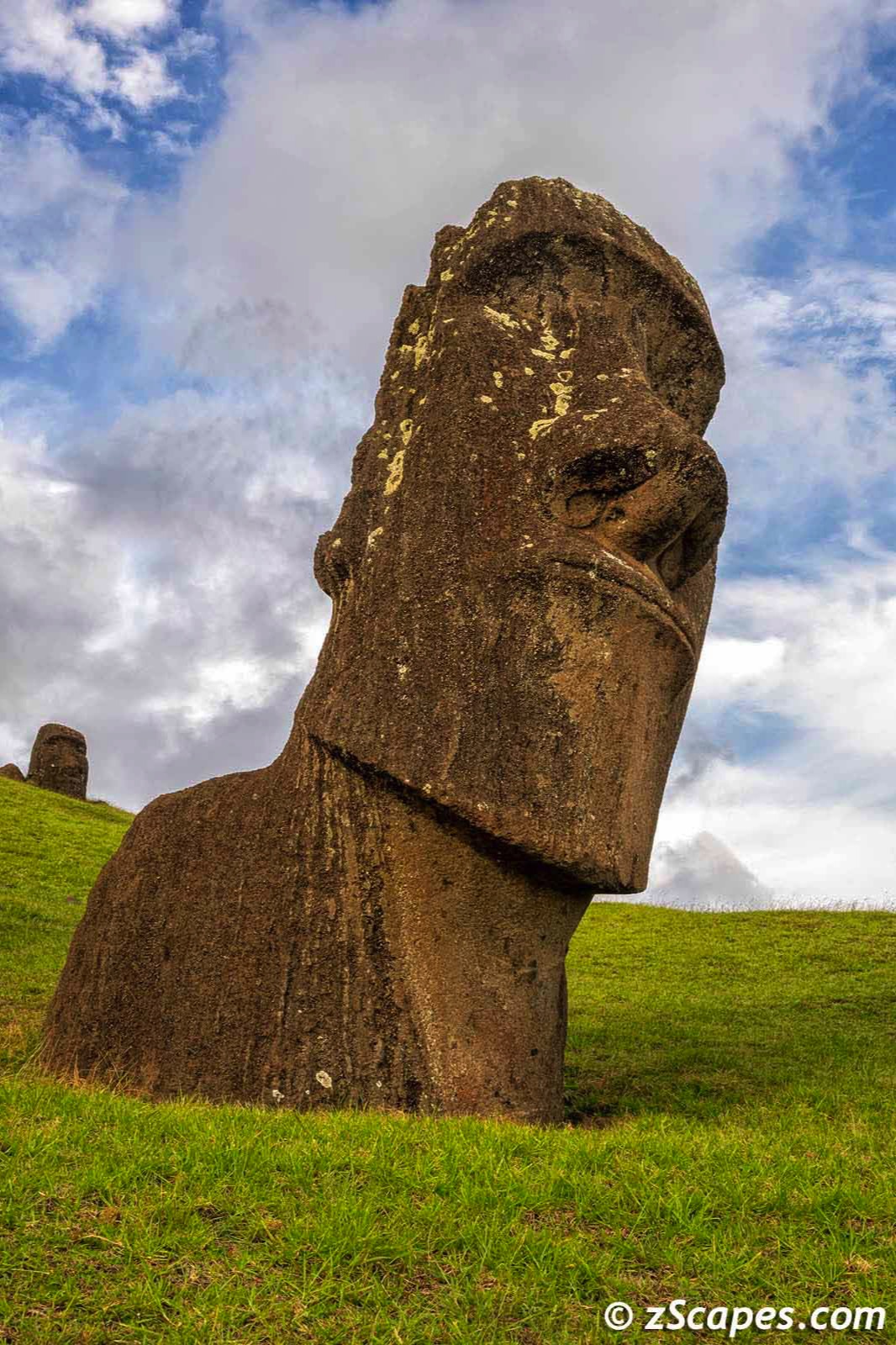
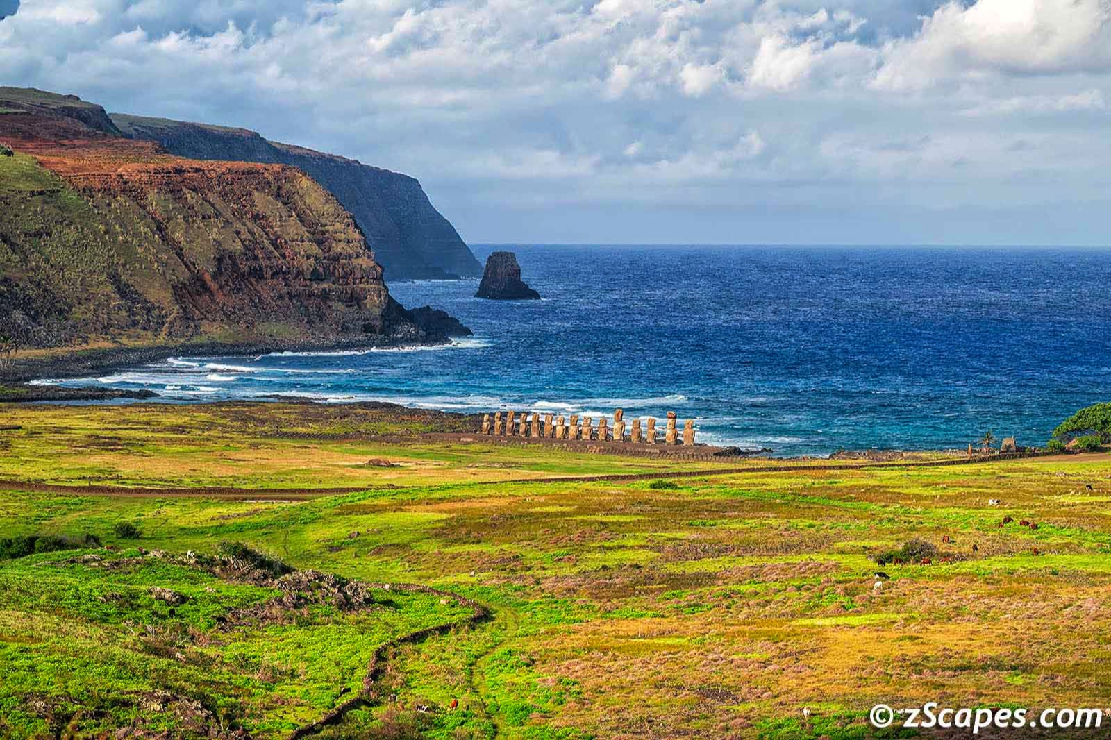
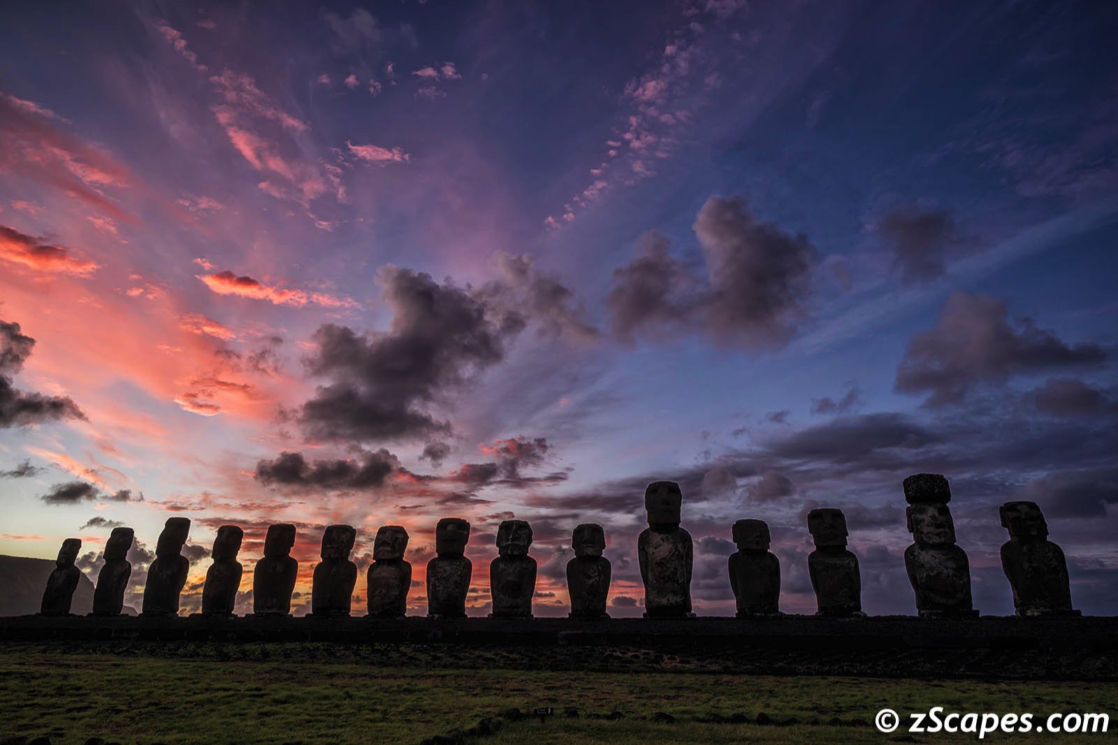
The Moai :: Polynesian Wonder of the Ancient World
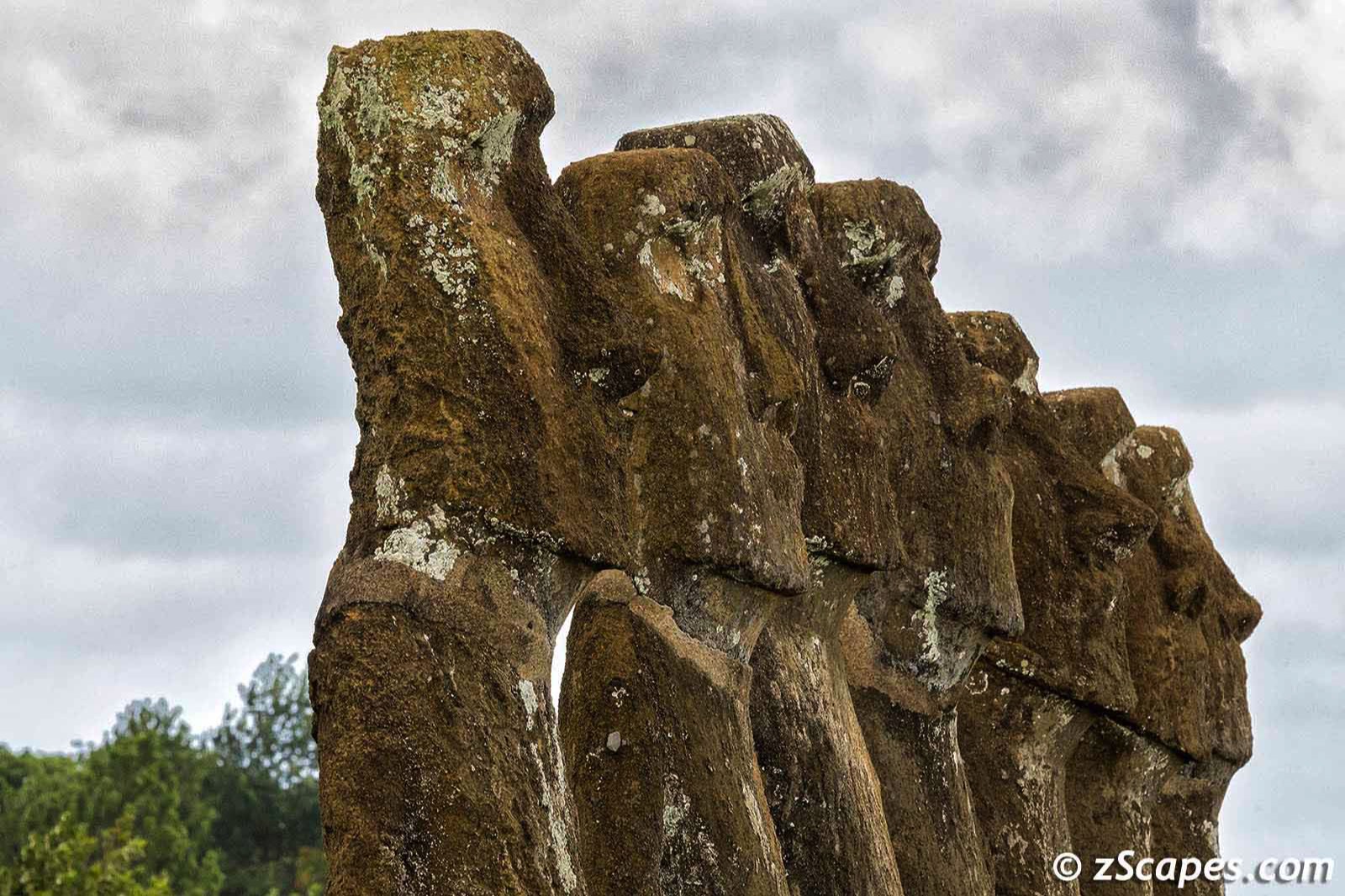
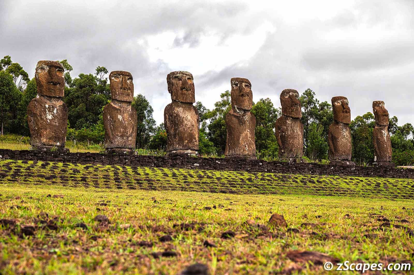
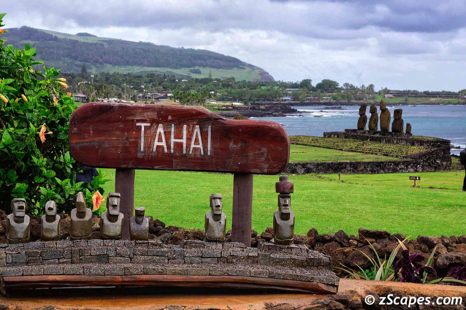
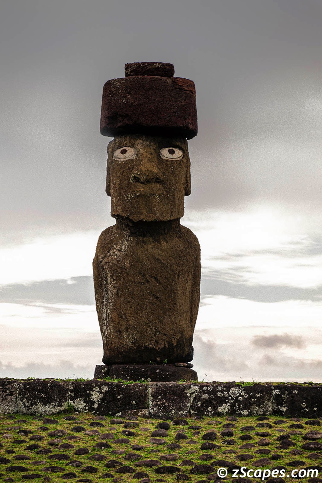
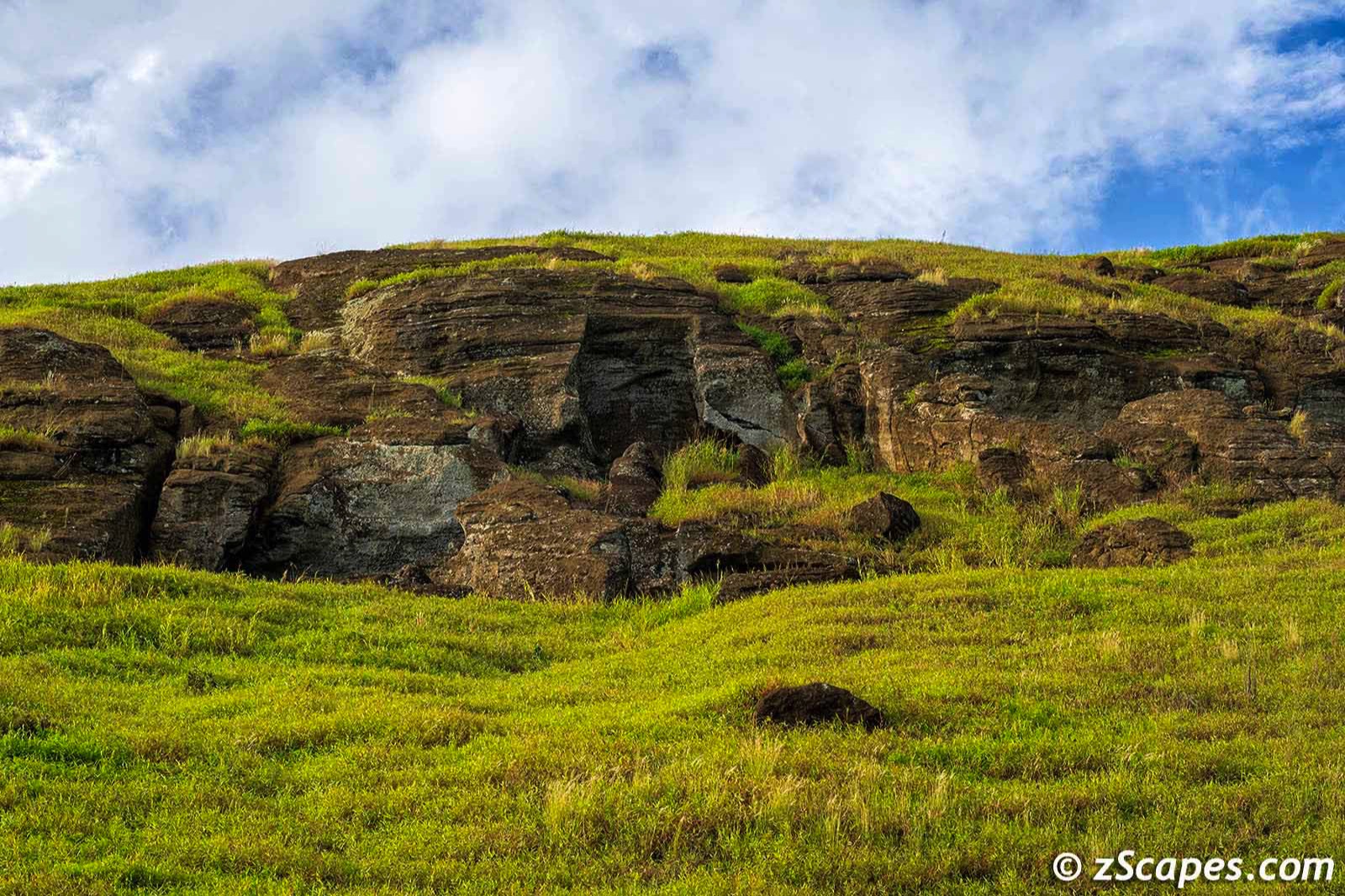
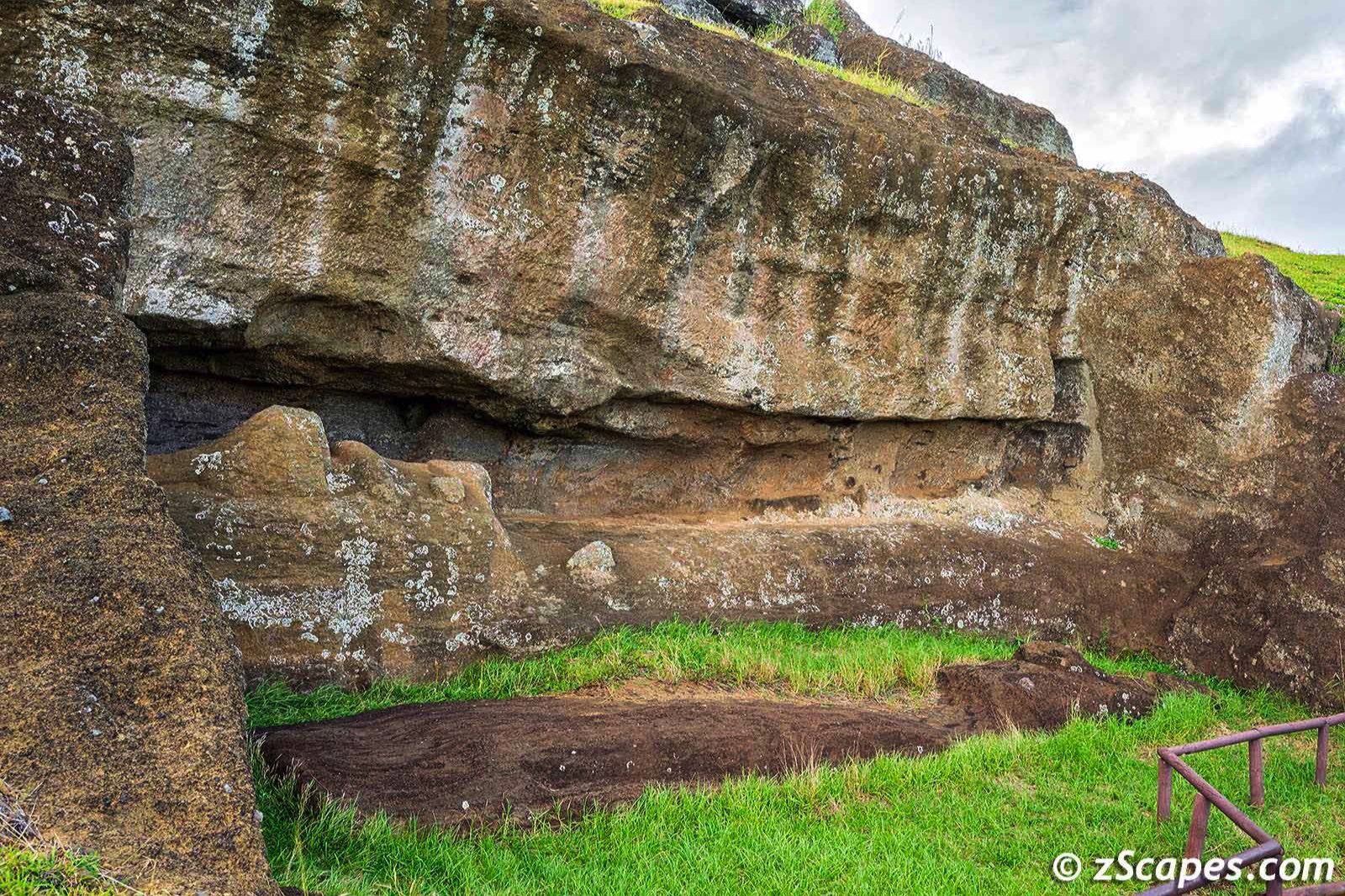
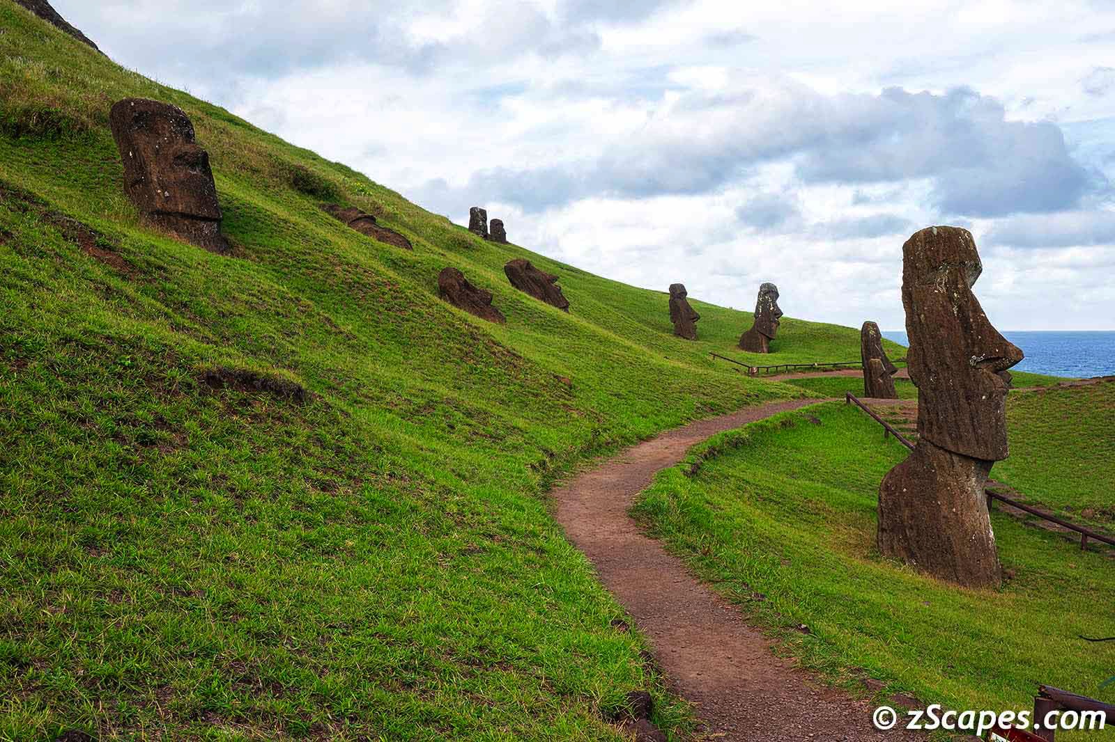
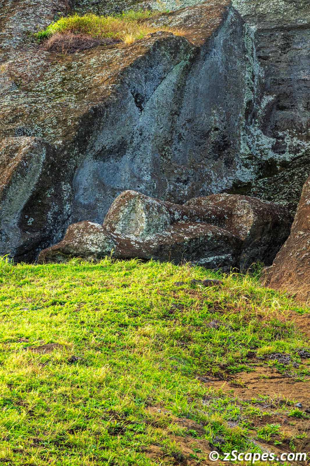
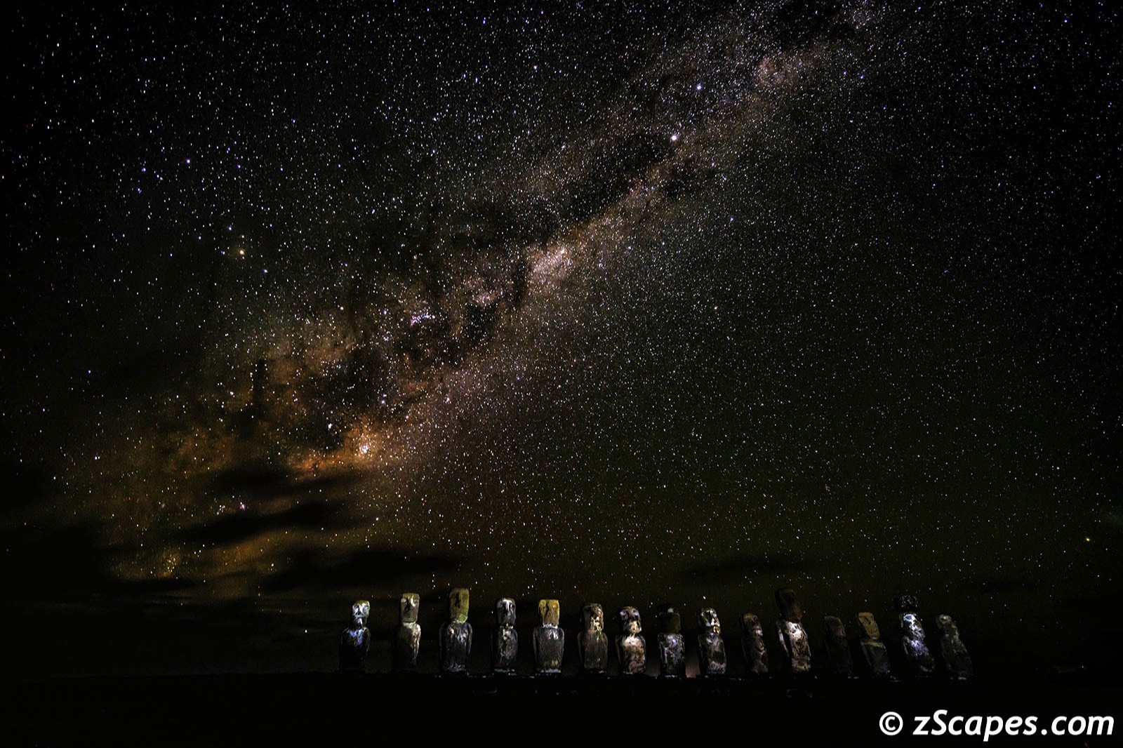
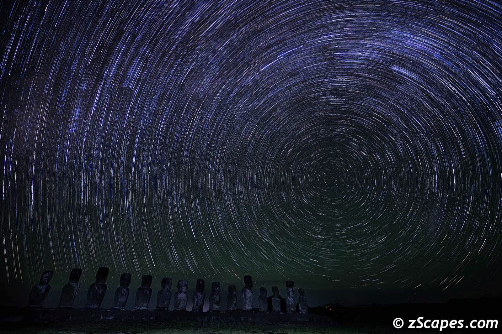
These amazing masterpieces were carved between 1250 and 1500 by the Rapa Nui from the volcanic tuff at the main quarry, Rano a Raraku. Nearly half are still at Rano a Raraku with hundreds transported from there and set on stone platforms called ahu around the island's perimeter. Almost all moai have overly large heads, which account for three-eighths of the size of the whole statue. They also have no legs. The moai are chiefly the living faces (aringa ora) of deified ancestors (aringa ora ata tepuna). I have to admit, they are breathtaking and another example of engineering in the ancient world, in parallel with the Inca engineering marvels in Peru. My favorite spot was the quarry with the statues in various states of creation. More @ Wikipedia
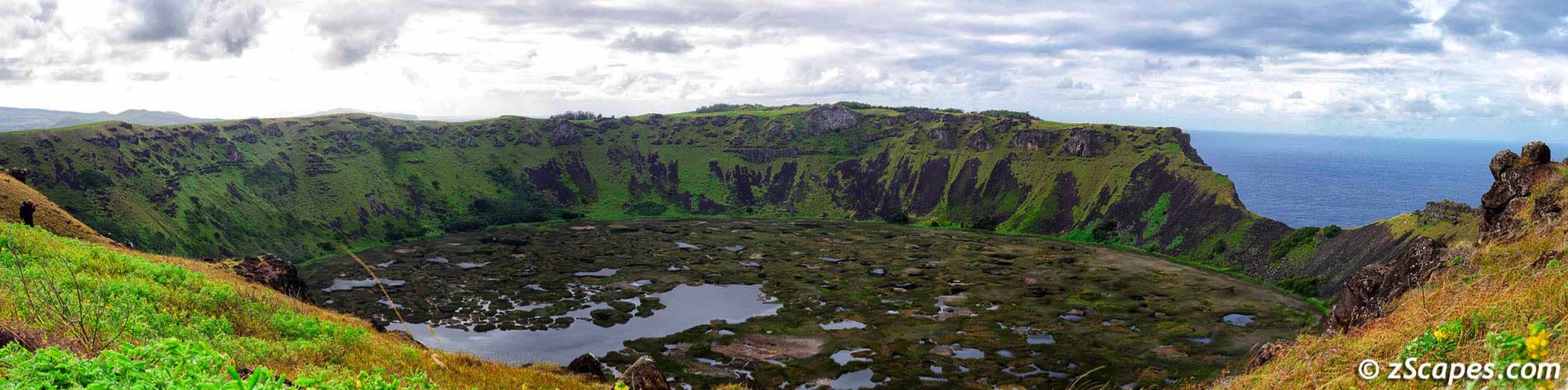
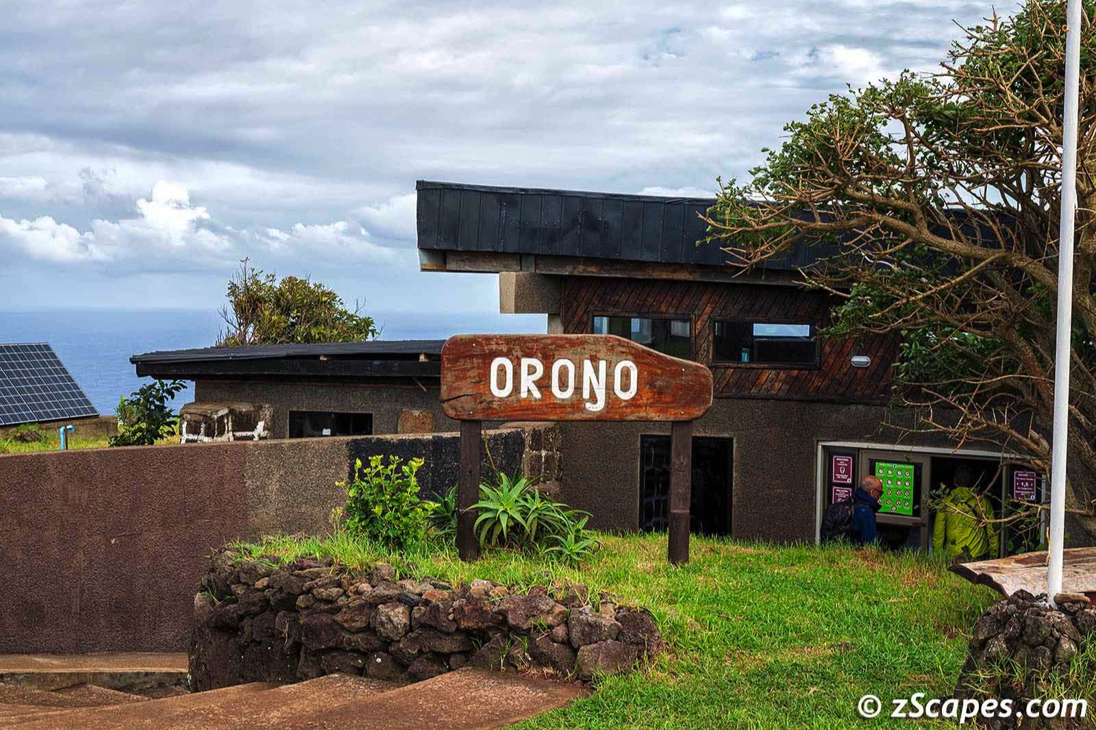
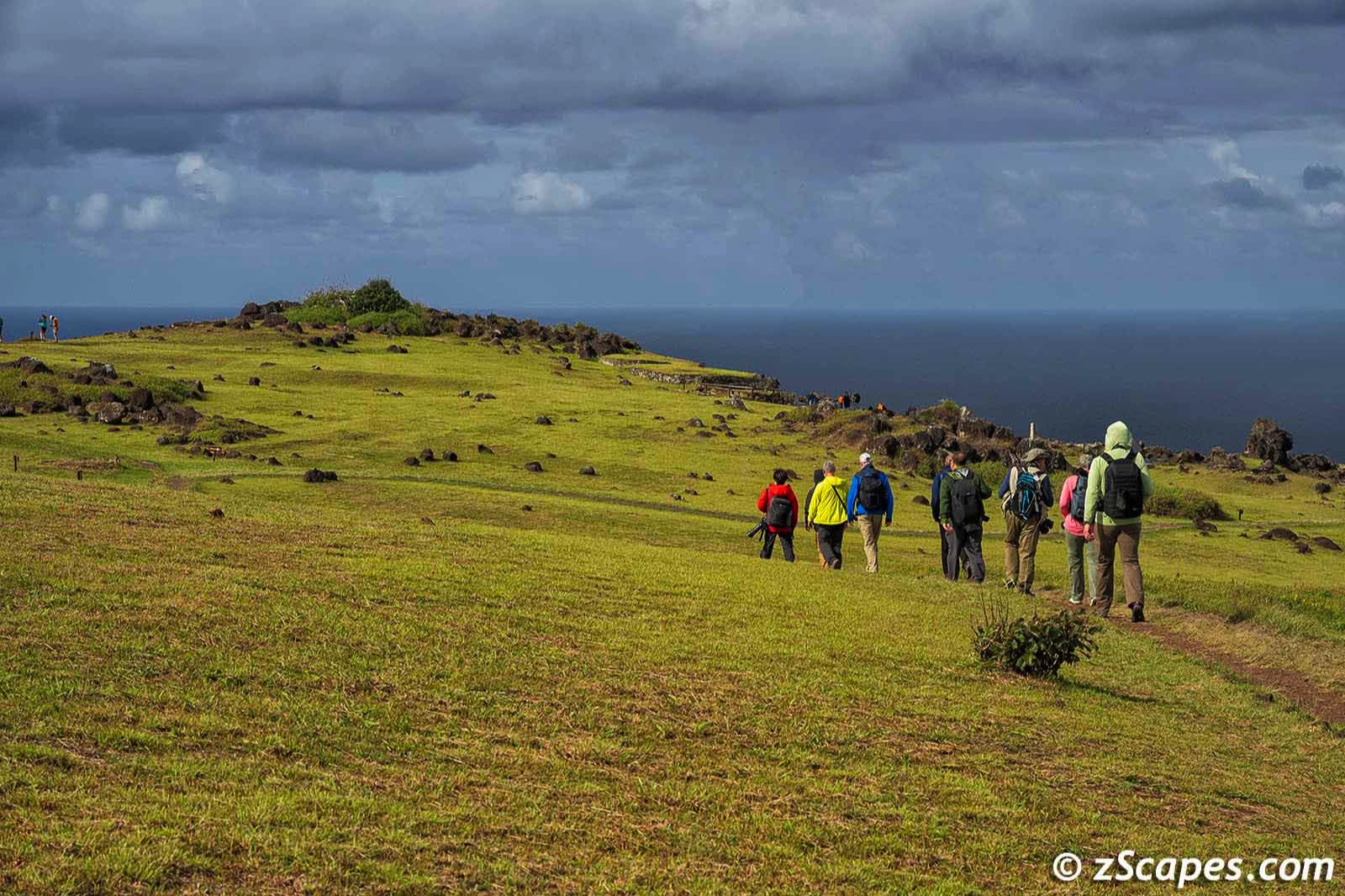
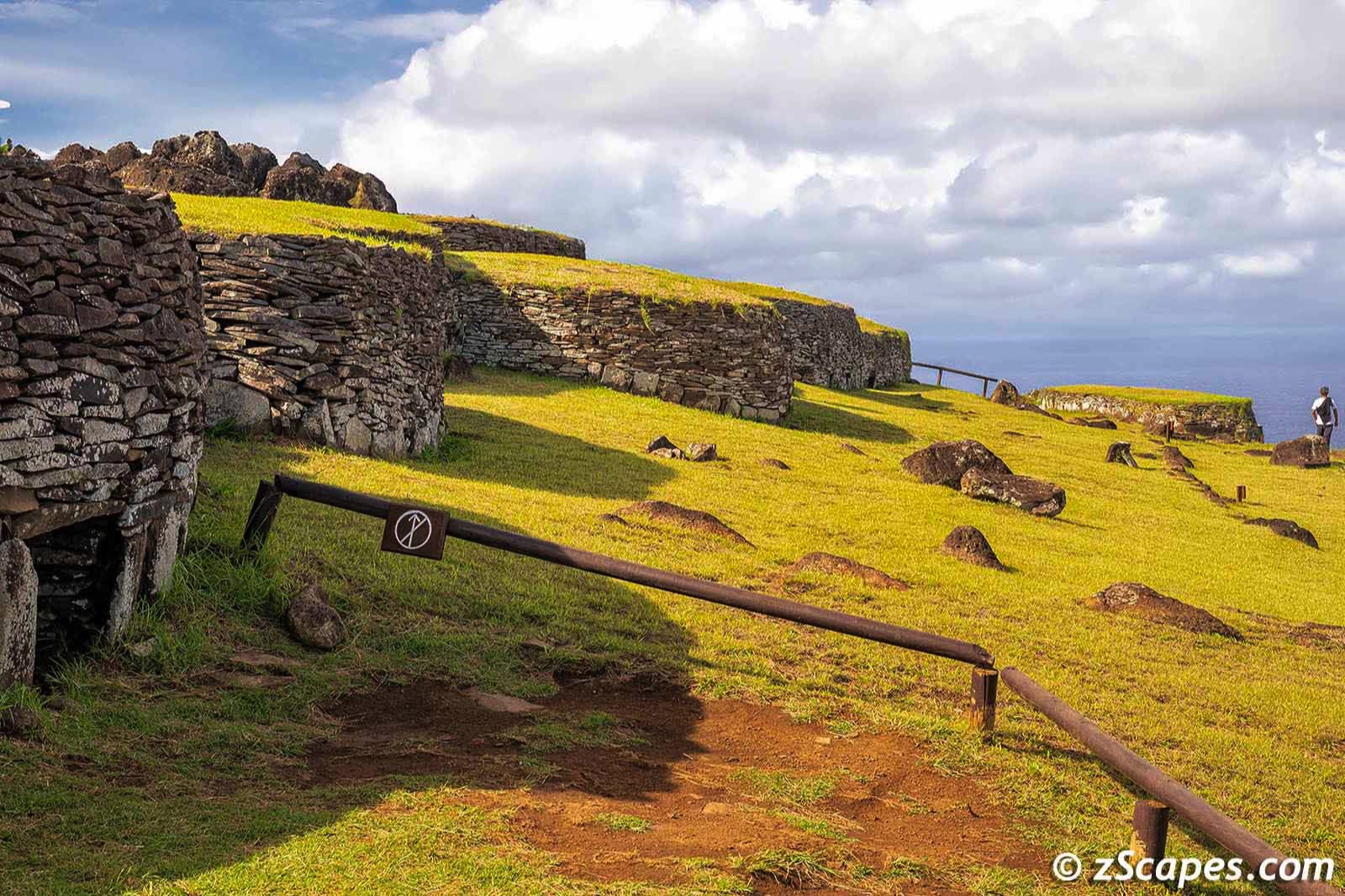
South Island :: Rano Kau & Orongo
On our second day, we visited Rano Kau, an extinct volcano and Orongo, a stone village ceremonial center on the southwestern headlands.
Rano Kau at 1063 ft tall and a mile across was formed of basaltic lava flows containing obsidian and pumice used by island craftsmen. The caldera contains a fresh water lake (only 3 on the island) and the crater walls create a microclimate that shelters flora from the strong island winds, allowing figs and vines to flourish. Terevaka (tallest @ 1643 ft) & Poike (oldest) complete the trio of extinct volcanos.
Orongo was the ancient center of a yearly challenge where each tribe would send their best warrior to retrieve a mantra (sooty tern) egg undamaged from Moto Nui and return to Orongo. The task involved scaling down a 300 meter cliff (no ropes), swimming with sharks for a mile and then returning along the same danger laced path. The tribe of the first warrior that made it back alive would then rule the island until next challenge. Interesting way to solve inter-tribal conflicts!
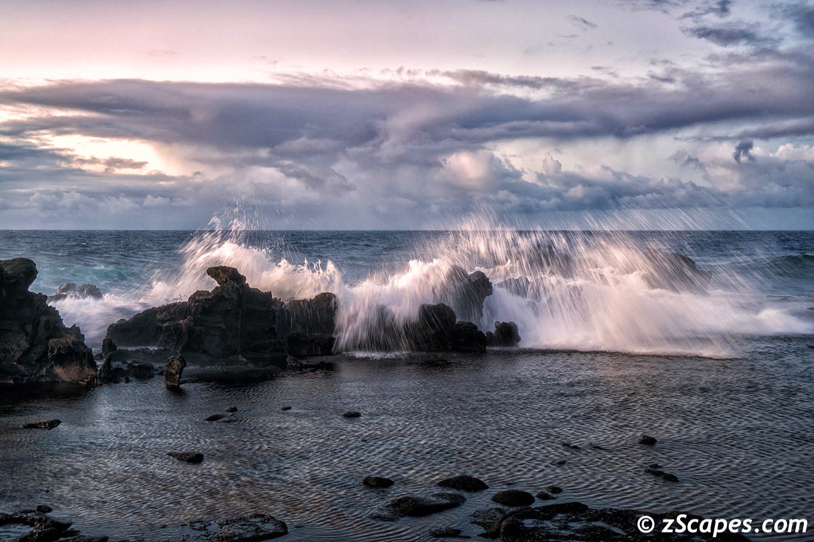
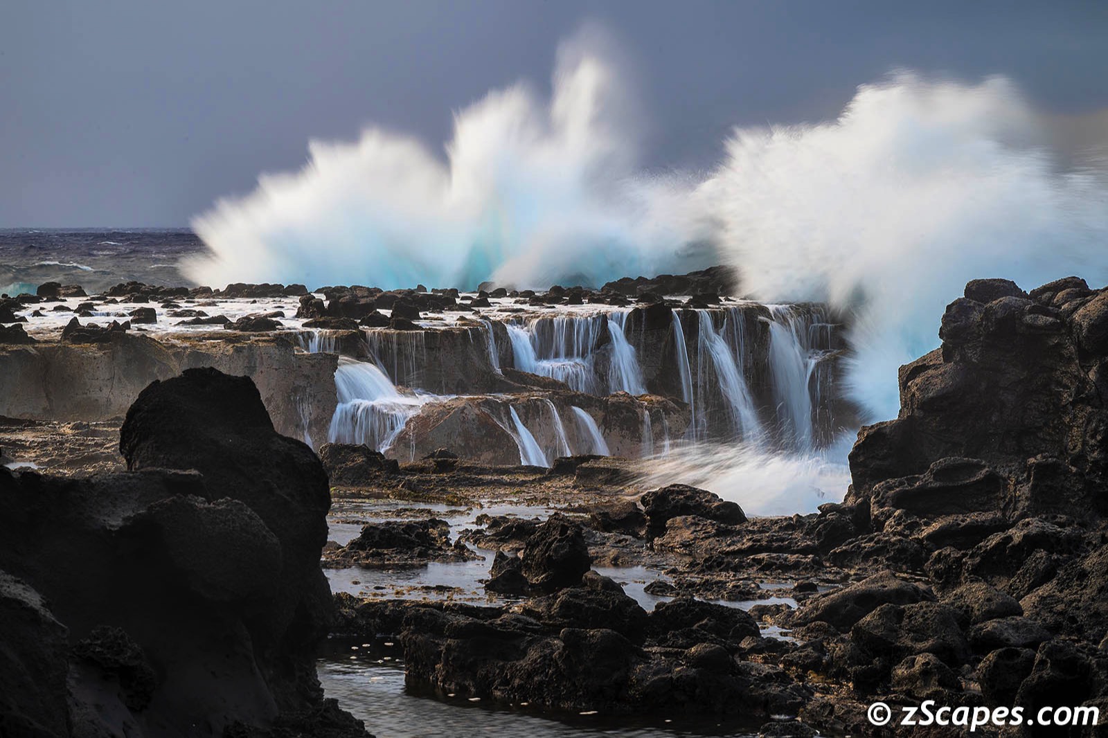
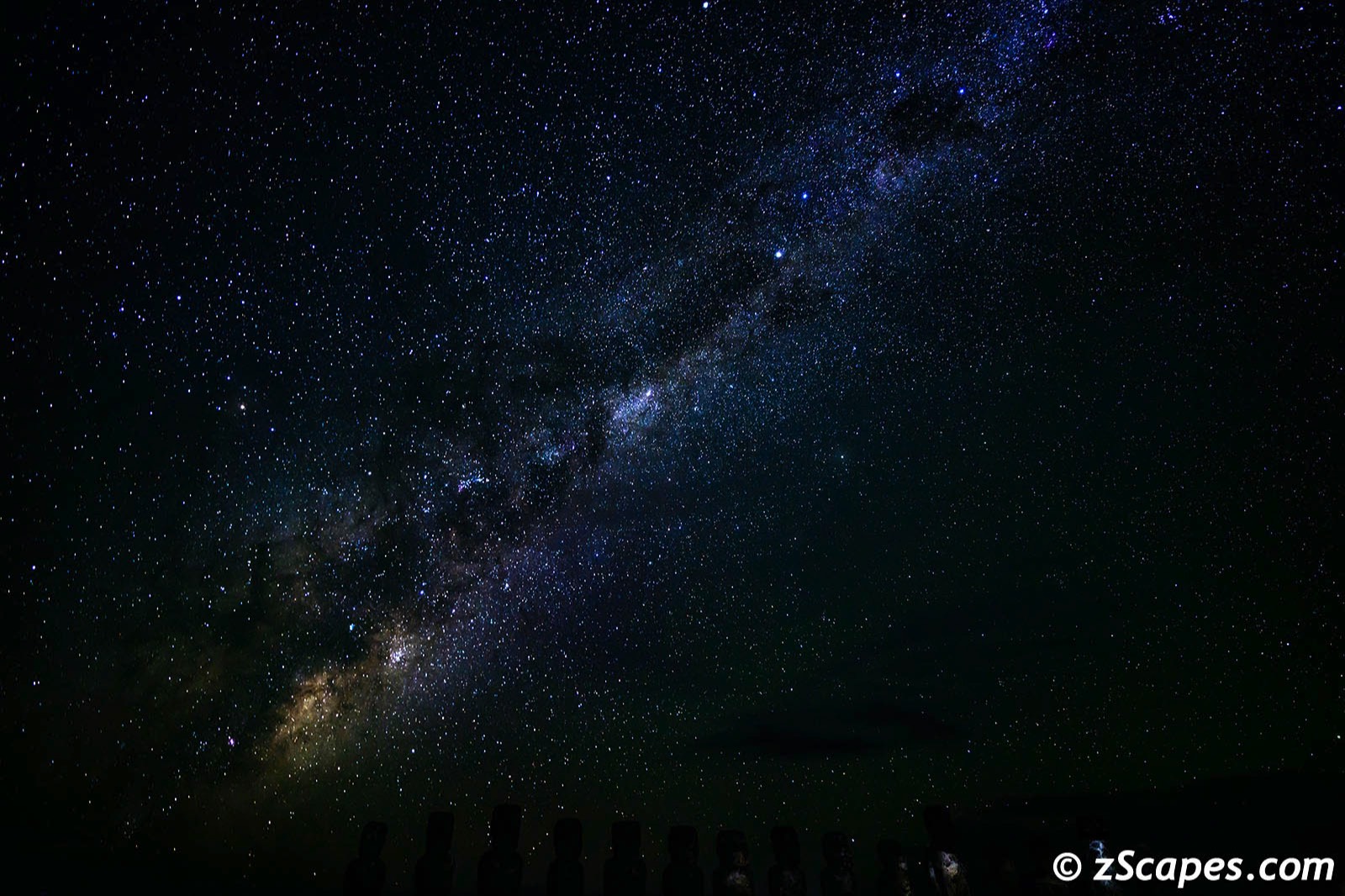
Day into Night :: The Beauty Unfolds
This island has beauty around every corner. We experienced out of this world sunrises, majestic coastlines and nights filled with magic. And Katsu and the Explora team guided us along. This section will highlight the raw power of nature, enjoy!
Around the Island
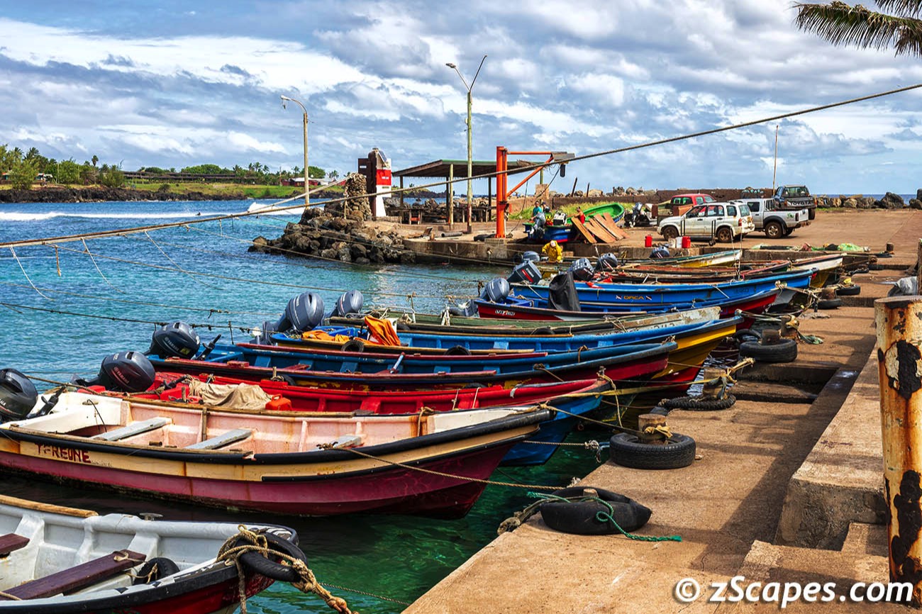
Besides the rich Rapa Nui & Moai history and culture, the island has much to offer. Hanga Roa is the main city, port, fishing village and center of Rapa Nui life. We also ventured into caves @ Ana Te Pahu to practice light painting, captured local wildlife (photos not traps!) and enjoyed our time exploring.

Local Stuff
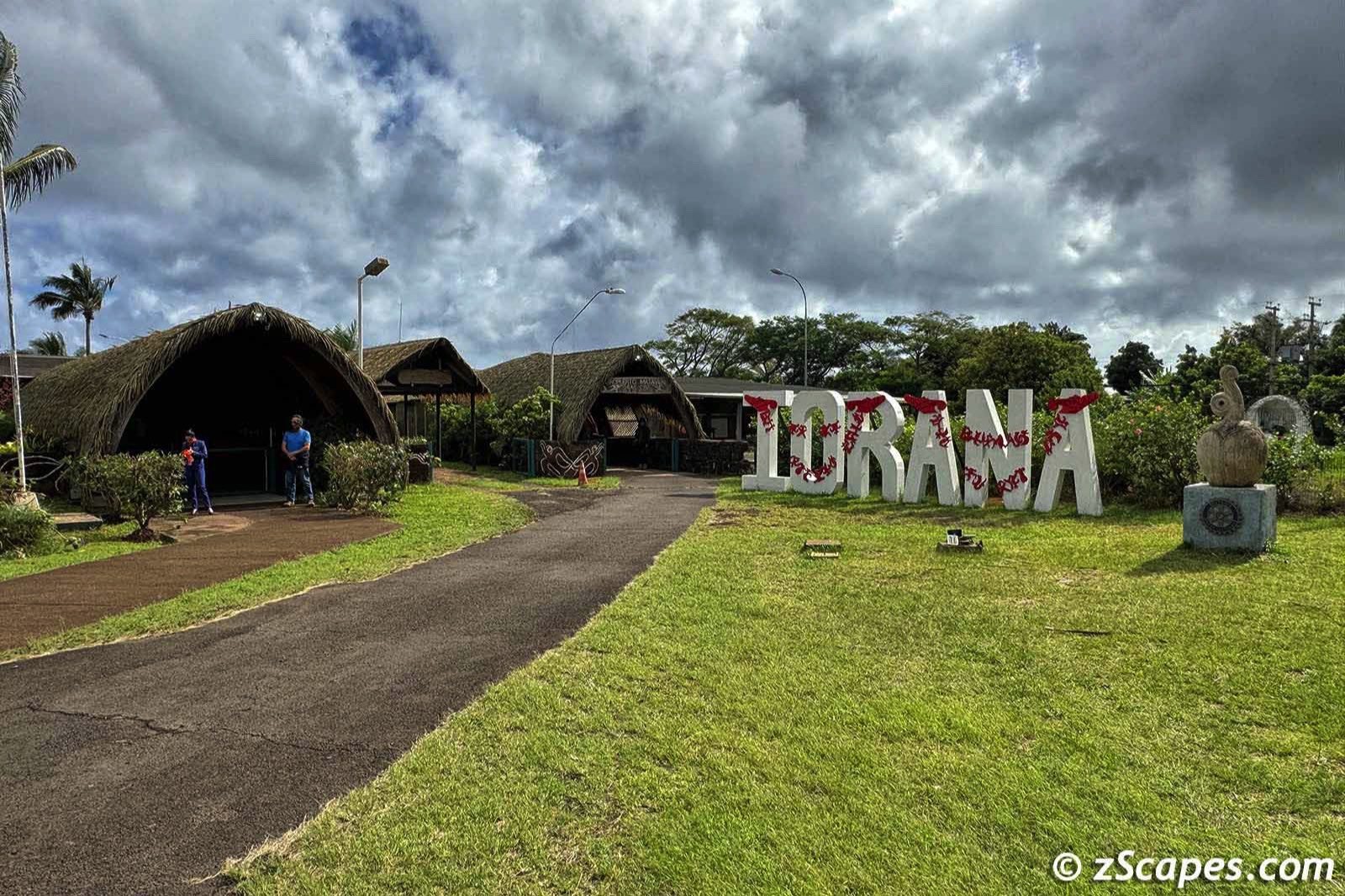
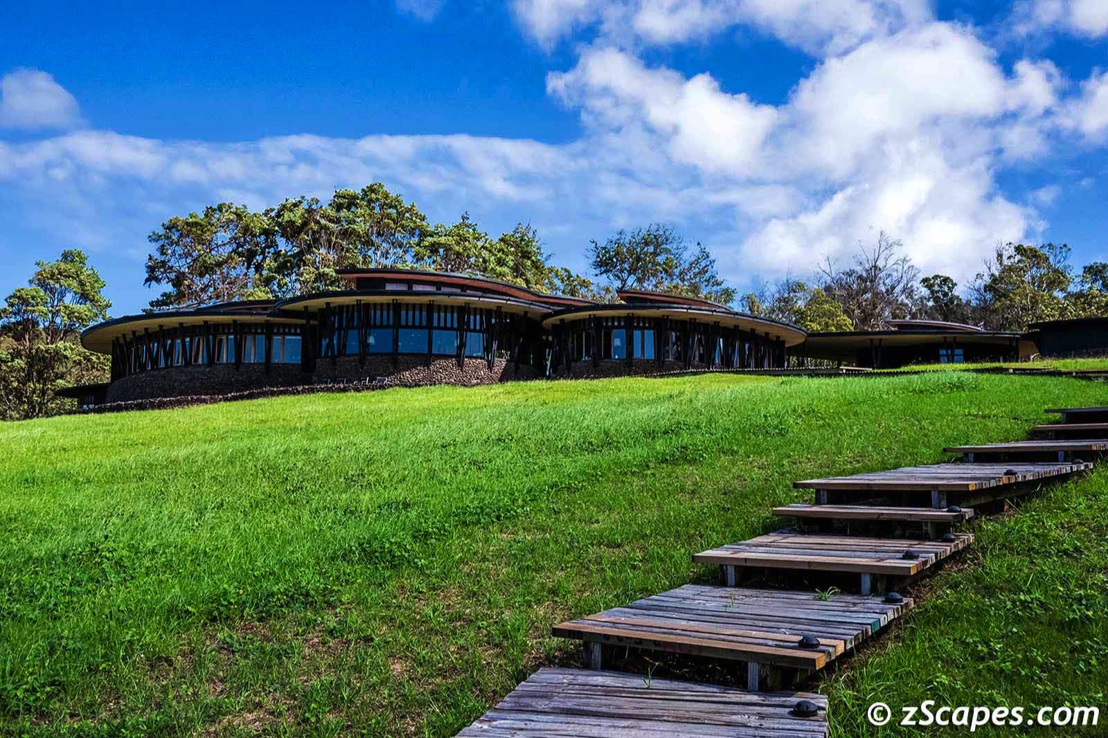
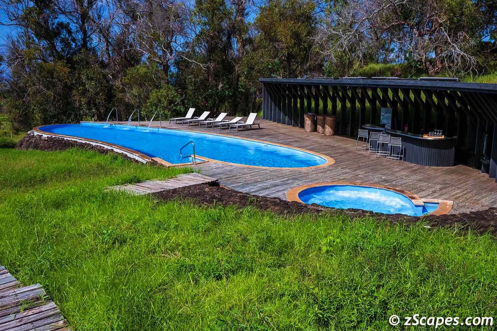
The workshop included accommodations @ Explora, a first class resort with first class team members.The staff was as attentive as I have experienced, professional, friendly and knowledgeable. If you stray into this corner of this world, this is the place to stay, all-inclusive so you leave your logistics behind and they take care of you. A it is a five start experience.
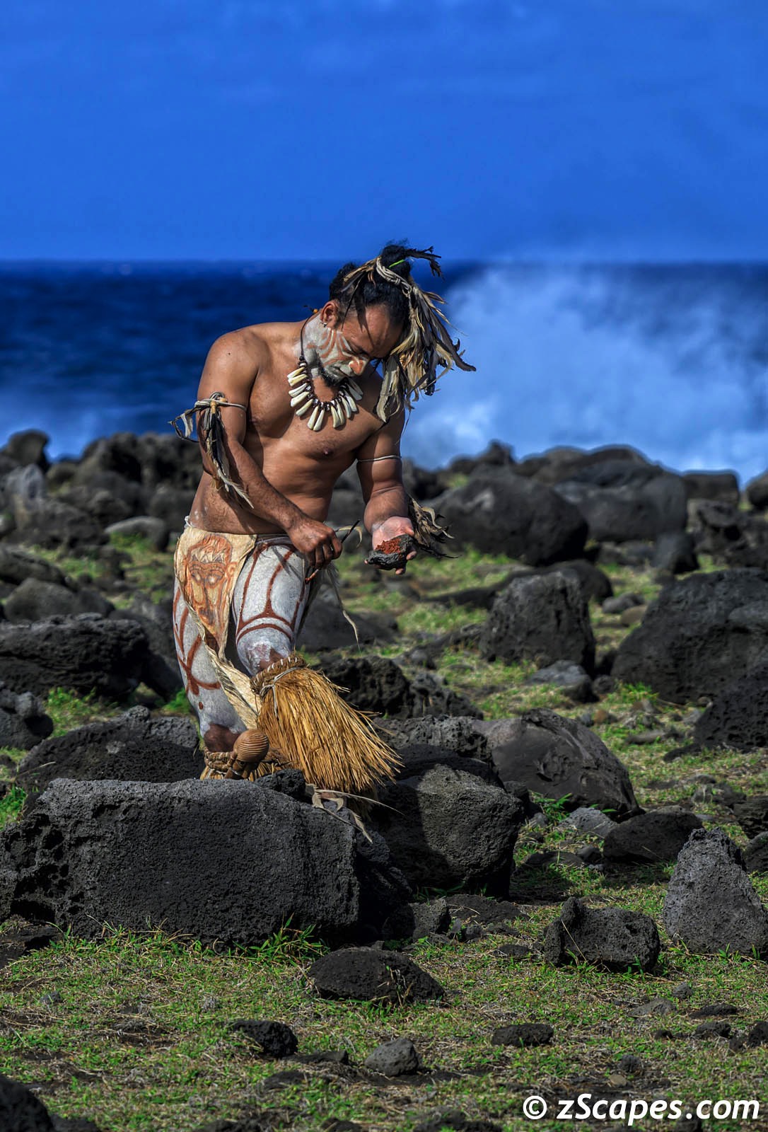
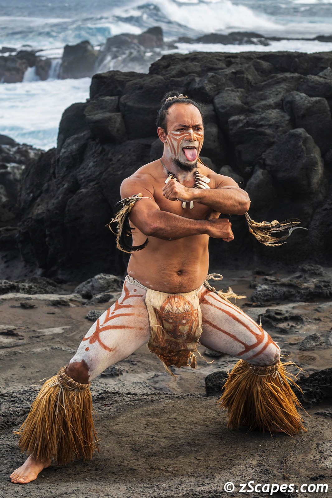
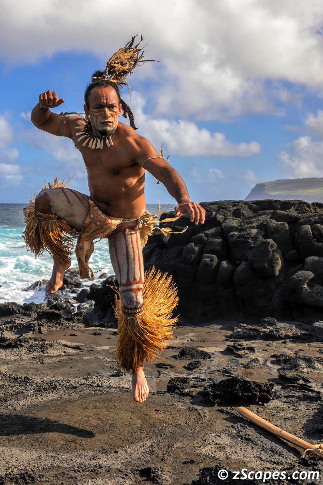
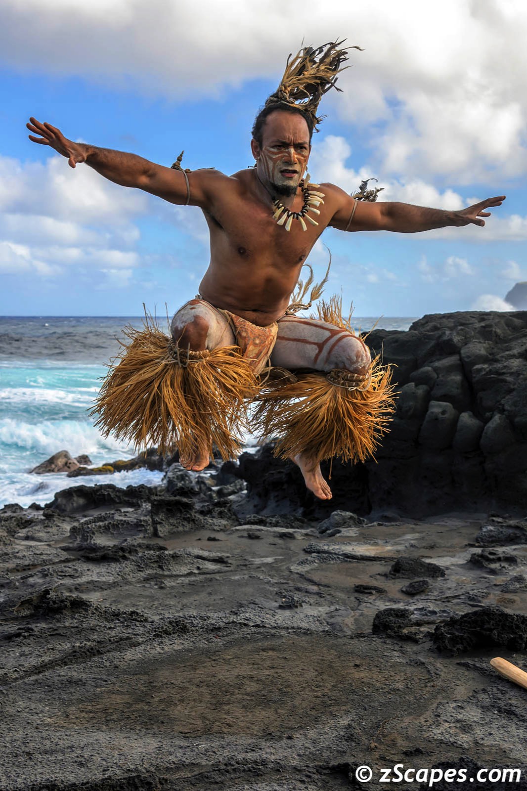
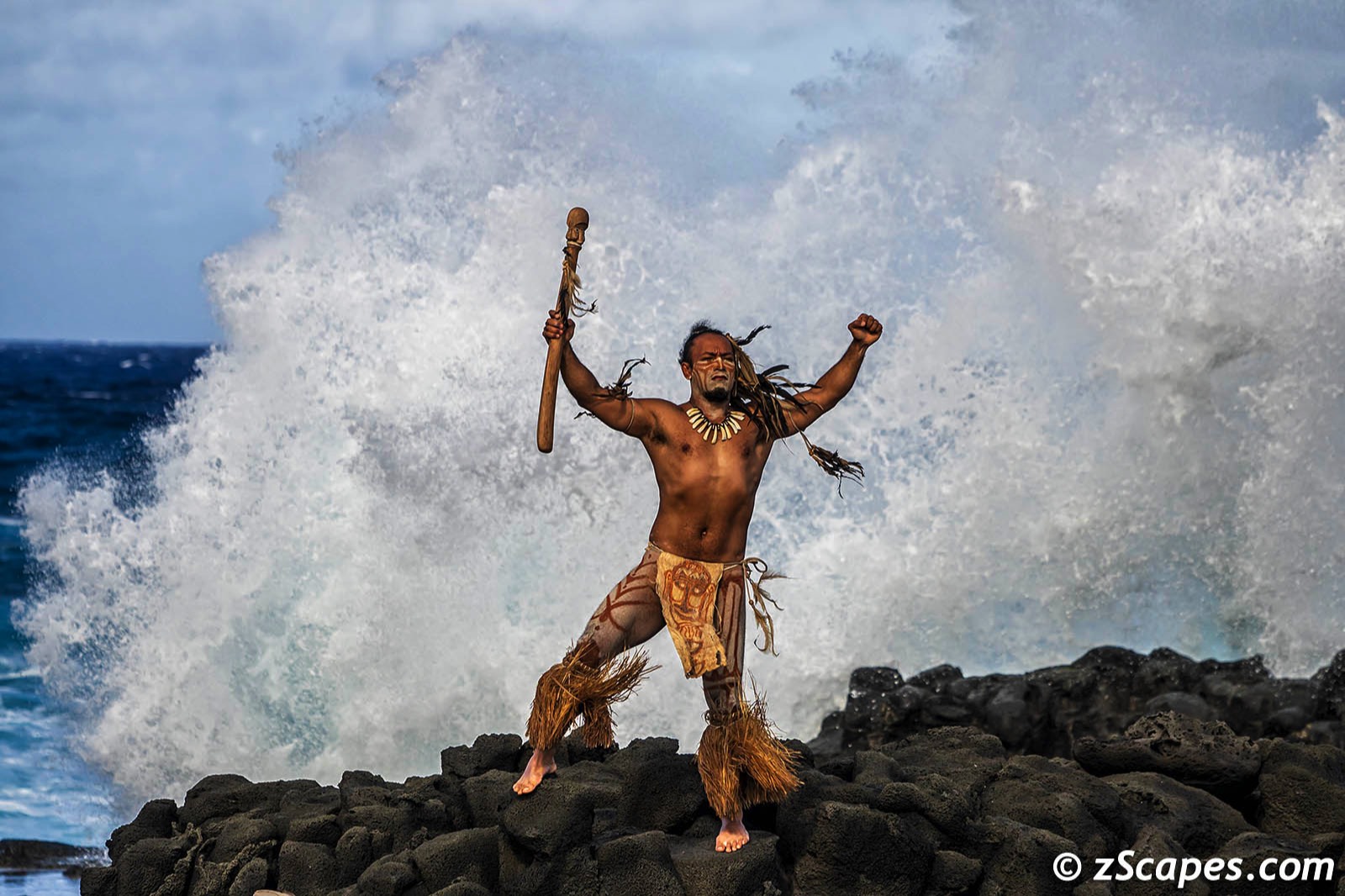
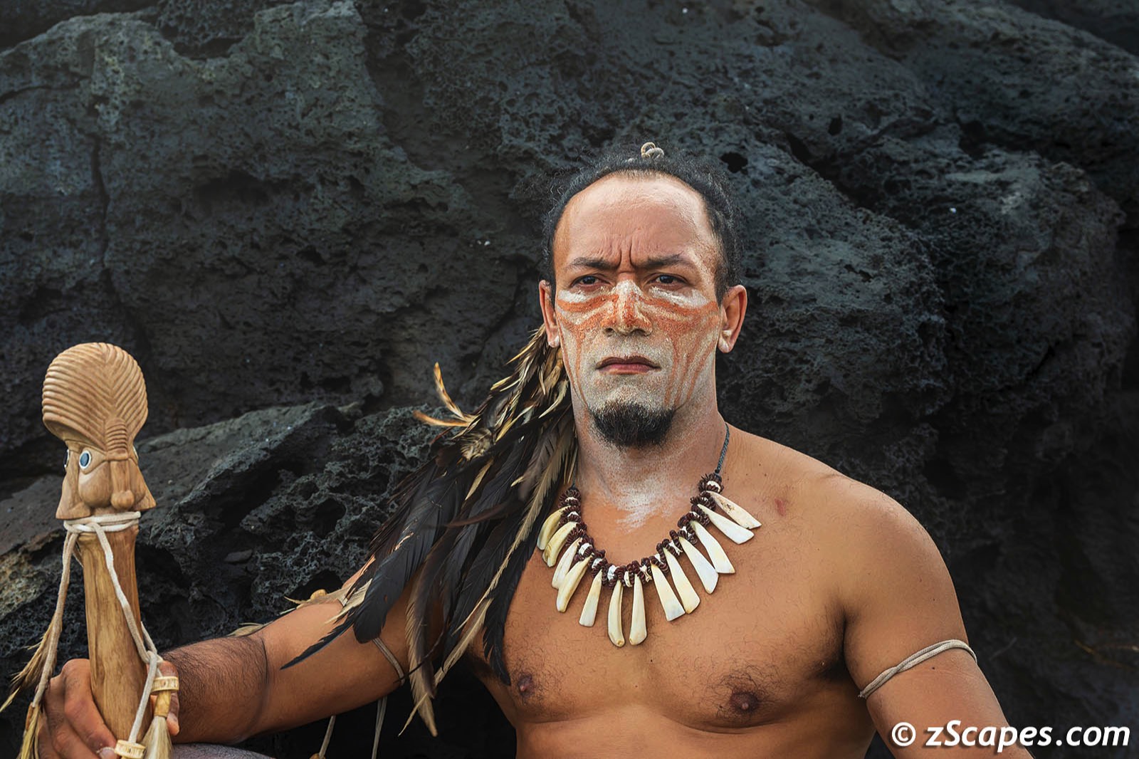
The resort itself is a blend of local architecture incorporating the Orongo warrior clan dwellings design and lines. On every excursion, the guide staff was there to educate and answer our questions bringing to life the landscape and history. On our final day, one of the guides, MeaMea, transformed himself into a Rapa Nui warrior beginning with body painting, showing off some athletic moves and posing for stills. The power and grace of his movements was mesmerizing and we are grateful for this glimpse into local culture.
The resort itself is a blend of local architecture incorporating the Orongo warrior clan dwellings design and lines. On every excursion, the guide staff was there to educate and answer our questions bringing to life the landscape and history. On our final day, one of the guides, MeaMea, transformed himself into a Rapa Nui warrior beginning with body painting, showing off some athletic moves and posing for stills. The power and grace of his movements was mesmerizing and we are grateful for this glimpse into local culture.
May our paths & errands meet
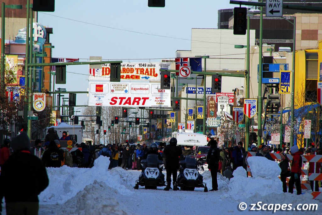
Iditarod "Last Great Race"
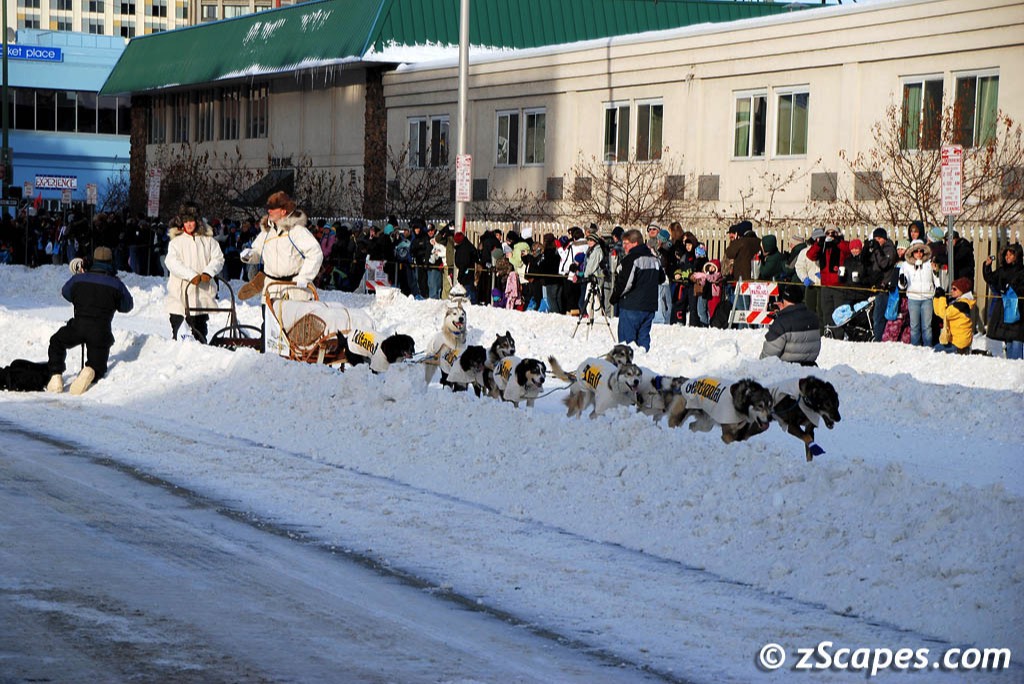
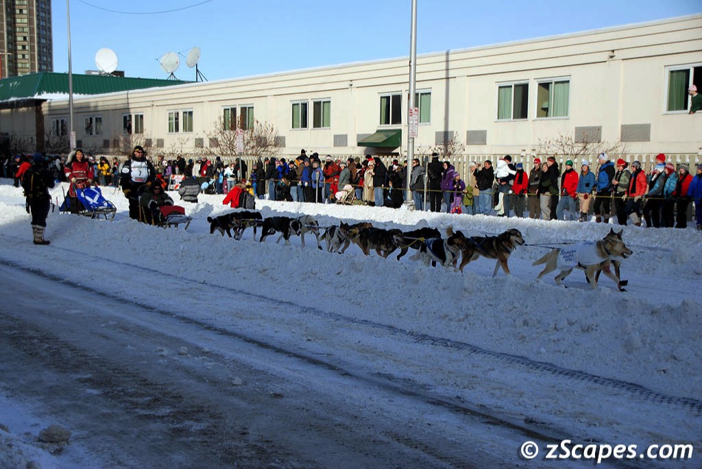
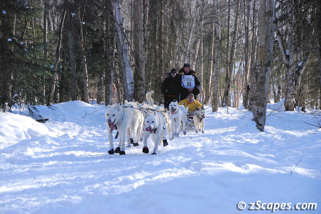
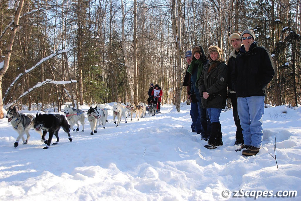
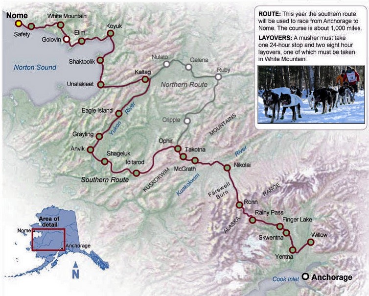
It is called 'The Last Great Race' and it spans 1150 miles over some of the most inhospitable and beautiful landscape this earth has to offer. For the daring at heart, 25 checkpoints and the whims of mother nature are all that separate you from the first prize of $69,000 and a new Dodge pickup truck. And that can be a big gap! Of the 67 teams that entered in 2009, 52 finished the race in Nome with 15 scratches along the way.
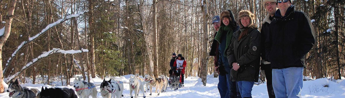
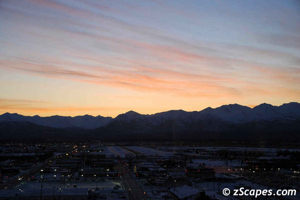
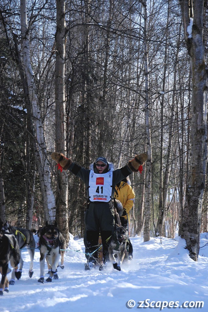
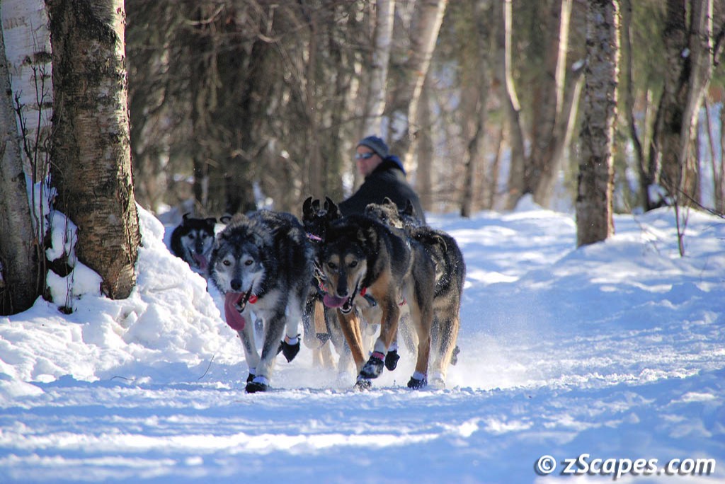
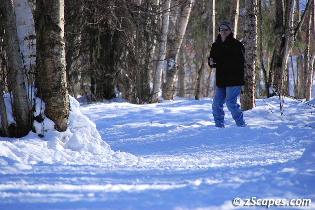
I was on a business trip that just happened to coincide with the start of the 37th running of this remarkable race. I met up with a gang of friends organized by a co-worker early on Saturday morning to experience the ceremonial start thru the streets and park trails of Anchorage. There was fanfare, people bundled up, snow trucked in to pave the roads with that white stuff and a lot of people and a whole lot of dogs.
I was on a business trip that just happened to coincide with the start of the 37th running of this remarkable race. I met up with a gang of friends organized by a co-worker early on Saturday morning to experience the ceremonial start thru the streets and park trails of Anchorage. There was fanfare, people bundled up, snow trucked in to pave the roads with that white stuff and a lot of people and a whole lot of dogs.
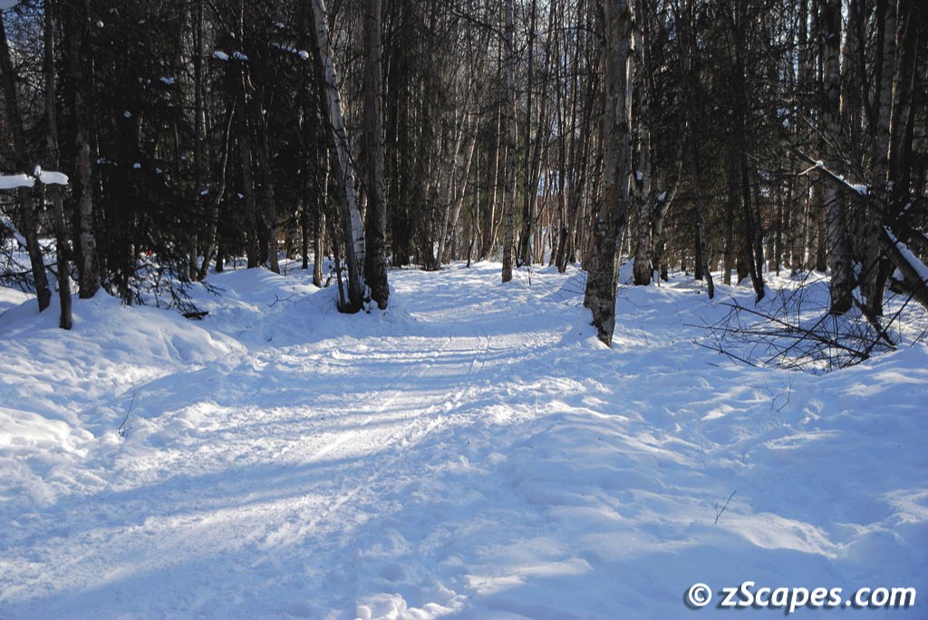
Iditarod Trail
The Iditarod Trail is a National Historic Trail which started as a mail and supply route from the coastal towns of Seward and Knik to the interior mining camps at Flat, Ophir, Ruby and beyond to the west coast communities of Unalakleet, Elim, Golovin, White Mountain and Nome. Mail and supplies were swapped for gold and dog sled teams were the backbone of travel in this wide open frozen country. In 1925, part of the Iditarod Trail became a life saving highway for epidemic-stricken Nome. Diphtheria threatened and serum had to be brought in again by intrepid dog mushers and their faithful hard-driving dogs.
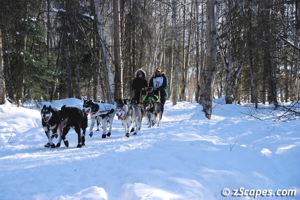
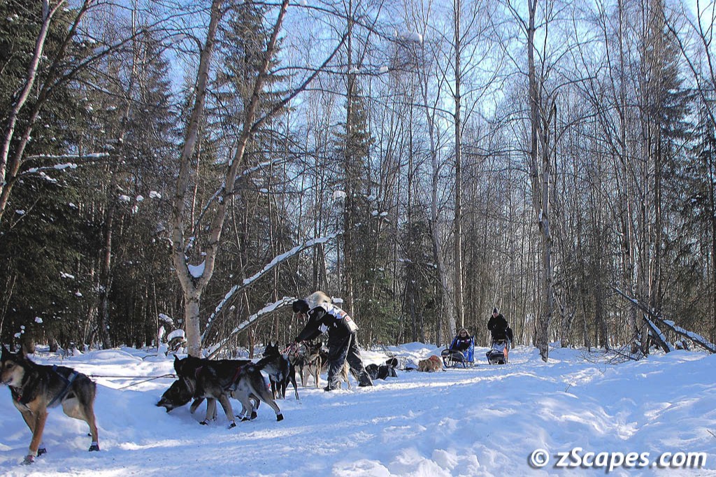
On the first day the Iditarod competitors travel thru an elaborate inter-city trail network and we set up at about the halfway point to watch the teams and mushers as they passed by. There were several large parties going on with the requisite barbecue, lots of food, beer and friends.
On the first day the Iditarod competitors travel thru an elaborate inter-city trail network and we set up at about the halfway point to watch the teams and mushers as they passed by. There were several large parties going on with the requisite barbecue, lots of food, beer and friends.
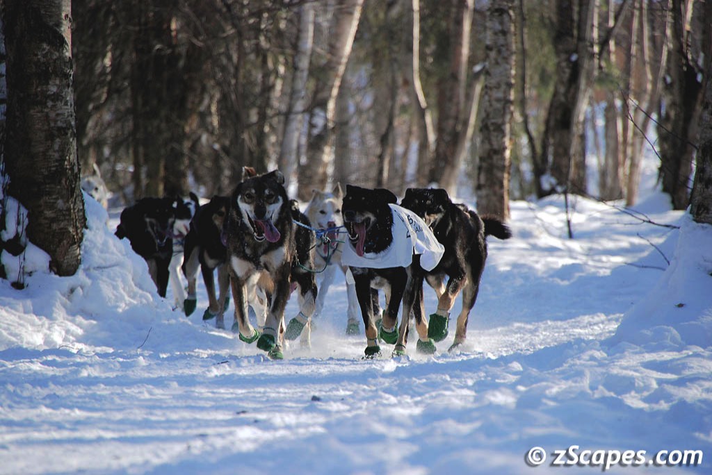
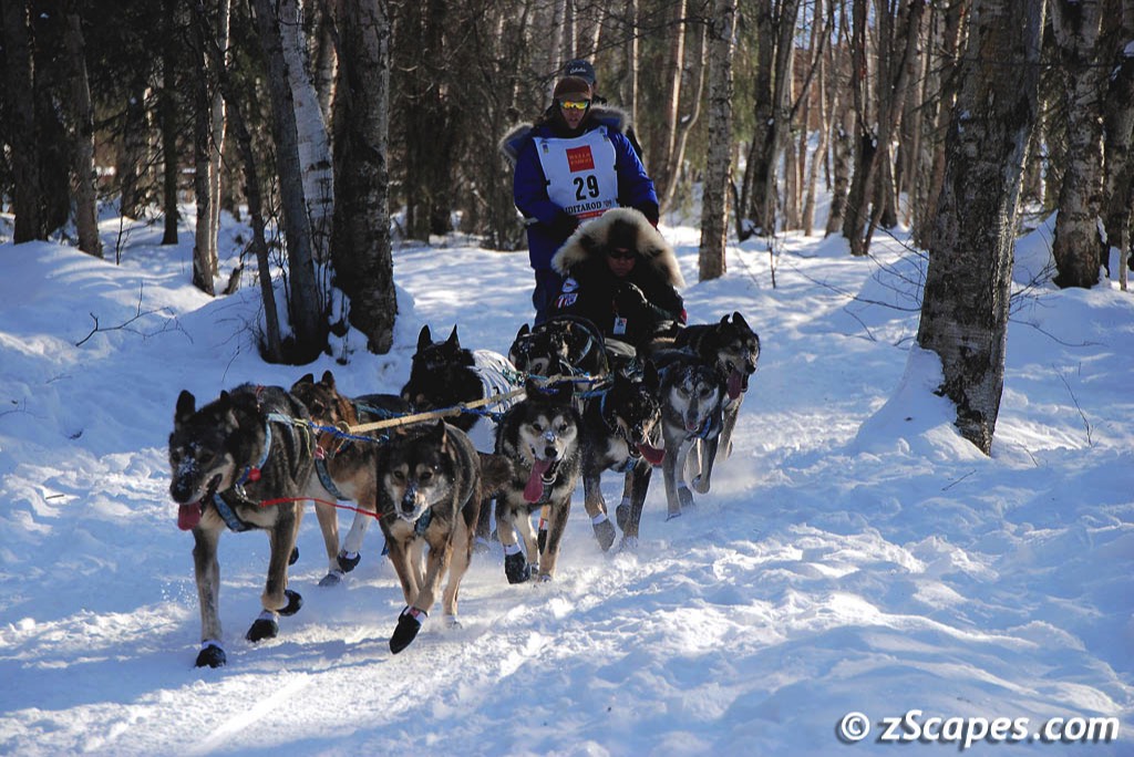
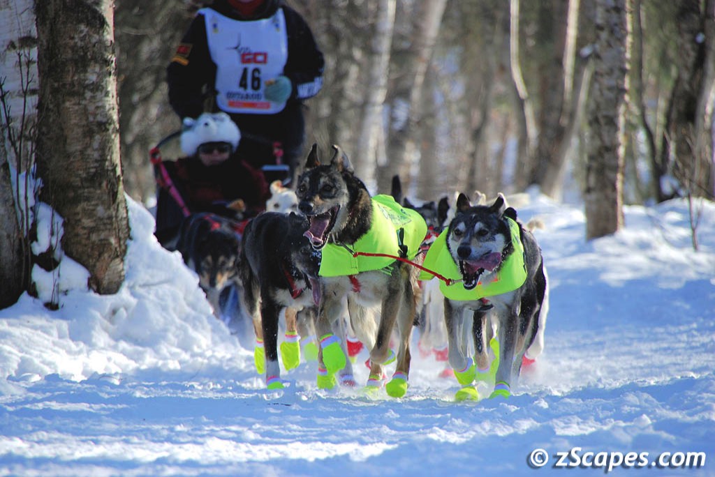
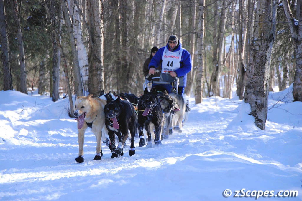
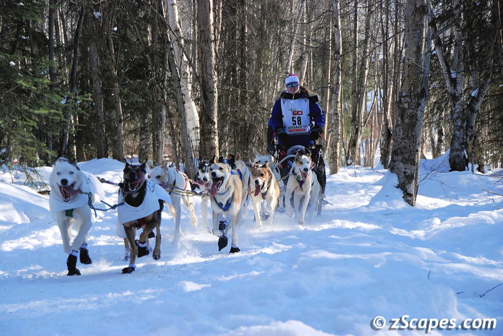
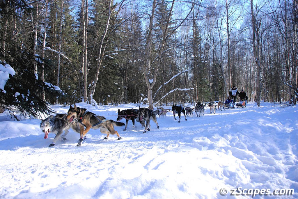
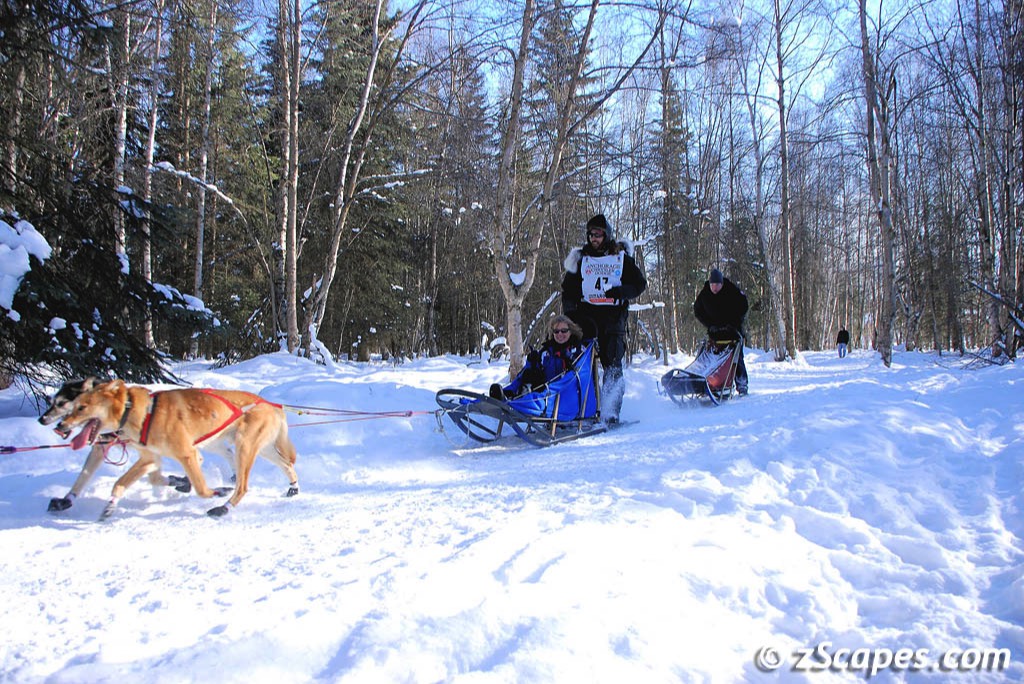
The Mushers & Teams
Sixty seven teams started out with just as many stories. From the best in the world, to 15 rookies out to prove themselves, to a nuclear physicist with a team of pure Siberians, they represent that rugged individualism that it takes to survive the journey and a love for their dogs who make that possible.
Jeff King Money leader with over $746,000
Sonny Linder Never finished below 25th
John Baker Another top money leader

Tim Osmar Trail guiding Rachael Scdoris who is legally blind
Rachael Scdoris Born with congenital achromatopsia, she is colorblind and her acuity is 20/200. An inspiration of determination
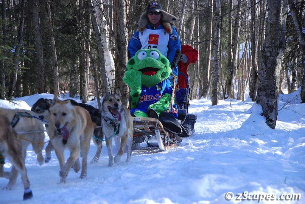
Bill Cotter Traveling with his good luck frog. Another top money leader and the owner of six top 10 Iditarod finishes and a Yukon Quest title
As Lance Mackey rounded the bend where we were waiting, one of his dogs got tangled in the hitch line and he came to a halt right in front of us. After a short struggle he set the team straight and continued on his way. Lance eventually won the race for his third in a row, tying Susan Butcher and Doug Swinley for a prestigious honor. He also announced that after over 12,000 miles, finishing eight Iditarod's and four Yukon Quests, his lead dog, 9 year old Larry, will be retiring to " lounging around and soaking up rays" as Lance put it. I believe that Larry is the up front left dog in the first picture on the panel above.
The Motley Crew
An event of this magnitude is best spent with friends and needs to have a feast attached to it, with age appropriate drinks. We were in luck. The host and toast of Anchorage was our ring leader and he opened his house and adult beverage cabinet to friend and stranger alike. Red crab legs, baked salmon and it just went on and on. Thanks Jim for a memorable time.
May our paths & errands meet
Awards & Showings
G2 Gallery - Alaska & Hawaii 2017
My second showing at The G2 Gallery Nature & Wildlife Photography in Venice, California. The National Parks of Alaska and Hawaii exhibit will start on January 17th and go through March 18th, 2017, so if you are in town, drop by and take a browse at all the entries. All G2 proceeds from sales are donated to environmental causes and I will donate my proceeds as well if you purchase after seeing this page and drop me a note.
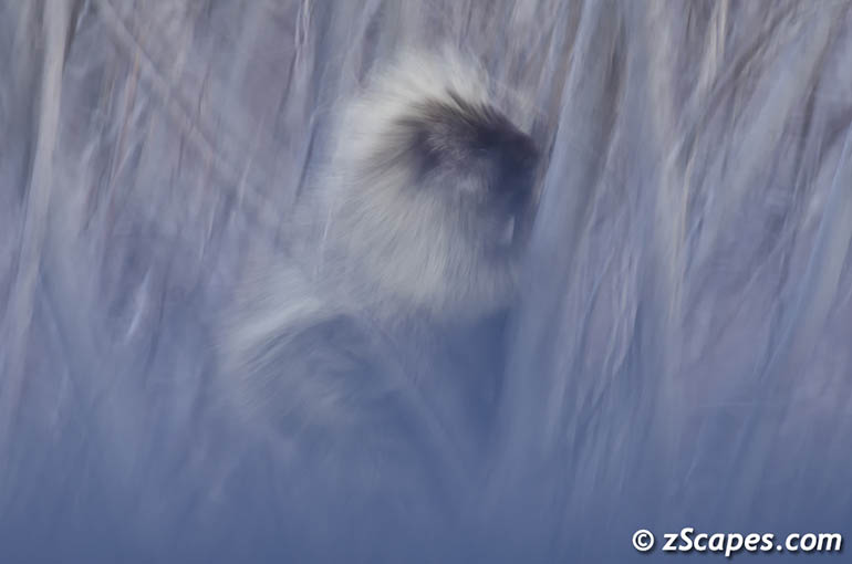
Porcupine Swaying in the Myst
Yosemite Conservancy Postcards
I have been fortunate to be associated with the Yosemite Conservancy and John Senser as a photo instructor for several outdoor workshops (Winter, Firefall & Moonbow), which allows me to visit and soak in the wonder of Yosemite. As I believe in their mission I have donated several images that are to be part of a new series of postcards that will help raise funds for this worthy cause. If you visit, please help by buying some and while it is not cutting edge, USPS still delivers your thoughts and wishes on printed material to your friends across the globe!
G2 Gallery - Off The Beaten Path 2015
My first selection to a gallery showing with proceeds going to help the Yosemite Conservancy. I was honored to be selected and had an enjoyable experience with Betsey and friends at the artist reception and opening night. Off the Beaten Path ran from September 29th through November 15th, 2015.
San Mateo County Fair 2005
May our paths & errands meet
Copyright © 1990-2025 zScapes. All rights reserved


